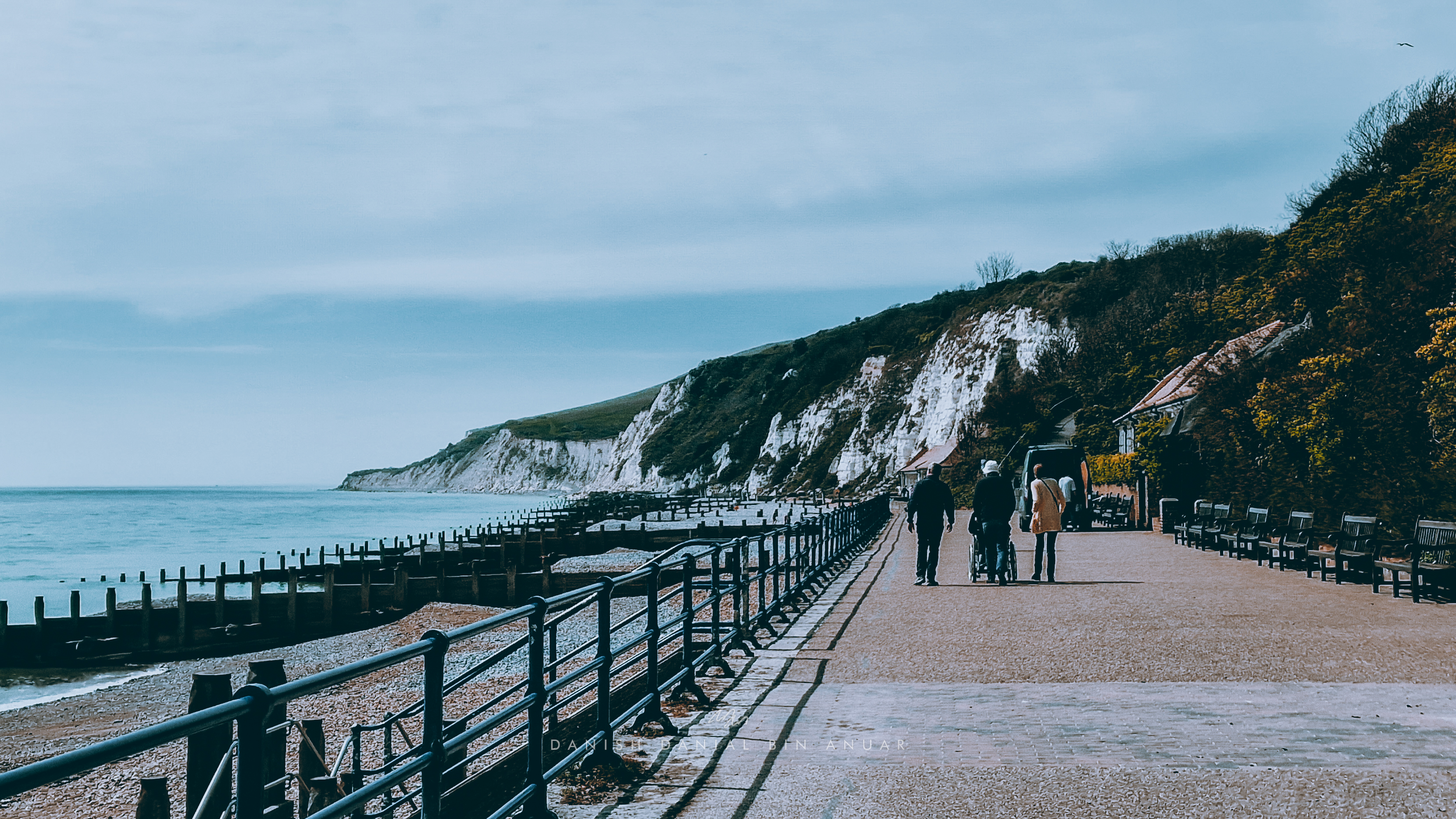
On one of those rare occasions when the weather wasn’t as cloudy or rainy as it usually is, we decided to go on a hike on the south coast of England. We boarded a train bound for Eastbourne, where we would start our hike. Our hike covered places such as the Beachy Head Cliffs, the Birling Gap, the Seven Sisters Cliffs, Cuckmere Haven, and finally, ending in Seaford. The hike lasted for 6 and a half hours over 20 kilometres, but that was largely because we took our time and we gave ourselves some time to rest at various points along the way.
Eastbourne, the town where we decided to start our hike, is very accessible with frequent trains calling here from London or Gatwick Airport (about less than an hour from Gatwick). You can also choose to start your hike from Seaford, which is roughly an hour away from Brighton on Bus 12X. We chose to start at Eastbourne because we could start our hike right away once we arrived. Additionally, most of the points of interests are accessible on 12X as well, however, points such as Beachy Head is only accessible on 13X, which only works on Weekends and Public Holidays.
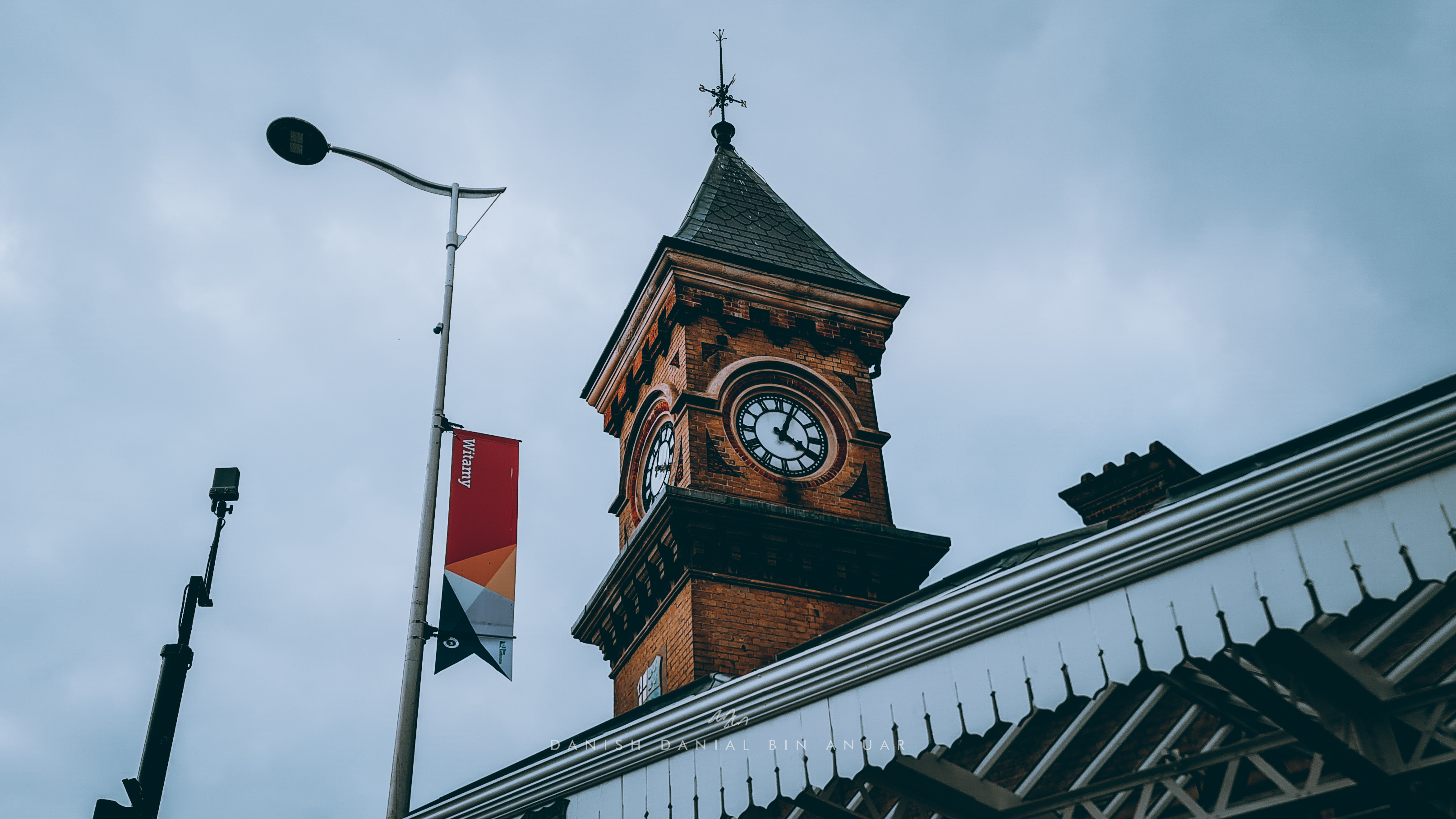
Eastbourne Train Station
Eastbourne is pretty much a cute, scenic coastal town. It’s what I like to call a mini-Brighton. There are tons of Victorian-era buildings and a nice boardwalk that extends out from the beach. Well, we didn’t choose to spend time here since we were more into the hiking bit. Essentially, for this hiking trail, all we had to do was follow the coastline and follow the signposts that directed us along the south coast trail.
Eastbourne Beach
At the start of South Downs Way, we start to get a taste of the first of many inclines that we were going to face on our hike. At the top of the first hill at the end of Eastbourne beach, we had a nice bird’s eye view of the town.
View of Eastbourne
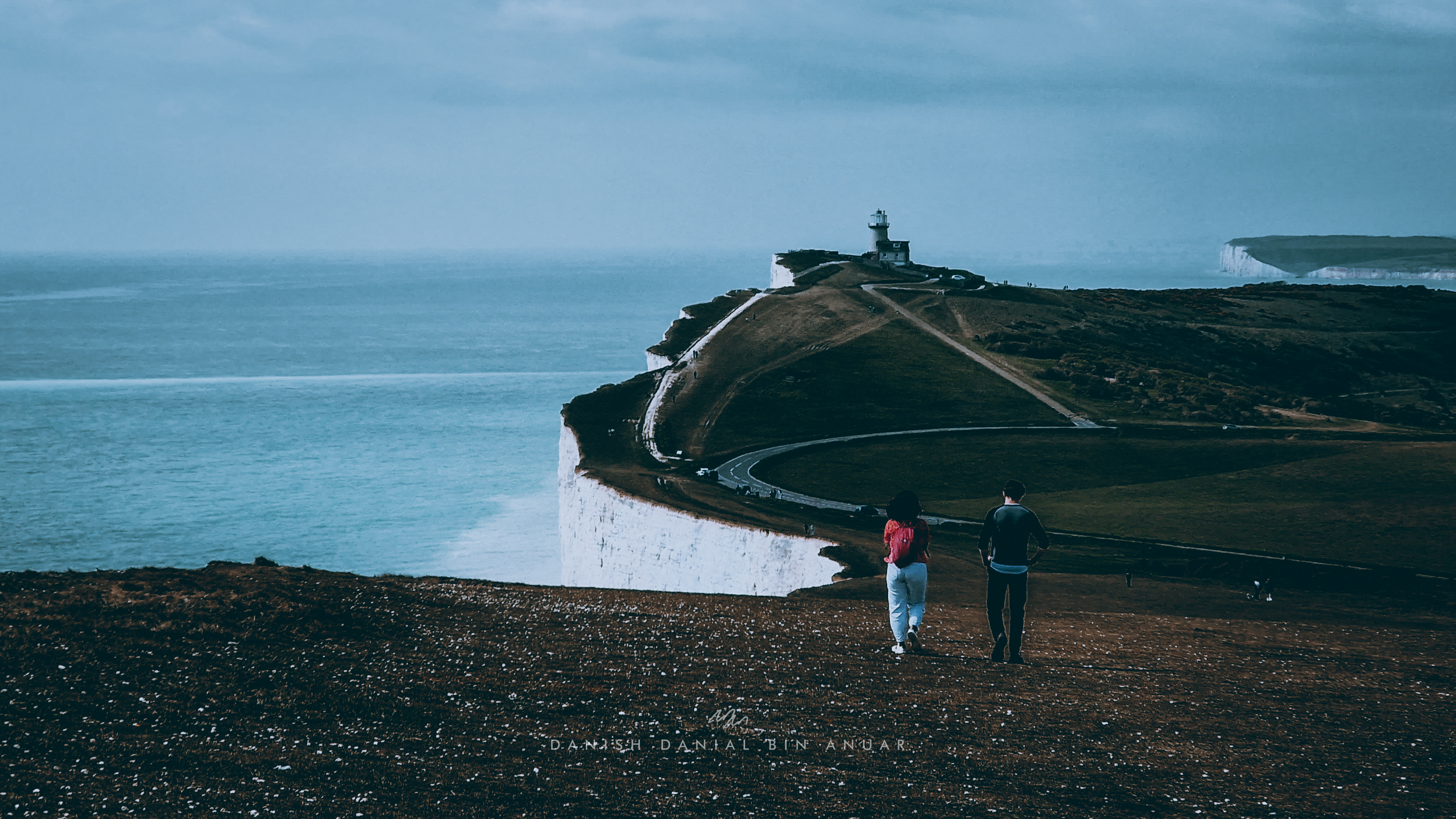
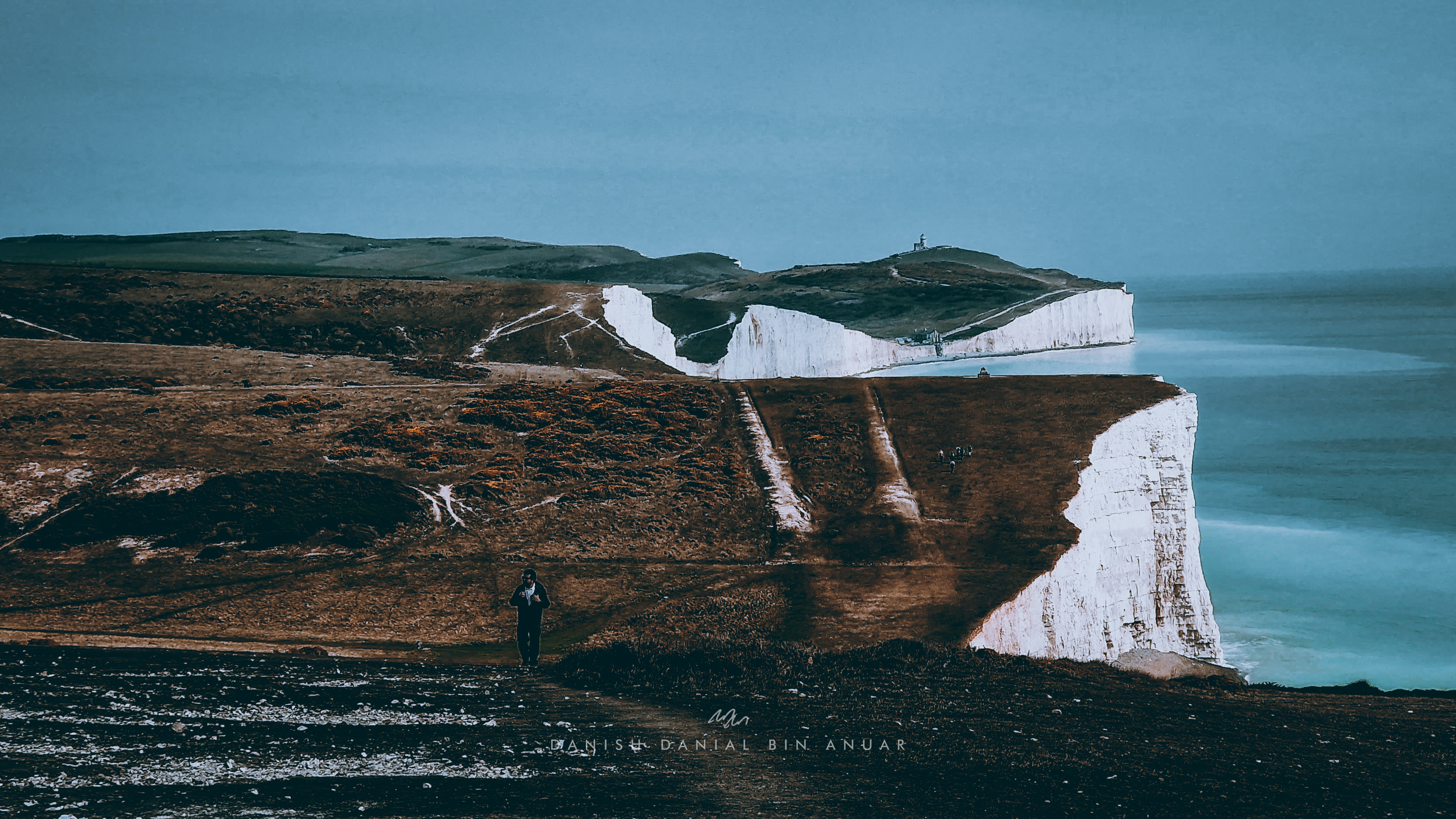
After a steep incline which needed at least 2 breaks, we arrived at our first checkpoint, the Beachy Head Cliffs. This was where we finally got to see clearly the huge pristine-white limestone cliffs that lined the coast. They were beautiful especially as they contrasted with the light blue waters of the English channel. Here, there was the Beachy Head lighthouse standing pretty much on its own away from the coastline. Well, according to some people, this was one of the best photographed lighthouses in the country, and I can understand why.
The Beachy Head Lighthouse
Our hike to the next stop wasn’t particularly too difficult. Along the way, there were families having their picnics, and couples walking their dogs. Surprisingly, there were also children playing and running around close to the cliff’s edge. Along the way we passed by Belle Tout lighthouse, and a huge fragrant yellow flower field which greeted us to the view of the Seven Sisters Cliffs in the distance.
Belle Tout LighthouseField of Flowers
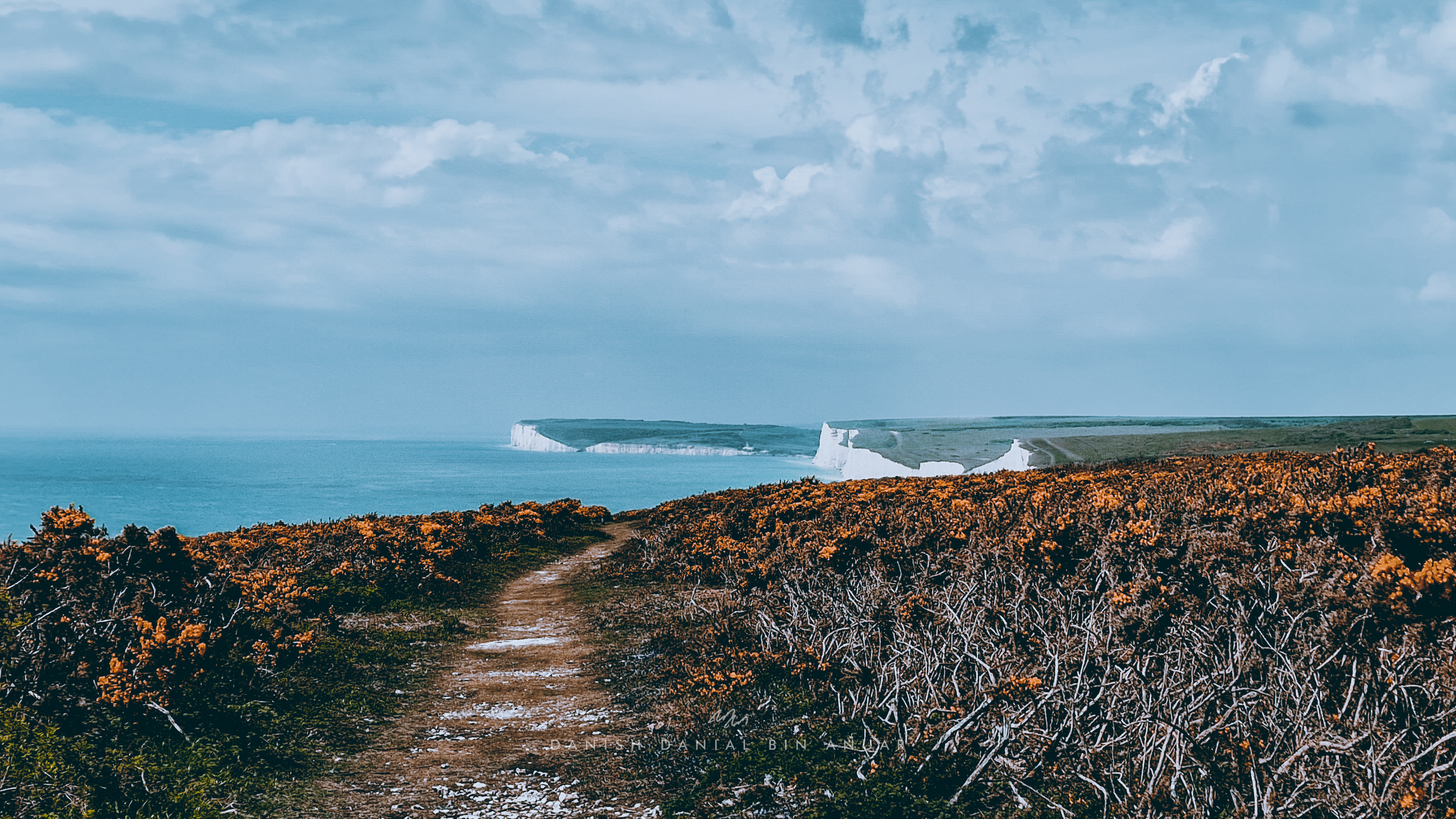
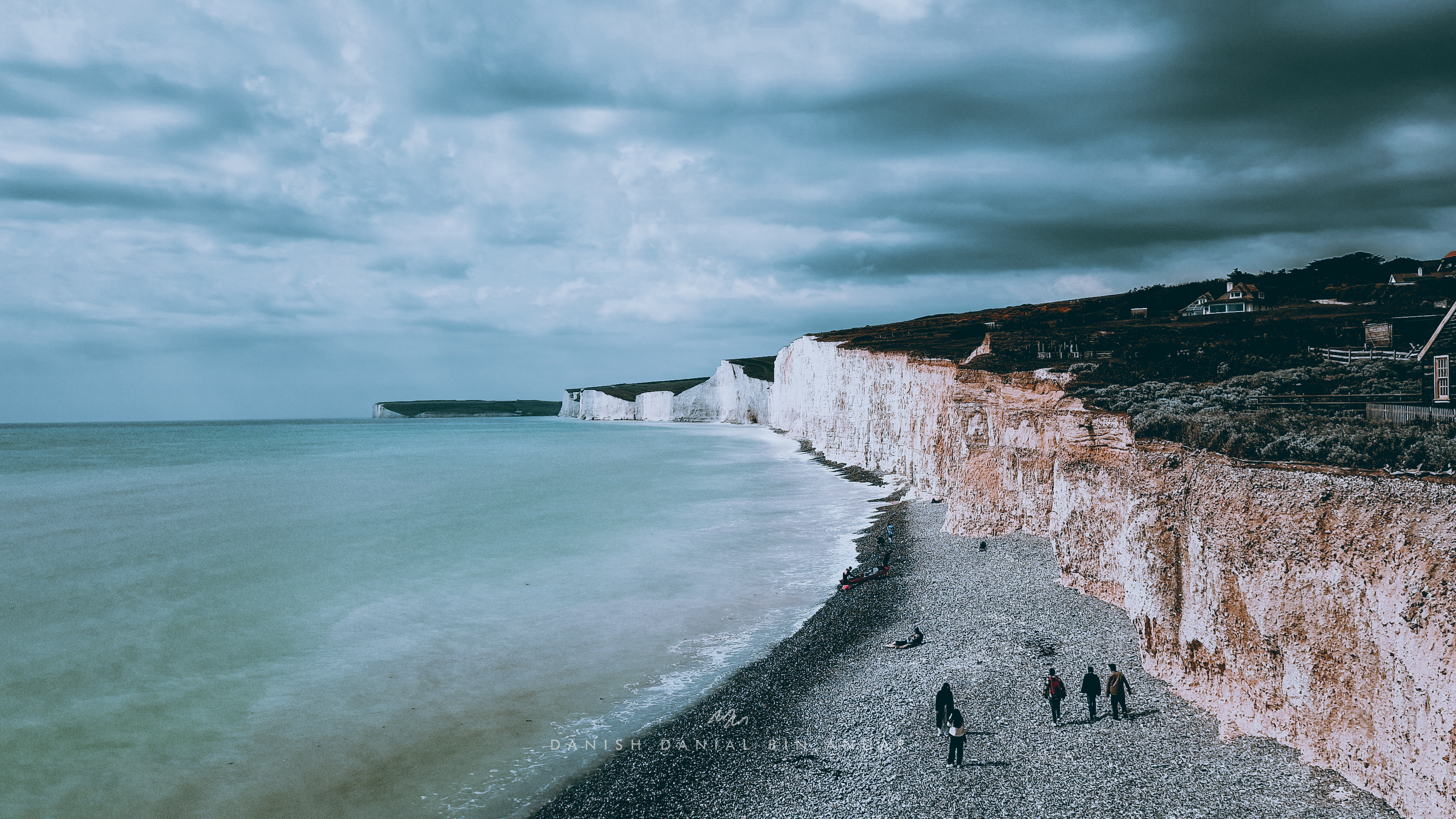
We finally arrived at Birling Gap where we got a sweeping view of the Seven Sister’s Cliff from atop a hill. At low tide, there is also a beach that we could access to get up close to the cliffs themselves. There was a café and a visitor centre as well. Here, we took our first long rest as we appreciated the scenery and enjoy a little bit of the sea breeze.
Birling Gap and the Seven Sisters Cliffs
Next was the challenging bit of the hike. This was when we walked along the Seven Sisters Cliffs themselves. We were there wondering why they were called the Seven Sisters Cliffs and we eventually figured (the hard way) that there were 7 hilltops along this stretch of cliffs. The inclines and declines were all of varying degrees of steepness with some requiring us to be careful of where we were setting our foot on. There were also rabbit burrow holes that we had to be careful of as well.
Hiking along the Seven Sisters Cliffs
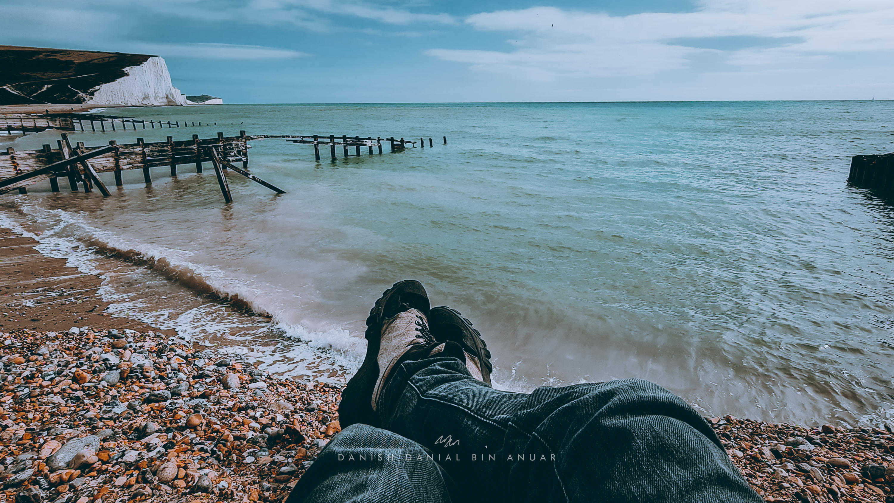
After conquering the seven hilltops along the Seven Sisters Cliffs, we descended along an extremely steep decline (that gave us matching white butts) that lead us to Cuckmere Haven which was a very tranquil beach with nice views of both the ocean and the cliffs. We spent some time here to rest as we just stared at the waves crashing against the shore.
Cuckmere Haven
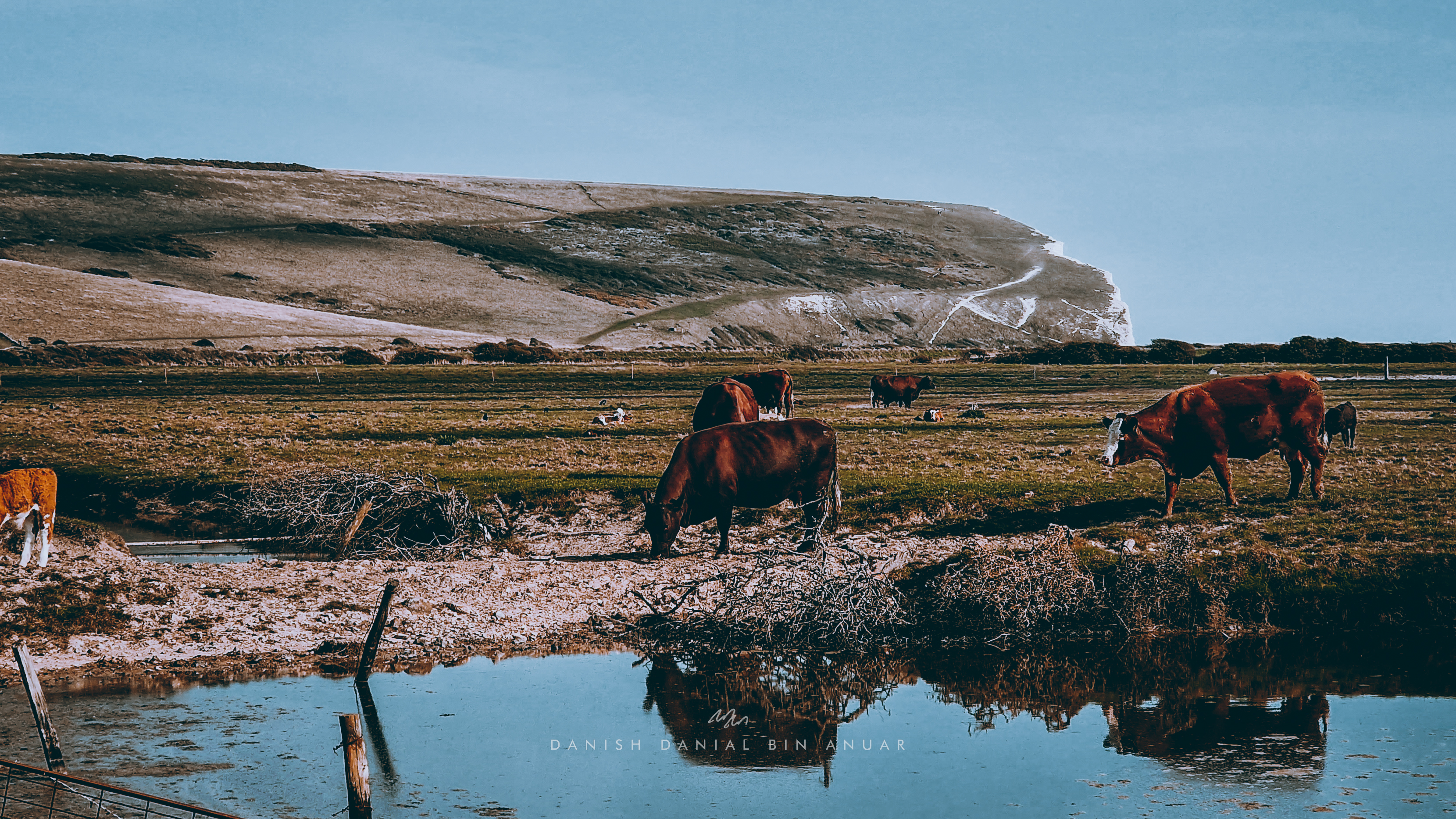
In between where we were and our final point-of-interest, there was a crossing at the mouth of Cuckmere River that would show up only on lower tides. However, at that time, the tide wasn’t low enough so we had to go the long way round to get to Seaford Head. Along the way, we cut across a cow and sheep field along the Cuckmere River to get to the other side.
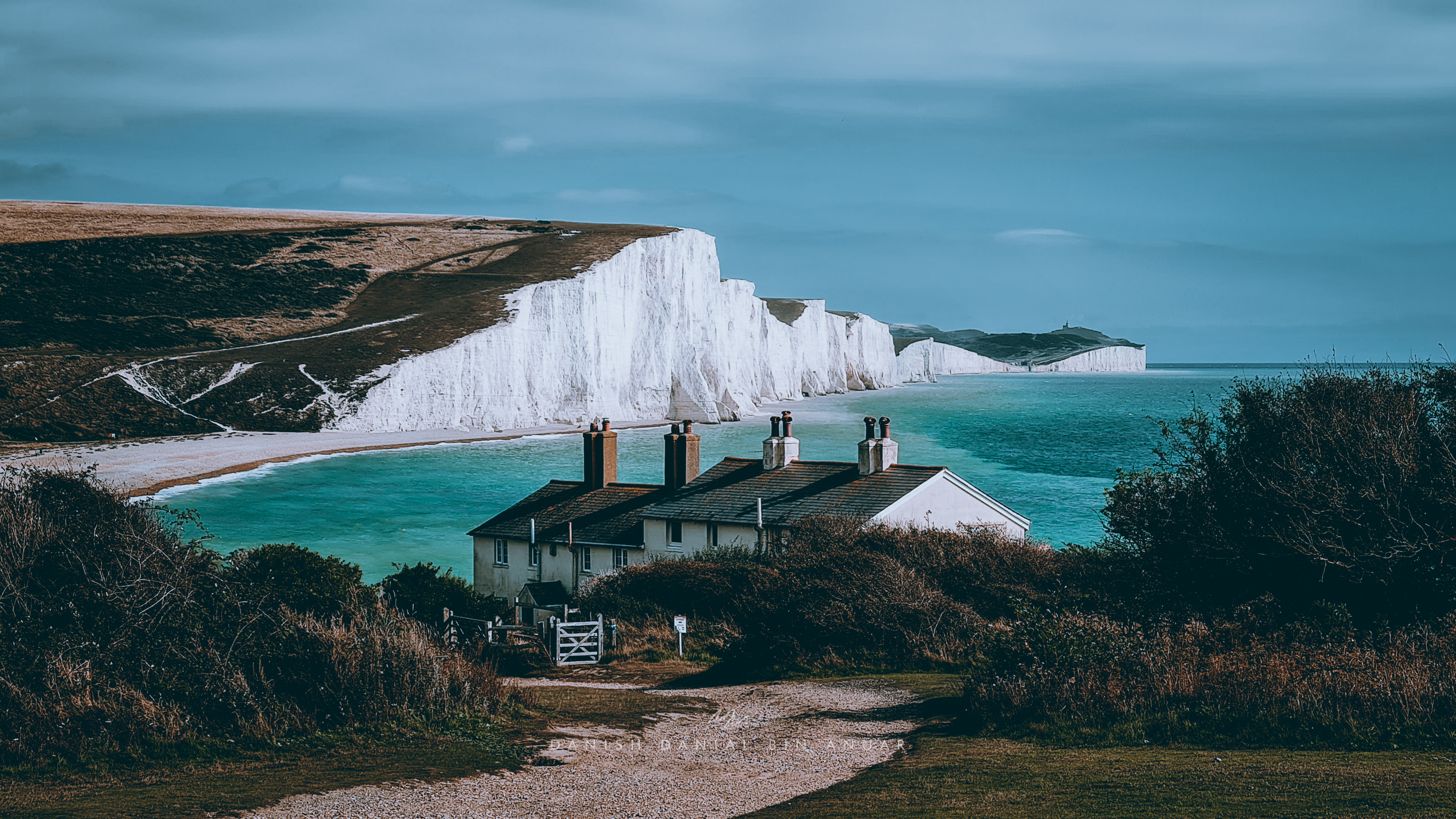
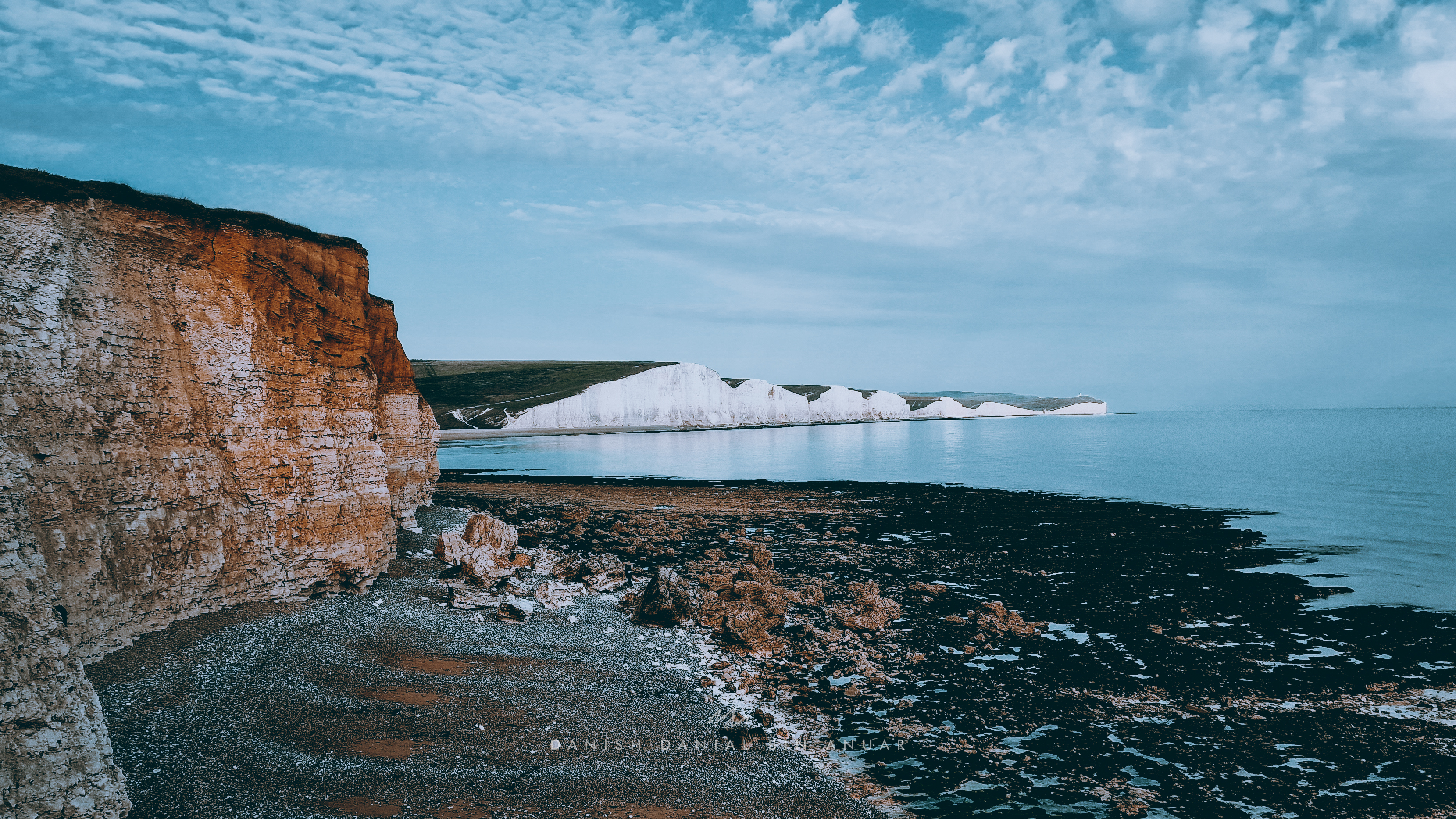
Eventually, we arrived at Seaford Head, where we got another vantage point of the Seven Sisters Cliffs. We took another rest on one of the benches there and we almost fell asleep as the sea breeze kissed our faces and we succumbed to the hypnotic sounds of the waves. We picked a really nice spot that had a view which looked like something out of a postcard with the coastguard cottages in the foreground and the cliffs in the background.
The Seven Sisters Cliffs with Coastguard Cottages in the ForegroundThe Seven Sisters Cliffs from a different vantage point
Afterward, we walked to the nearest bus stop in Seaford and boarded the 12X bus back to Eastbourne. Overall, this was a pretty nice scenic hike especially if you’re thinking of doing an outdoor activity on the south coast of England!
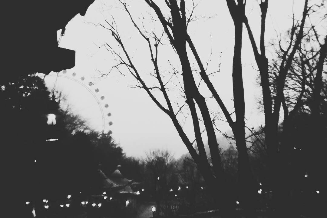
Unlike my other trips, this was the only trip I carefully picked the dates of my travel. For a lifetime, I have always longed to see the Northern Lights myself. I was told that tourists aren’t exactly lucky largely because of the weather or they came when there was no solar activity. Months prior to my trip, I studied the solar cycle, weather trends, squeezed in free dates in between my lectures and my shifts. All of this triangulated me to the first week of April, also incidentally, the first week of Ramadan. Eventually, all of that effort paid off as I got to see the Northern Lights clearly for 2 days in a row. While I did come to Iceland mainly for the Northern Lights, Iceland unexpectedly gave me so much more, making this one of the best weeks I’ve spent in my life.
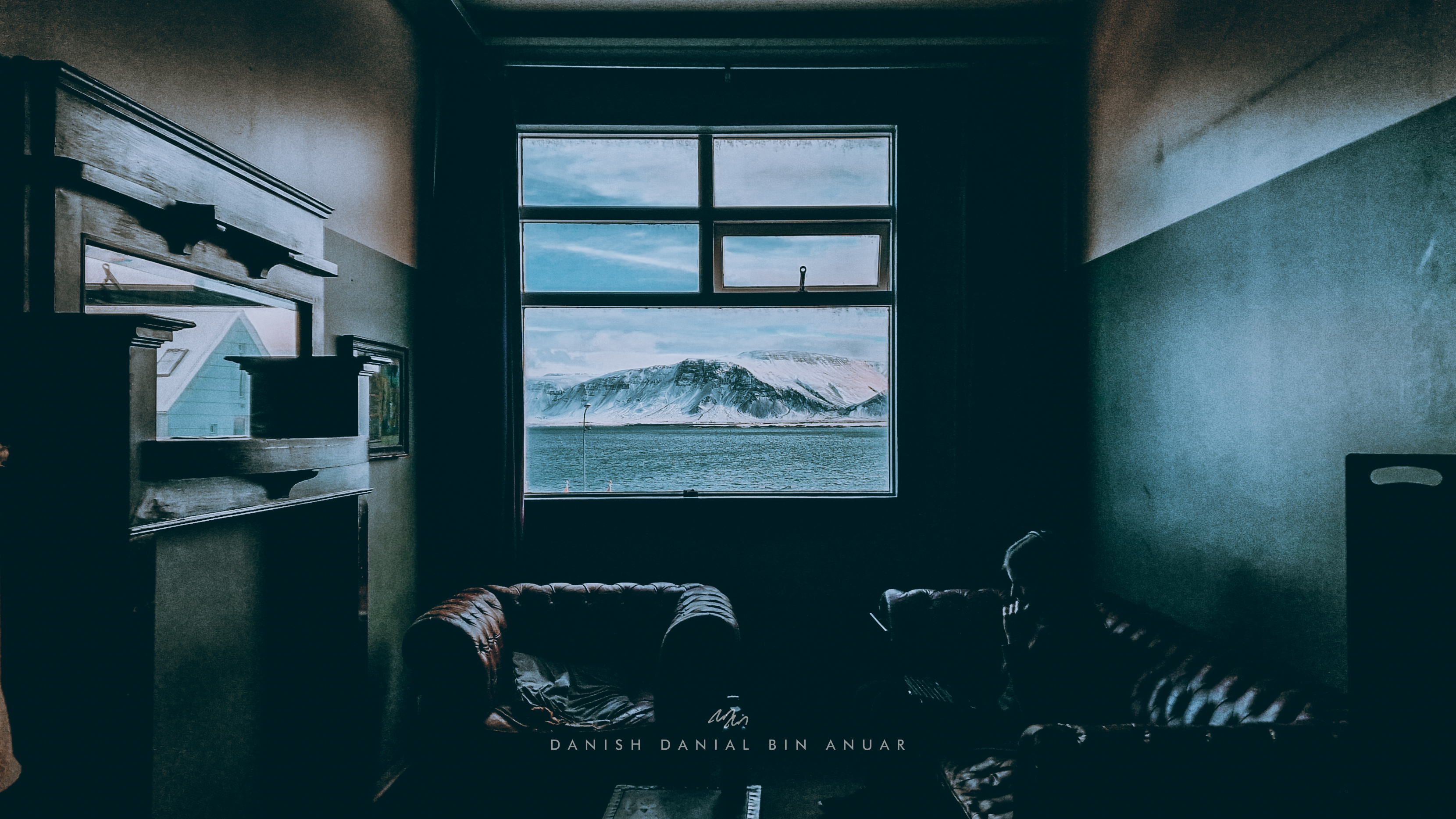
To be honest, I didn’t plan my trip until I actually got there. I got a little too caught up with my coursework. In fact, I spent my first night underneath my blanket Googling what’s interesting to see or do. While I initially hoped to rent a car, eventually, I decided to join tour groups instead over the course of the next week. I found some really good ones on platforms such as Viator and GetYourGuide. Plus, they provide hotel pickups as well! I stayed in the north side of Reykyavik, in full view of the Esja mountain range, and the view was like something out of a postcard.
Day 1
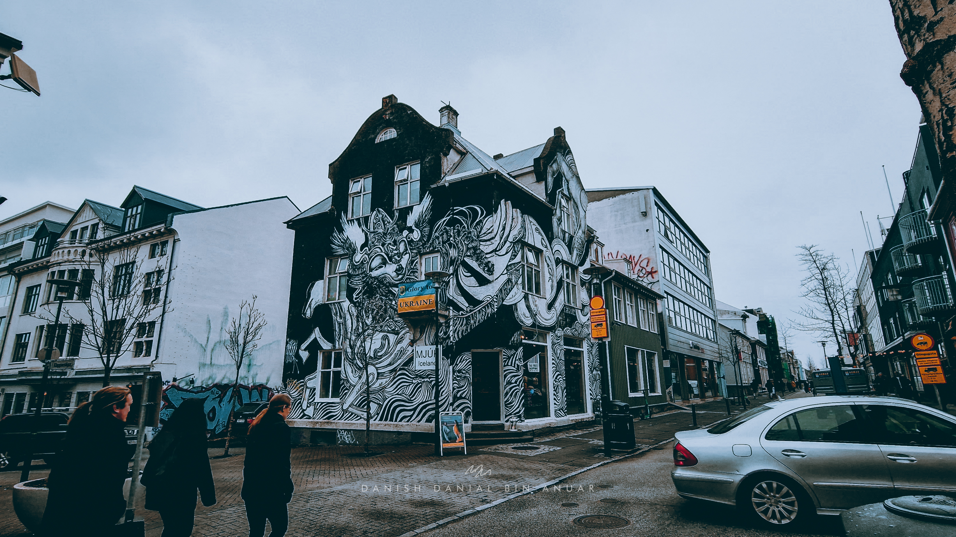
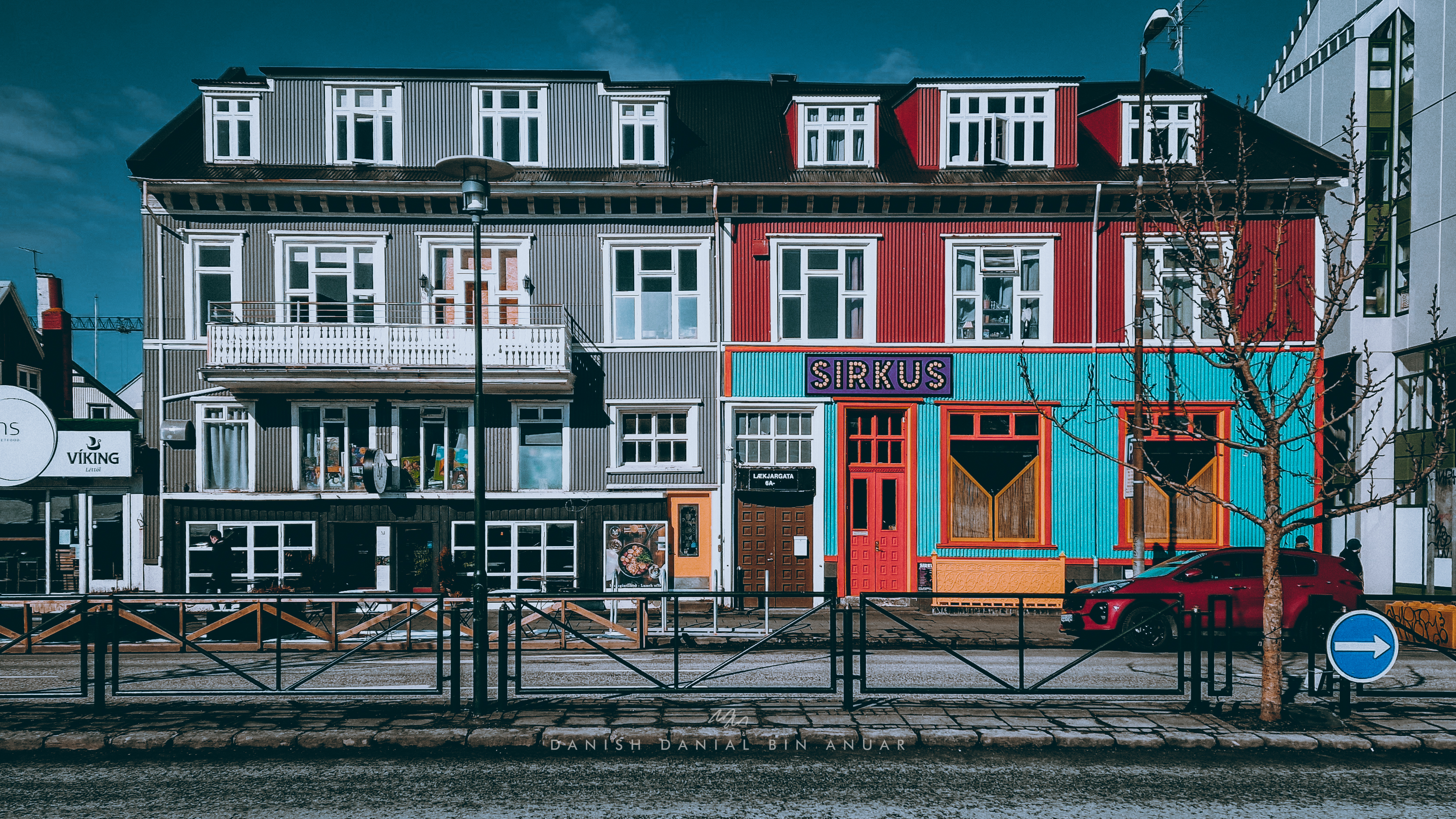
The morning after my flight, before my scheduled Horseback Tour, I decided to have an aimless sightseeing walk around Reykjavik. Everything was pretty much accessible on foot as the city isn’t exactly that huge. Down the streets, I found a mix of old and new buildings, all kinds of street art, as well as parks. Basically, I walked a loop around the city starting from the Sun Voyager, through the streets surrounding the Hallgrímskirkja area, into the city centre, and back.
The Sun VoyagerStreet Art in ReykjavicA Street in ReykjavicShophouses in ReykjavicHljómskála ParkA street in the City Centre
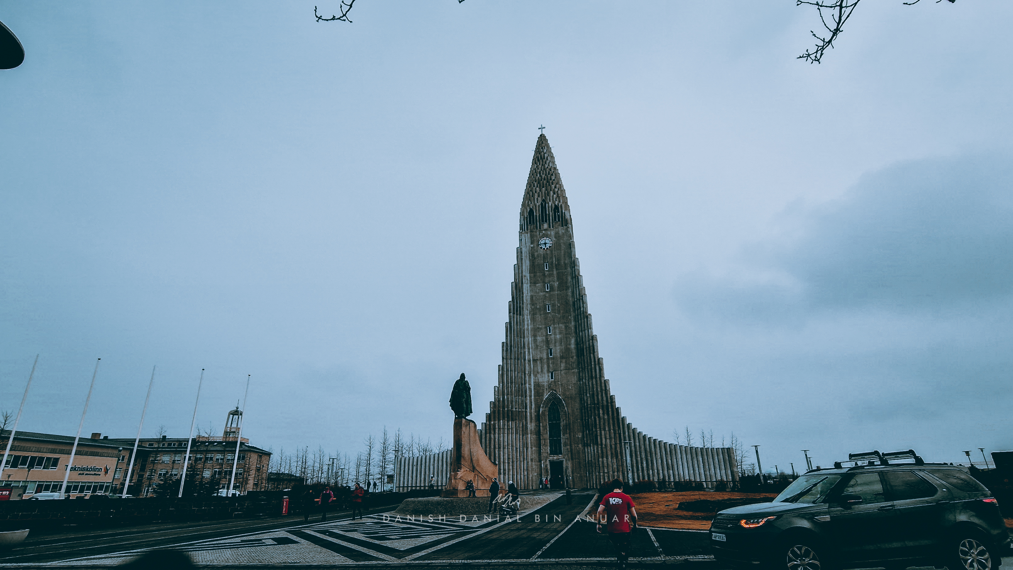
The main landmark towering over the city is the Hallgrímskirkja. Built in the 1980s, it has since become an icon of Iceland. The church was designed in such a way that it represented the natural features of Iceland. Its winged structure resembles basalt columns, while its triangular structure resemble that of mountains and glaciers.
Hallgrímskirkja
I was able to enter the church’s chamber and occasionally, there are organ concerts that anyone can sit in and listen to. The organ pipes were huge and were featured prominently in the middle of the chamber.
Chamber of the HallgrímskirkjaOrgan Pipes of the Hallgrímskirkja
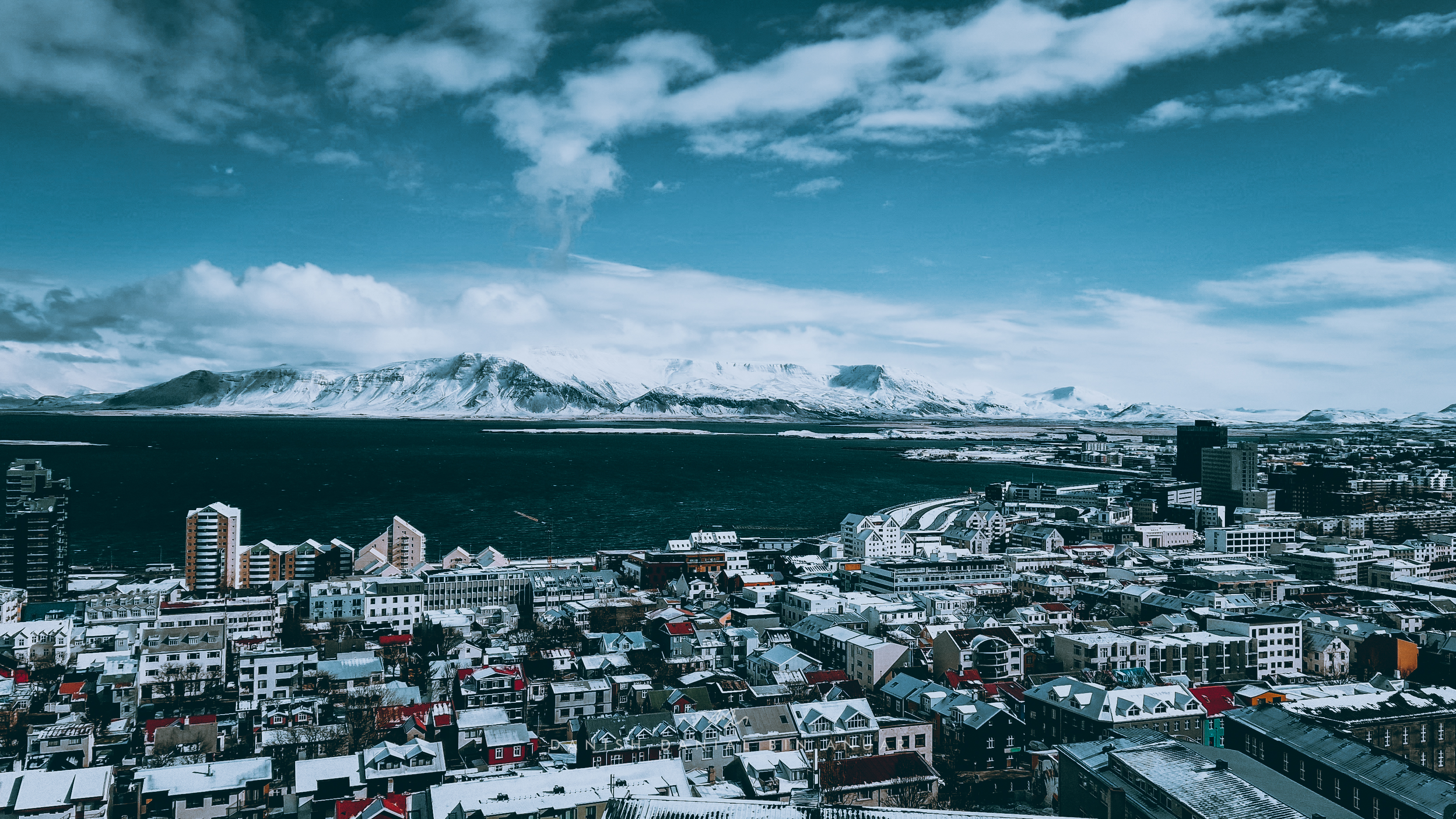
The church also had a bell tower that I was able to climb to catch breathtaking sweeping views of Reykjavik.
Reykjavik with the Esja Mountain Range in the background
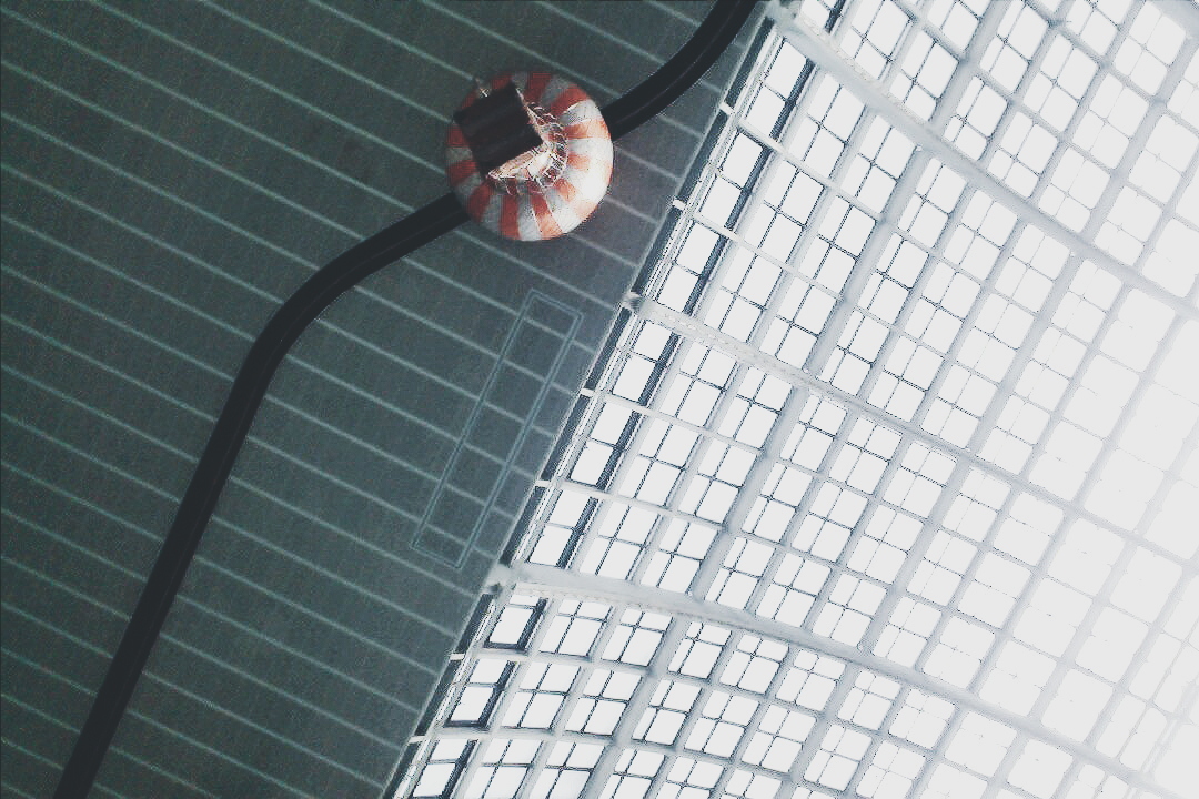
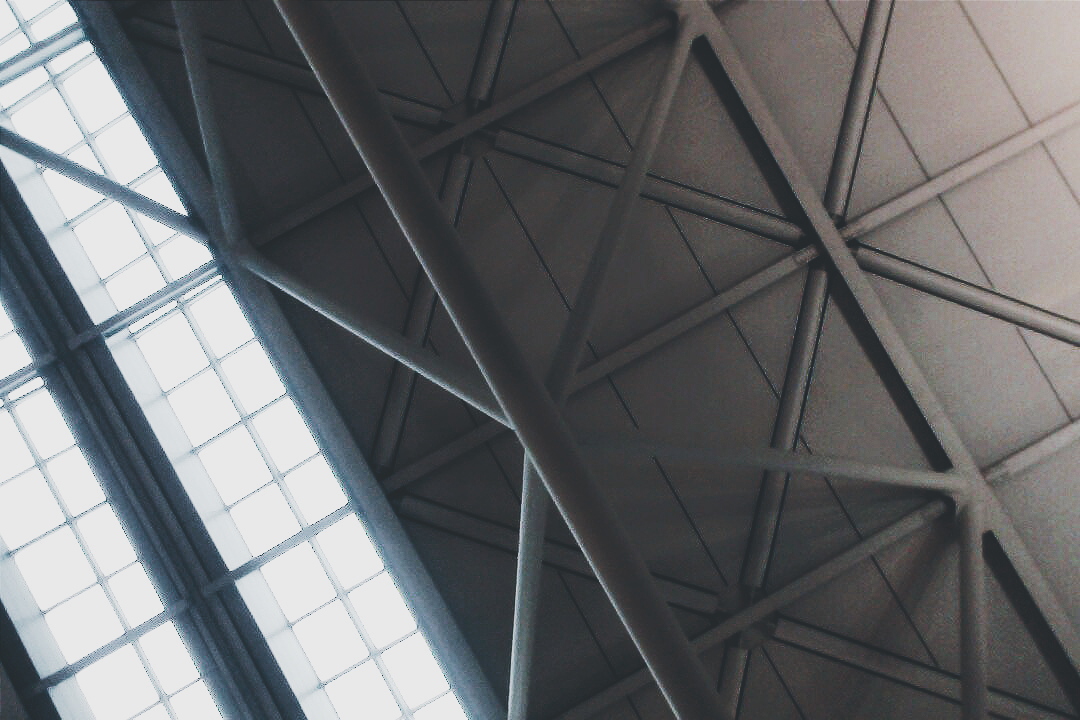
On my way back to my accommodation, there was a glass building called the Harpa, which was a concert and conference hall. The design was inspired by a honeycomb structure and it was a nice building especially to take photos of.
Interior of The Harpa
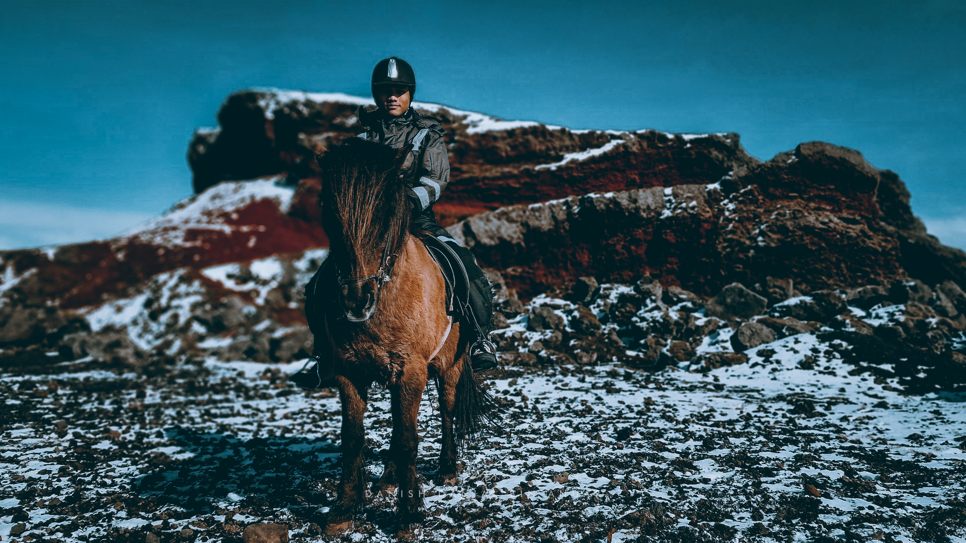
For the 2nd half of the day, I booked a Horseback tour with Solhestar to visit some red lava formations somewhere southeast of Reykjavik. Our driver took us to a place called Rauðhólar which was a cluster of remnants of pseudo-craters, common across Iceland. Pseudo-craters are formed by explosive steam when hot lava traverses over a wet surface such as a lake or a swamp. At the stable, we had to gear up a winter riding jacket and I was introduced to my horse, Valiant, who was going to take me around the area.
Icelandic Horses are pretty unique. Like other horses, they are able to walk, trot, and canter. However, unlike other horses, they are also able to, what Icelanders call, tölt and skeið. All you need to know is that they have the capability of moving stably at high speeds. There were points in the tour where the horses sped up, and as how I was taught how to trot back in England, I naturally lifted my back up and followed the rhythm of the trot. However, the guide insisted that I leave my back on the saddle, and surprisingly, it was pretty smooth.
The tour was about an hour long; it sounds short but felt really long, especially when you’re on the back of a horse the entire time. There were some really good photo opportunities along the way, however, it is not advisable to take your phone out on the move as there were many puddles and mud, and the horse will be traversing small bodies of flowing water.
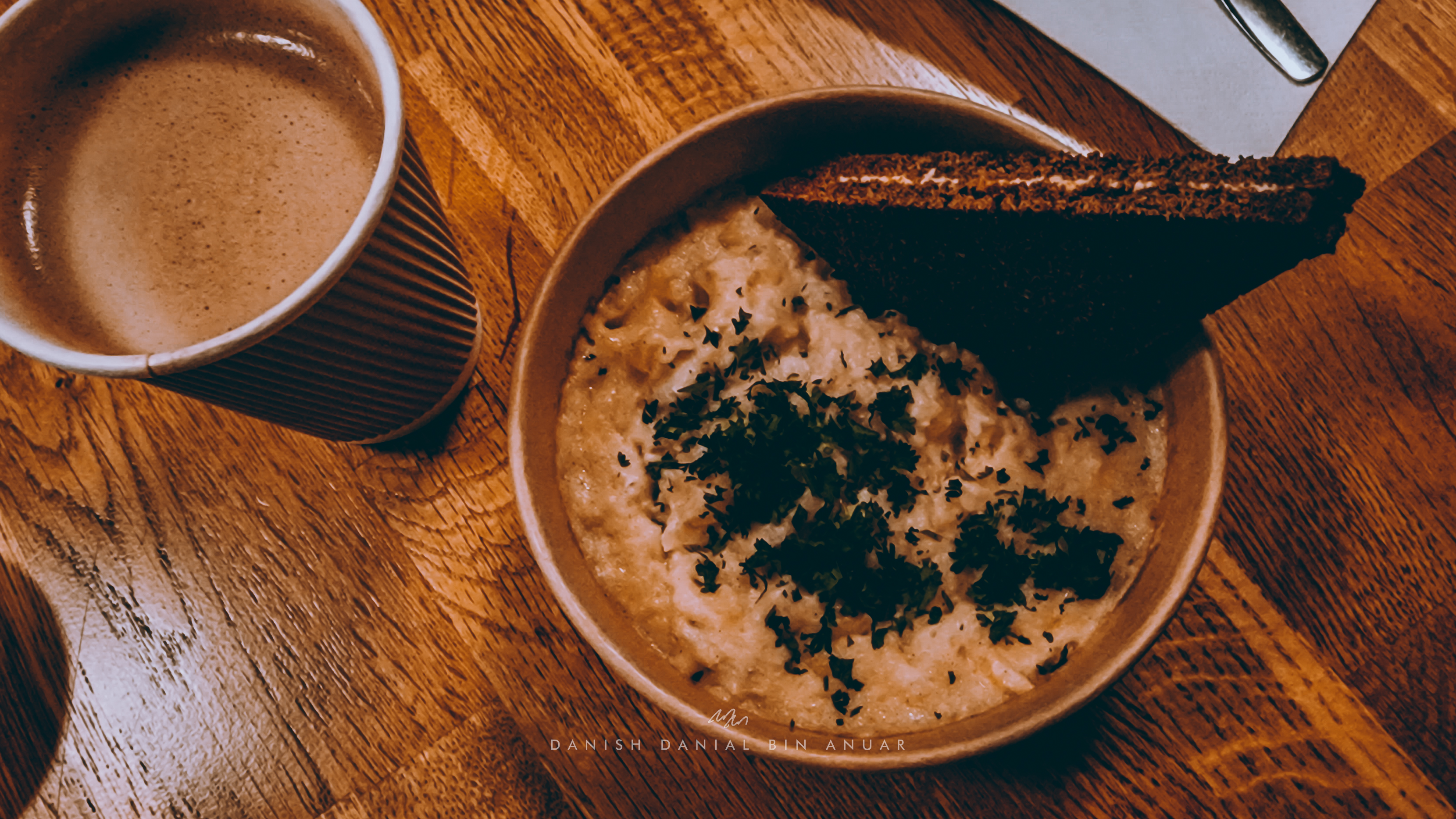
For dinner, I had a really cheap but sumptuous meal at 101 Reykjavik Street Food, a small restaurant on Rainbow Street. I was served traditional Fish Stew (mashed fish with potatoes) and some sweet rye bread. It doesn’t sound much but it’s absolutely delicious, and it’s one of my favorites from Iceland.
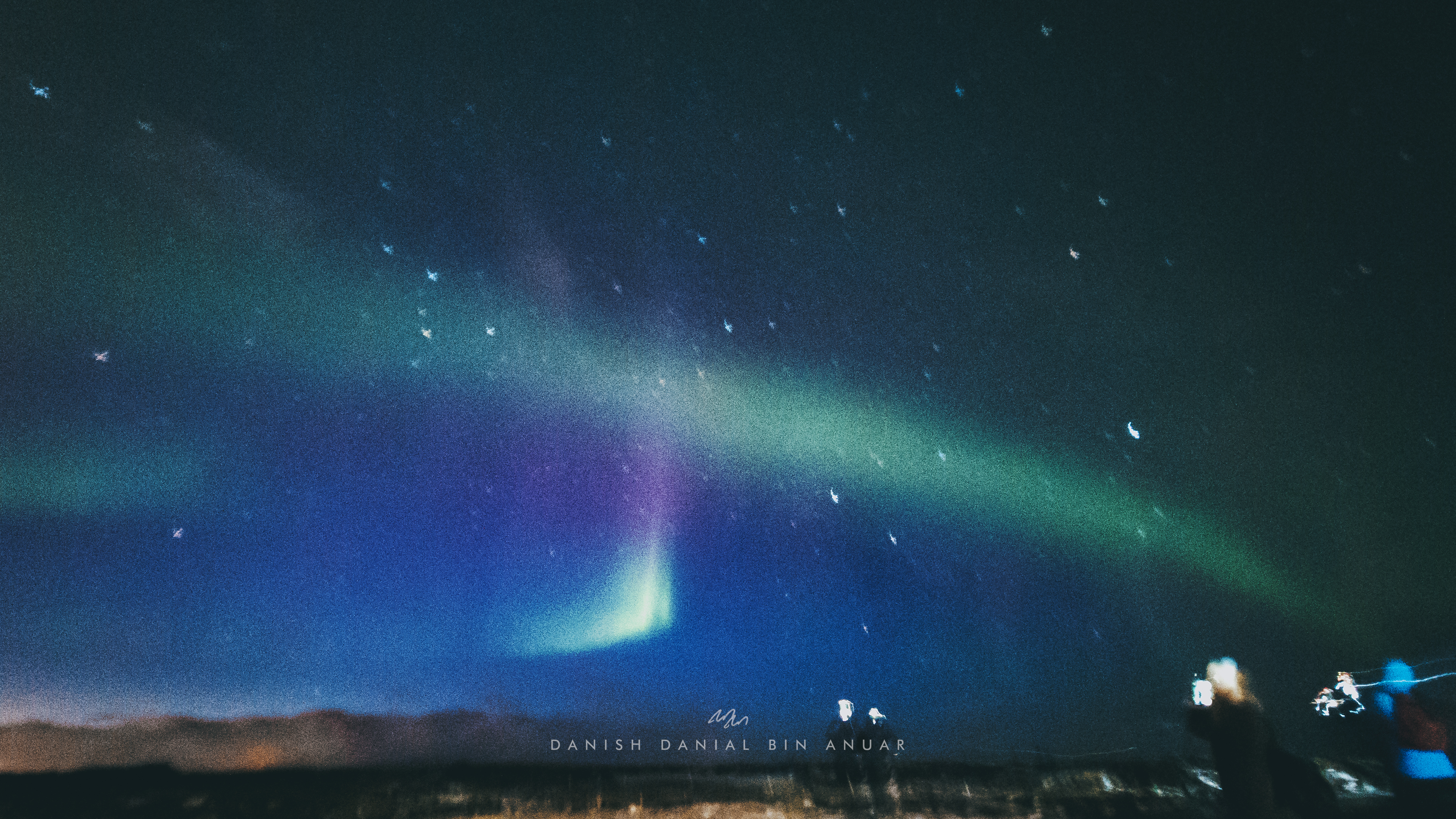
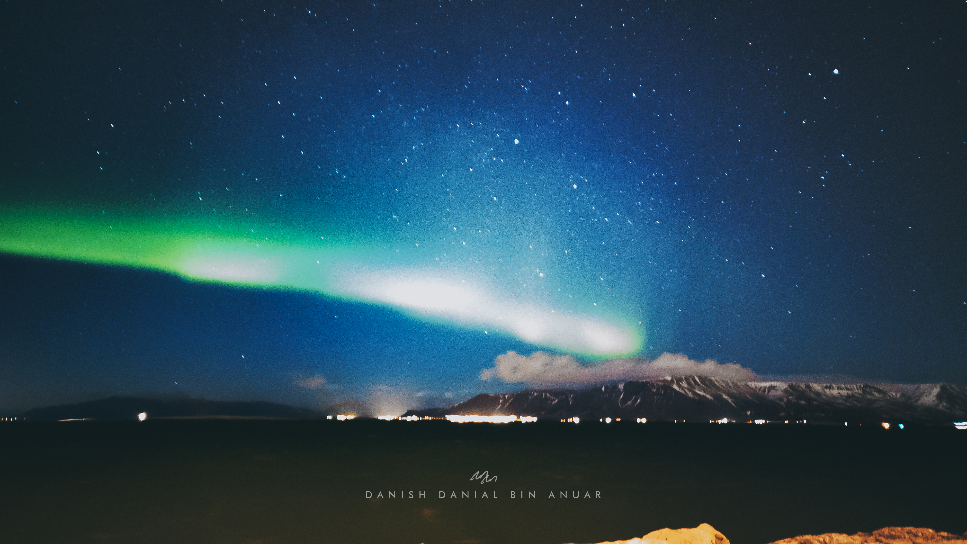
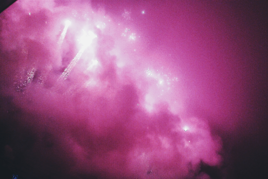
After dinner, I headed over to the central bus station to catch a bus to see the Northern Lights in a remote area to get away from all of the light pollution. Before moving off, I was ecstatic to learn that there was good solar activity and clear weather, which were ideal conditions to be able to see the northern lights clearly. When we arrived at the sighting location, I was completely mesmerized by the sight of the lights. The lights are a little different from what you see in photos; from a first glance, they looked white, like a long huge cloud across the sky. I didn’t waste time to take a couple of photos, unfortunately however, they weren’t clear due to windy conditions that didn’t allow my phone to remain on a stable foundation. However, I was a little lucky the night after (spoiler).
The Northern Lights can only be seen between September and April, and the high chances of activity are every 20-25 days.
Day 2
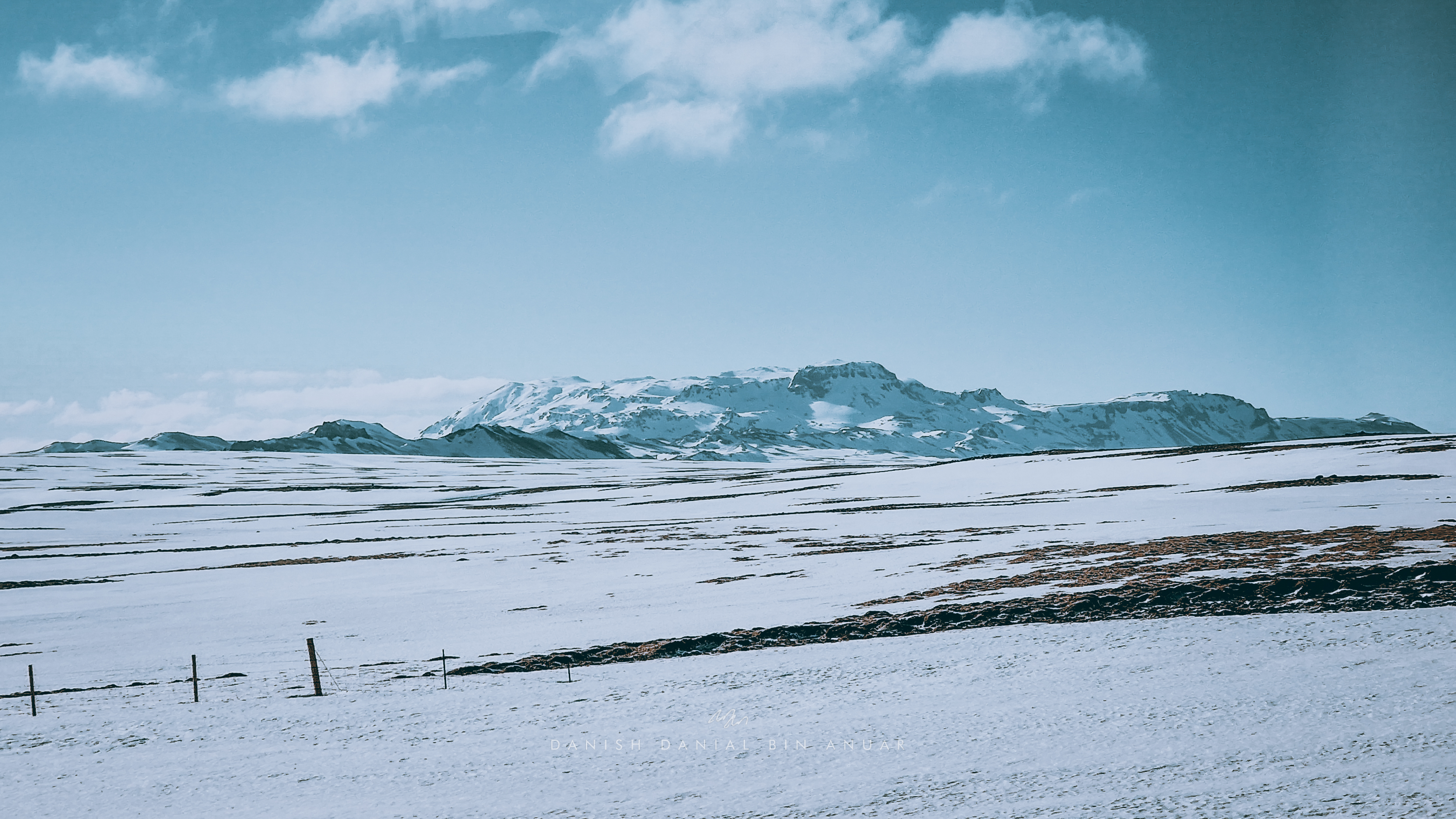
On Day 2, I boarded a tour of The Golden Circle. The Golden Circle is a route northeast of Reykjavik and serves as a fantastic introduction to what Iceland has to offer. The route goes through a number of natural wonders including Þingvellir National Park, Gullfoss, and the Haukadalur Geysir area. On our way to Þingvellir, one of the most interesting things that I’ve noticed is that the landscape changes dramatically every 20-30 minutes. For one moment, the landscape is covered with snow, and then greenery in the next. This is pretty much a recurring theme for my road trips in the coming days where the scenery would change completely every couple of miles. This is due to a combination of many environmental factors such as topography, weather, as well as geothermal activity.
Þingvellir, our first stop, is an important historical and natural location. Firstly, located here is the world’s oldest parliament established in the 900s. It also used to be where historically, travelers during the Viking Age would gather in July to trade goods.
Site of the World’s Oldest Parliament
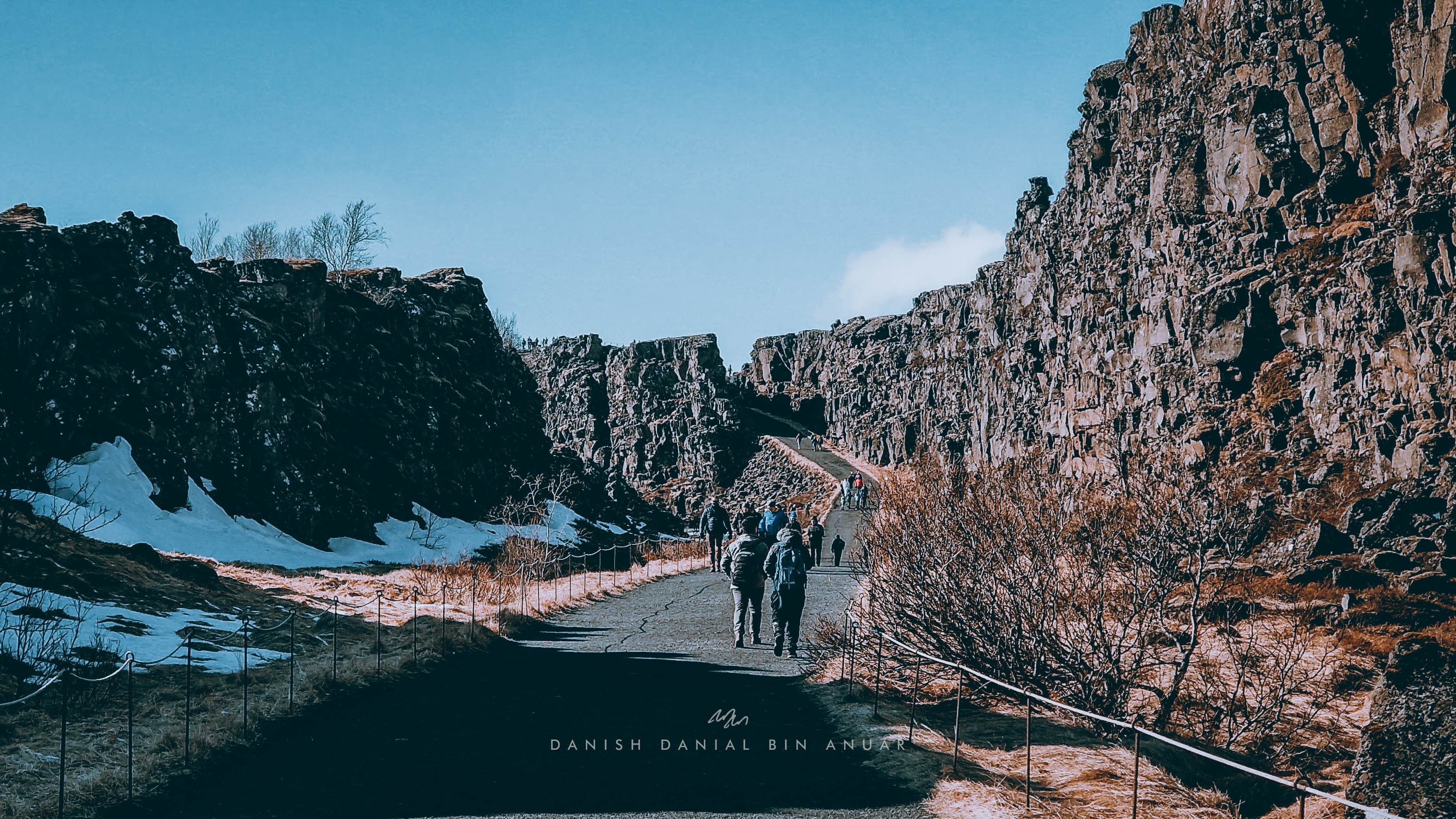
Secondly, this site is also only one of the few places in the world where the rift between the North-American and the Eurasian plates is visible. Every year, the two plates drift at an average of 2cm. There is a pathway between the two plates that you can walk through and gaze at the two huge ridges that represent each plate. Interestingly, this pathway used to be a road and in the process of converting it into a pathway, they were surprised to find a huge gap underneath the road.
Next, we headed over to Gulfoss, a canyon waterfall. It’s also known as the Golden Waterfall as it takes a golden color on a sunny day. The waterfall is fed by Langjökull, a long glacier that you can see from afar.
LangjökullGulfossGulfoss Canyon
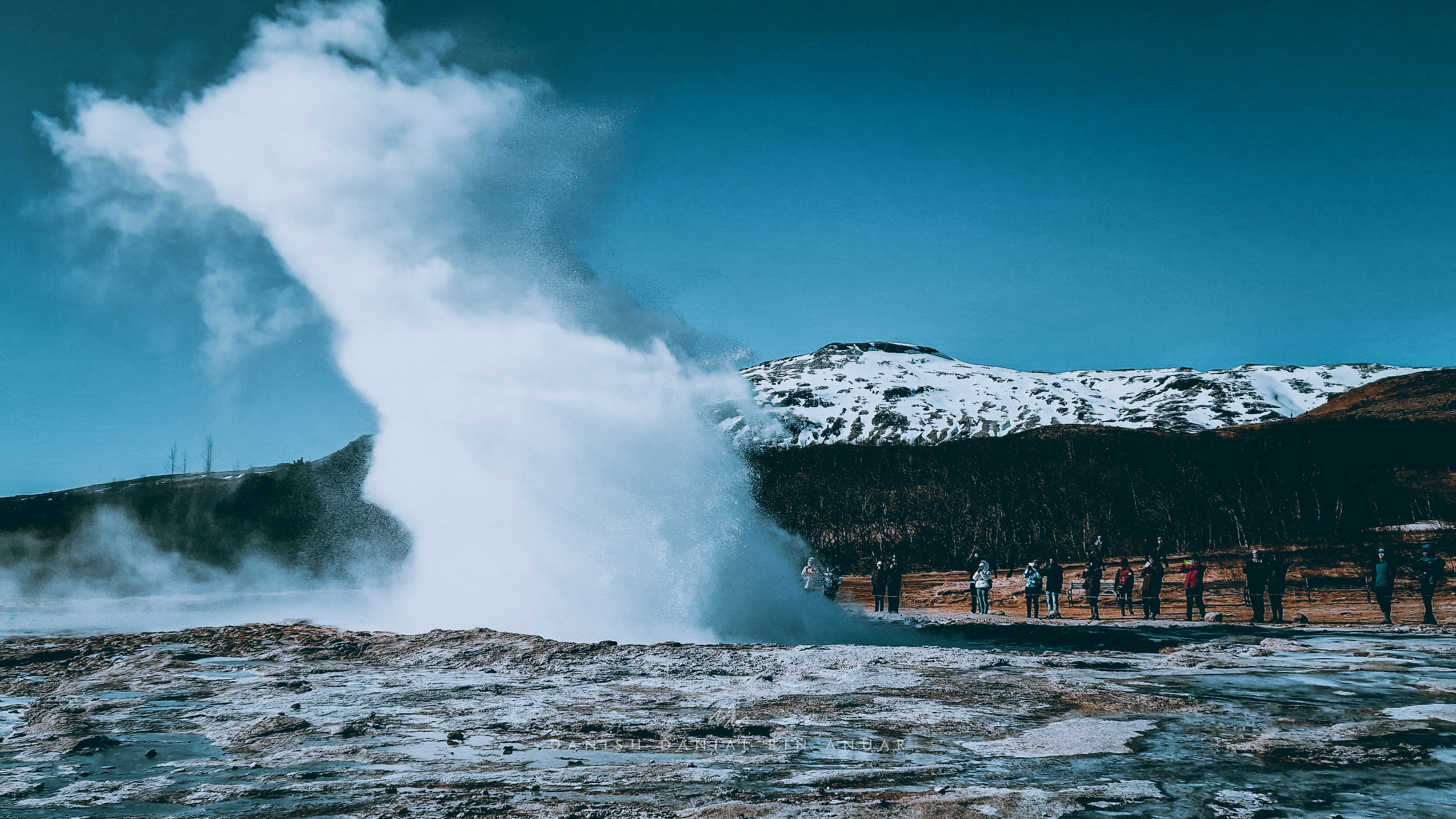
Afterward, we went over to Haukadalur Valley, where we got to visit a Geysir park. Geysers are made possible due to shallow bodies of flowing magma underneath the surface that heats groundwater. The constriction at the mouth of the geyser, causes water to burst, giving the occasional eruptions that you see at the surface. One thing to note when visiting the Geysir park is to never get too close to the geysers due to hot boiling water. Also, like most volcanic areas in Iceland, the area will smell like rotten eggs due to the presence of hydrogen sulfide, a gas produced from volcanic activity.
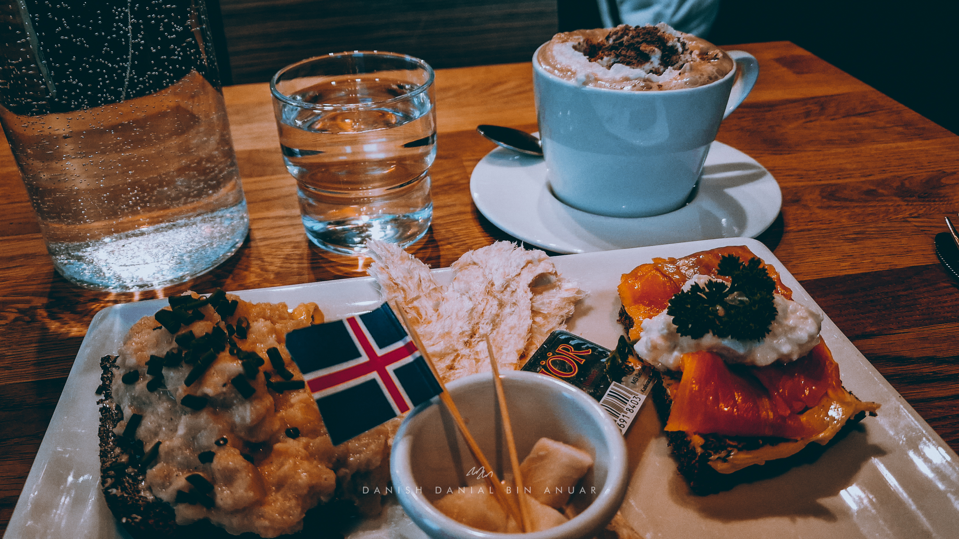
I headed back for dinner at Café Loki where I got myself a platter of a mix of different Icelandic food such as salmon on rye bread and fish stew. I also got a chance for the first time to try fish jerky which makes a really nice snack when combined with butter.
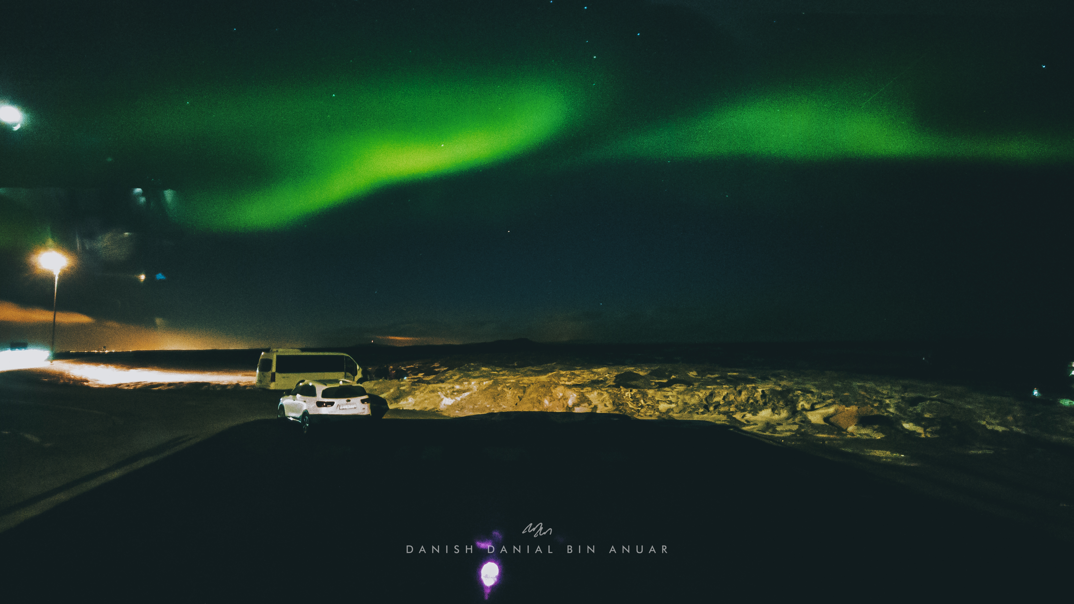
On my way back to my accommodation, I got a notification that there was high solar activity through a Telegram channel that I was in. I quickly went to the Solar Voyager area to spot the lights, and lo and behold – the Northern Lights manifested before my eyes.
Day 3
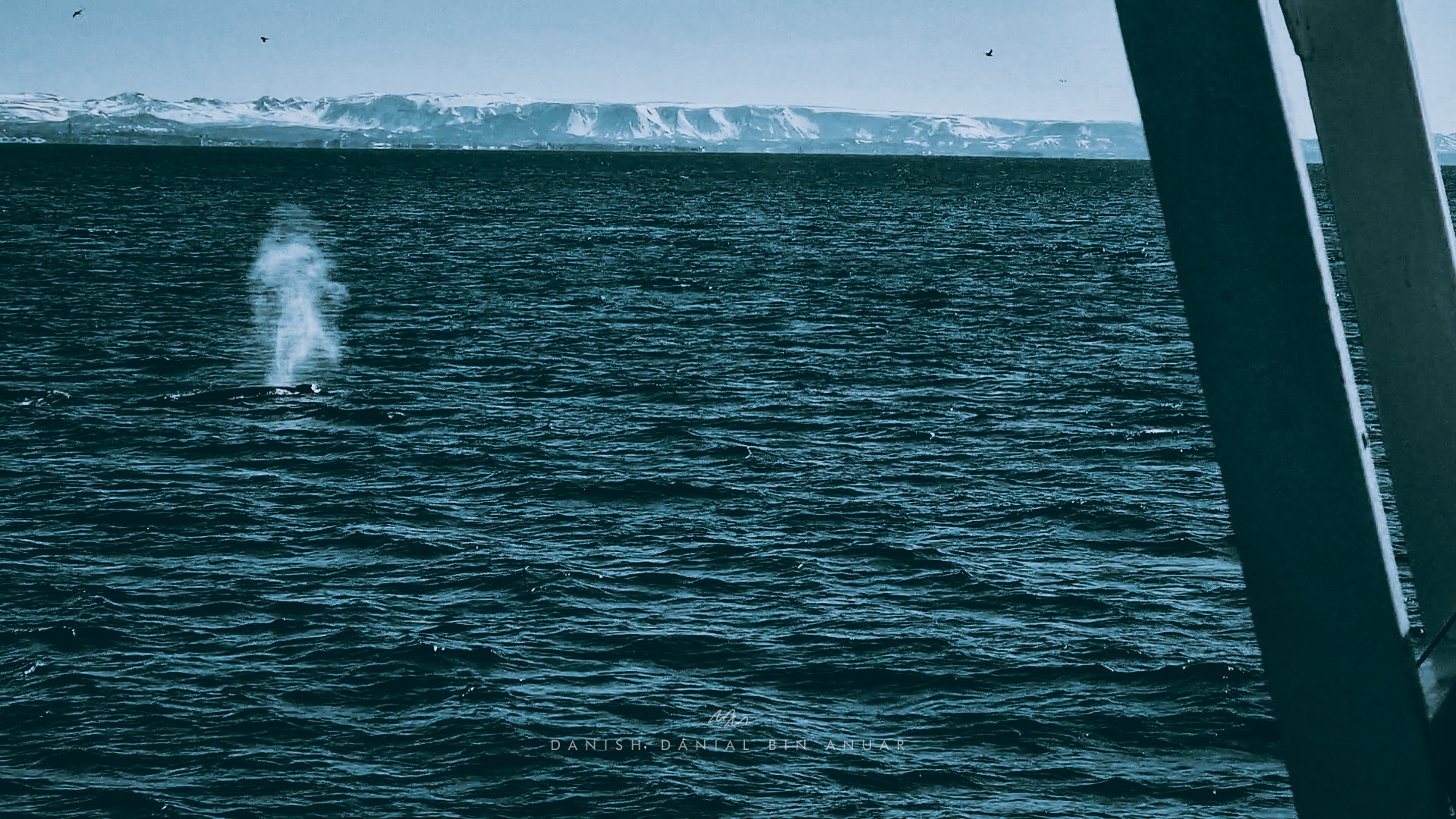
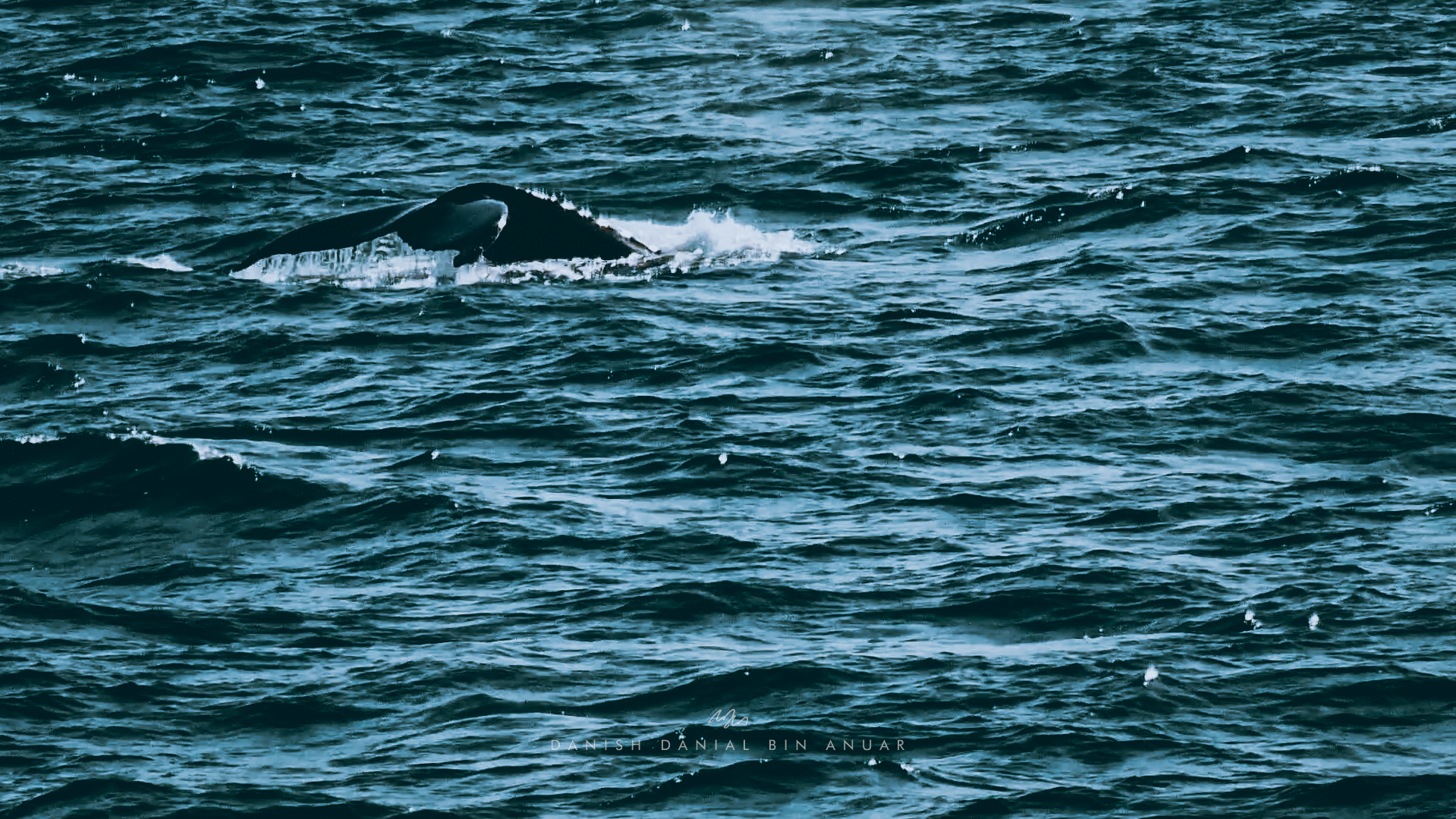
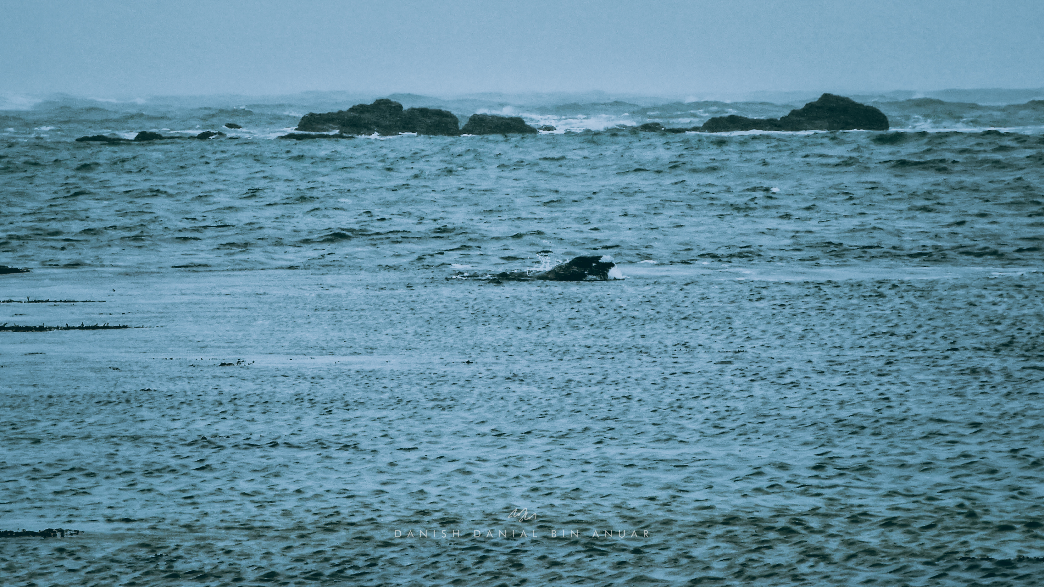
On Day 3, I decided to do some whale watching. Honestly, when I first booked this tour, I wasn’t very optimistic. I have always had the thought that the whales would likely avoid areas where large ships would traverse – I was wrong. We first set out from a historic harbor towards Akranes, a small town up north of Reykjavik. The area is also known Hvalfjarðarsveit, or Whale Fjord, due to the whale activity there. As we were on the way there, another boat reported seeing dolphins which I didn’t get to see for myself. However, soon, we got to see our first sight of humpback whales.
There are numerous tricks to anticipate spotting whales. Firstly, keep a lookout for birds. As whales rise to the surface, some of the seafood that whales feed on would be ejected through their blowholes, attracting marine birds. So wherever birds are anticipating food, that is where a whale would most likely have been. Secondly, blowholes usually would appear a couple of seconds before the whales would rise to the surface. Also, the blowholes are very visible from afar especially on a clear day.
For the rest of the day, I spent some time exploring more of the city centre, just going in and out of shops just to burn time.
For dinner, I went to another Icelandic restaurant called Salka Valka, and hands down – this was the best restaurant I’ve been to all of my time here. I had one of their mixed platters with fish of the day, sweet potato, some salad, rice, and sweet rye bread.
Day 4
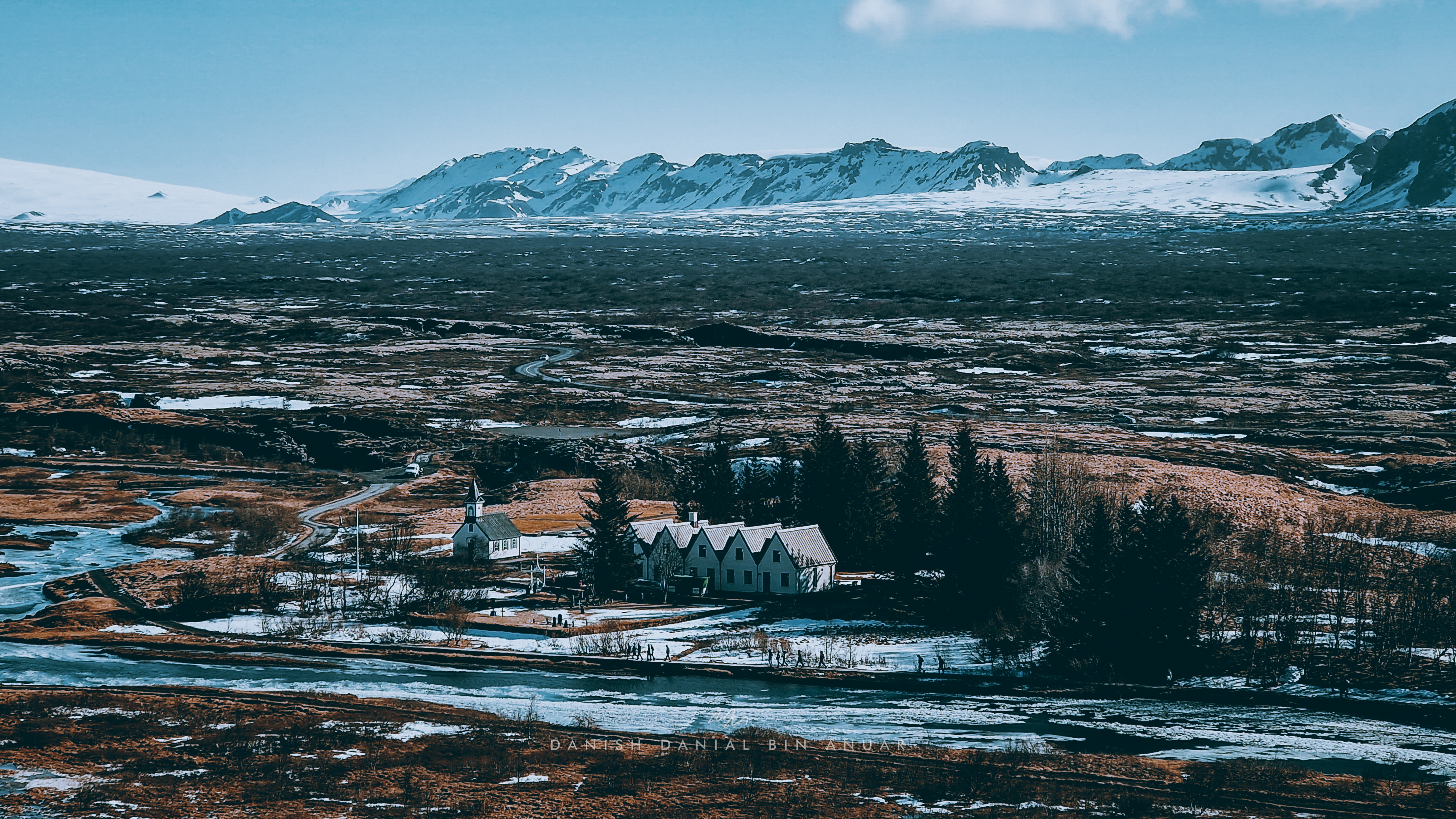
On Day 4, I went on a tour of the south coast of Iceland. I visited places such as Seljalandsfoss, Skógafoss, Reynisfjara Black Sand Beach, Vik, and Jökulsárlón Iceberg Lagoon. Along the way we saw breathtaking views, Icelandic horses, as well as lone, red churches standing out in contrast to the landscape.
For our first stop – the Seljalandsfoss waterfalls area is fed by Eyjafjallajökull, a glacier atop a volcano with the same name. This volcano is well known to be the volcano that erupted in 2010 causing a huge disruption to European aviation. There is an area around the falls where you can walk around behind the falls to get a different view. However, due to icy conditions, this was closed.
Just a 5-minute walk from this waterfall, there is a hidden waterfall called Gljufrabui, which makes for a very nice photo spot.
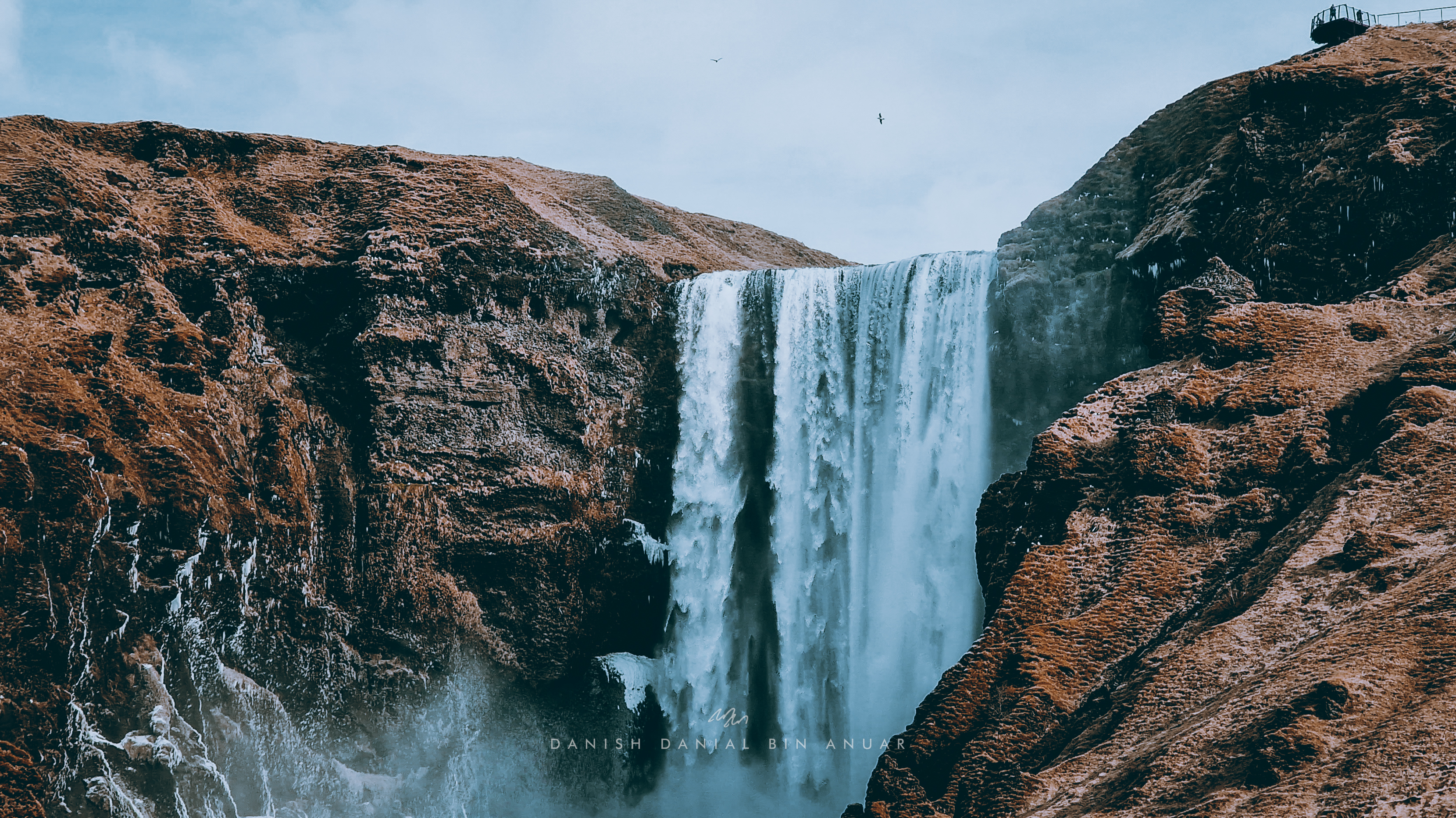
Afterward, we headed over to Skógafoss, which is one of the largest waterfalls in Iceland. There is a trail that leads up all the way to the top of the waterfall that gives you a nice bird’s eye view of the area.
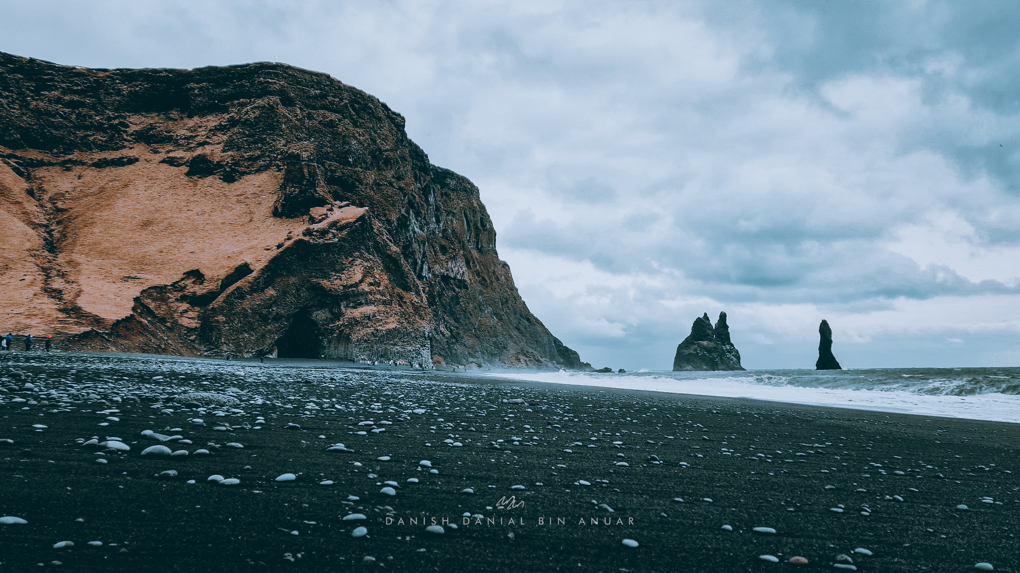
Next up was the Reynisfjara Black Sand Beach. The sand is black due to volcanic activity when hot lava cools to form black sediments. There are also other geographic formations on the beach as well such as caves and basalt columns. Just some things to take note – don’t get too close to the beach as the waves are really powerful (you can draw a straight line from the beach to Antarctica) and it is advisable not to go into the caves as there are reports of boulders falling from the roof.
Nearby, we headed to Vic, a small but important town for ships due to its location in the middle of the south coast. There is nothing much here but the town makes for a very picturesque place.
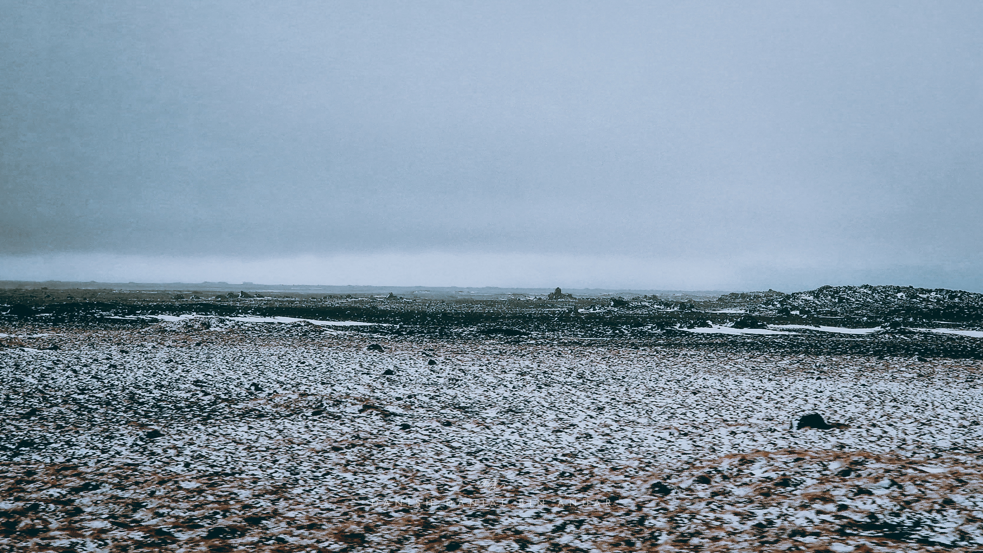
Next, we made our way to Jökulsárlón Iceberg Lagoon through Iceland’s largest desert. This was where the landscape completely changed every 30 minutes. There was a grassy plain, a snow-covered lava field, and a black-sand desert; and these rotated and shuffled every now and then. It’s one of the main reasons why I’m so intrigued by Iceland’s geography.
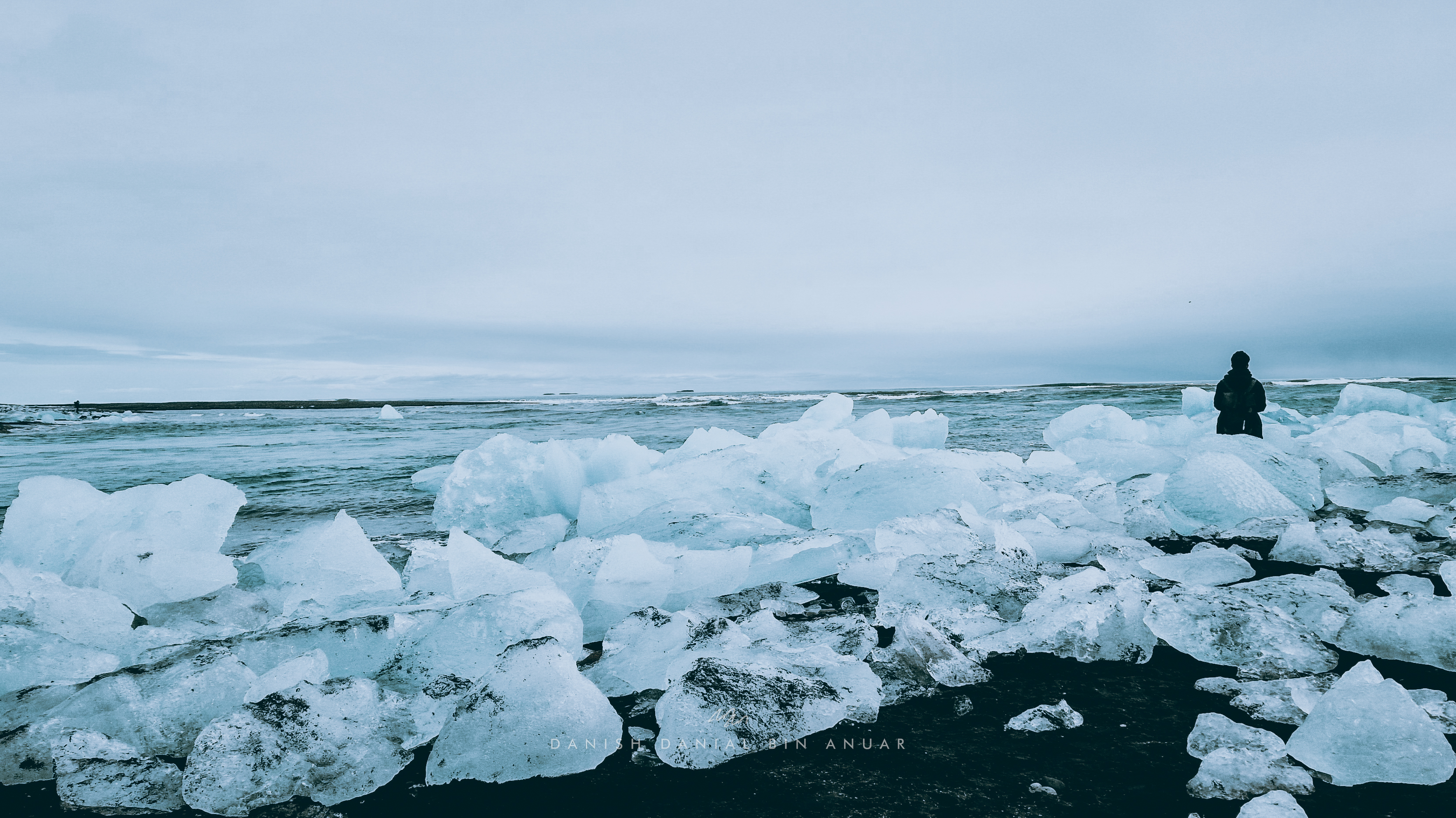
At Jökulsárlón Iceberg Lagoon, we first made our way to Diamond Beach where the residue of icebergs from the lagoon would get pushed back to the beach by the wave, creating this blue, ice-lined beach. Apparently, if you’re lucky enough, you’ll be able to see seals going up and down the lagoon from the beach. However, since the river was flowing faster downstream at the time, this wasn’t the case.
We then walked upwards to the lagoon itself. It was strewn with icebergs of different sizes separated from Vatnajökull, Europe’s largest glacier. This is possible due to the effects of global warming with the lagoon growing in size every year.
Day 5
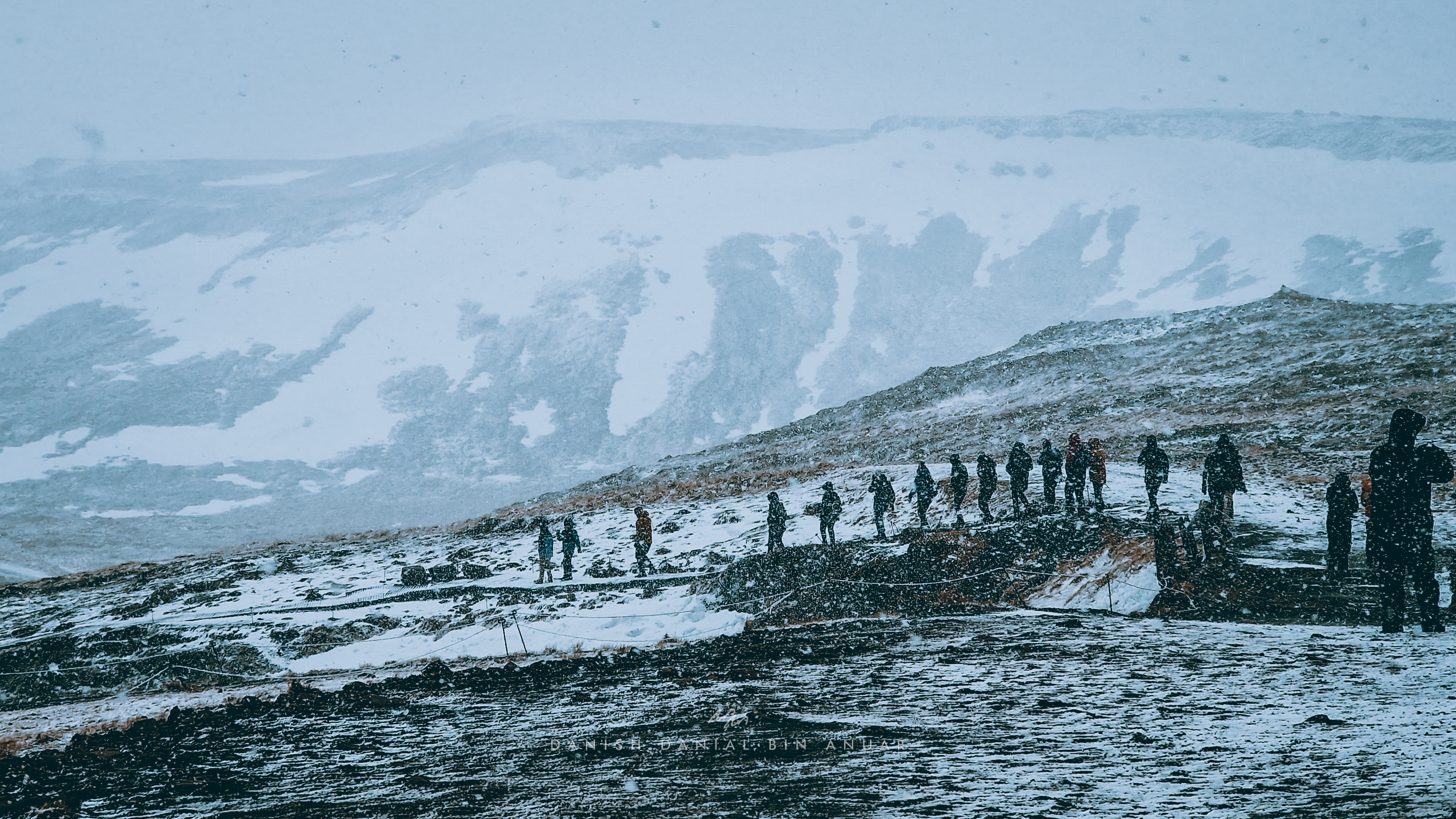
On Day 5, I went on a tour of the Snæfelsness Peninsula which was on the west coast of Iceland. The key places that we visited were Kirkjufell Mountain, Lóndrangar, Búðakirkja (Black Church), Ytri Tunga Beach, and Gerðuberg Cliffs. I was quite optimistic about this tour given that the weather was sunny in Reykjavik. However, once we stepped foot onto the peninsula strong winds and snow hit us in the face. Literally. And it was painful. The visibility got pretty bad and the roads were unsafe for driving. For the whole tour, our guide had to drive really slowly to get from point to point and stop concurrently due to strong winds. None of these exactly dampened my excitement though, as I felt that the experience as a whole really fun (maybe not quite for others).
Kirkjufell Mountain
After Kirkjufell Mountain, we headed over to Lóndrangar where we had views of the ridged-coastline which look like something out of a fictional movie. The winds were especially very powerful considering that we were facing directly against the Atlantic Ocean.
We then paid a visit to Búðakirkja, also known as the Black Church. The church was painted in tar, giving it its black color. Given the weather conditions, the church makes for good photos due to the contrast.
Next, we went to Ytri Tunga Beach where there was a colony of seals. The seals are pretty shy so most of them would lie on the rocks far from the shore. However, we got to see some up-close either lounging in the waters or fighting/playing with each other, whatever it is that seals do.
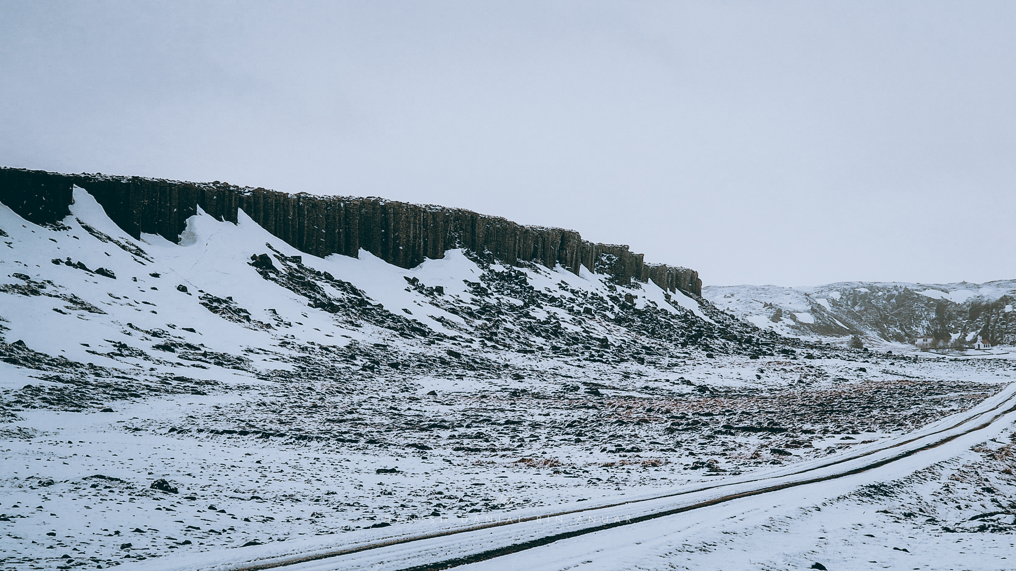
Finally, we visited Gerðuberg Cliffs, which was a long line of basalt columns. They weren’t exactly clear due to the snow but the area makes up to be very scenic.
Gerðuberg Cliffs
Day 6
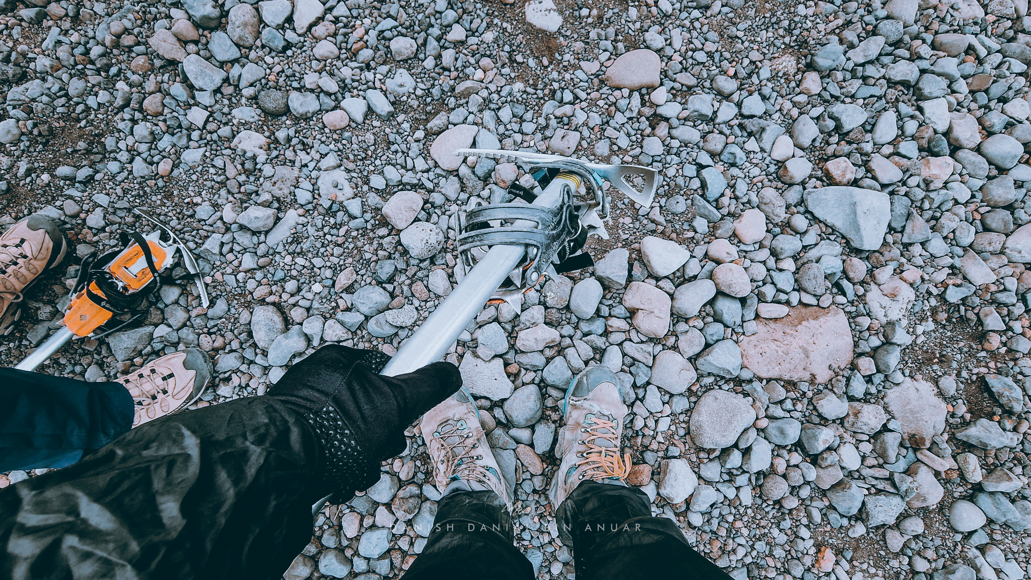
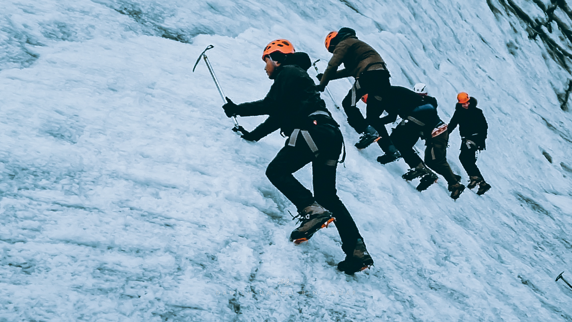
They say that one of the few things that you have to do in Iceland is to go on a hike. So, I booked a hike on one of the glaciers on the south coast of Iceland called Sólheimajökull, or Home of The Sun Glacier. This glacier is part of a larger glacier called Mýrdalsjökull which sits on top of Mt. Katla, which is an active volcano that is long overdue for an eruption. This hike was the best experience I’ve had in Iceland and it’s something I would recommend many to do.
Sólheimajökull
At base camp, we were given a harness, a helmet, an ice pick, and ice crampons for us to be able to walk on the glacier. Safety is of paramount importance here. As long as you follow instructions from your guide and remain attentive to your surroundings, you’ll be fine. The area itself risks things such as boulders falling from cliffs leading to the glacier itself, falling caves, as well as cracks as deep as 40 metres opening up. If anyone is thinking about climbing or even getting close to a glacial area, do closely follow the advise of a guide.
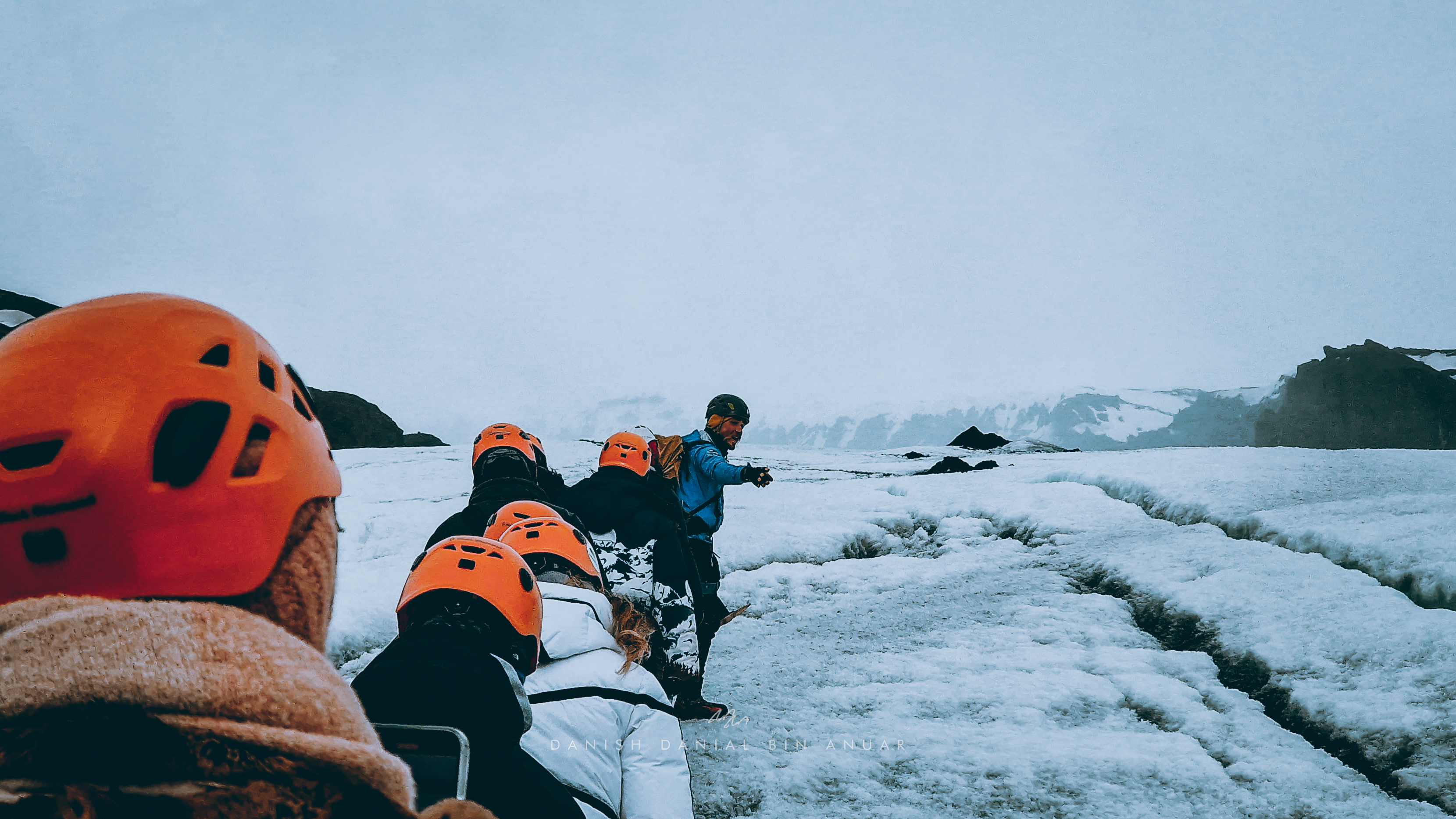
Once we got our equipment and a briefing, we followed our guide to the glacier itself. It was a little scary thinking about slipping walking on pure ice but once we got the hang of how our crampons worked, everything seemed fine. The glacier was covered in a mixture of snow and volcanic ash, and it is important that we kept a single file to avoid dropping into deep cracks or holes (that’s what the harness is for in case you fall into one).
One of the things that struck me from what the guide told us about the glacier is that it was progressively shrinking and breaking largely due to the effects of global warming. Additionally, the glacier changes its shape beyond recognition every few weeks or even days. This tour was the closest you can get to see for yourself the effects of climate change. From the expanding cracks to melting pieces of ice.
One of the best parts about this hike was that I got a chance to try and climb an ice wall. Our guide gave a quick tutorial on how to do it and the rest of us simply followed. Essentially, we had to lean forward, kick our crampons towards the ice, and use the ice pick as support.
So that was all I did in Iceland! One of the best experiences I’ve ever had in my life.
After my first course submission for 2022, I decided to go for my first solo trip of the year and so I booked a flight to Barcelona. I gave myself around 4 days there, but I wasn’t just confined to the city itself. I also did a few day trips to towns and cities around Catalonia including Montserrat, Tarragona, and Girona. Well, 4 days seemed short but I managed to pack in a lot of things mainly because I was traveling solo.
Day 1
After spending a night after my flight, I made my way to the nearest metro station. Along the way, I came across Casa Batllo. This building also known as Casa Dels Ossos or House of Bones stands out as a stark representation of Modernist Catalonian architecture. It was first constructed in 1877 and was then redesigned in 1904 by Antoni Gaudí, a well-known architect for his works including the famous Sagrada Família which was my next destination.
Casa Batllo
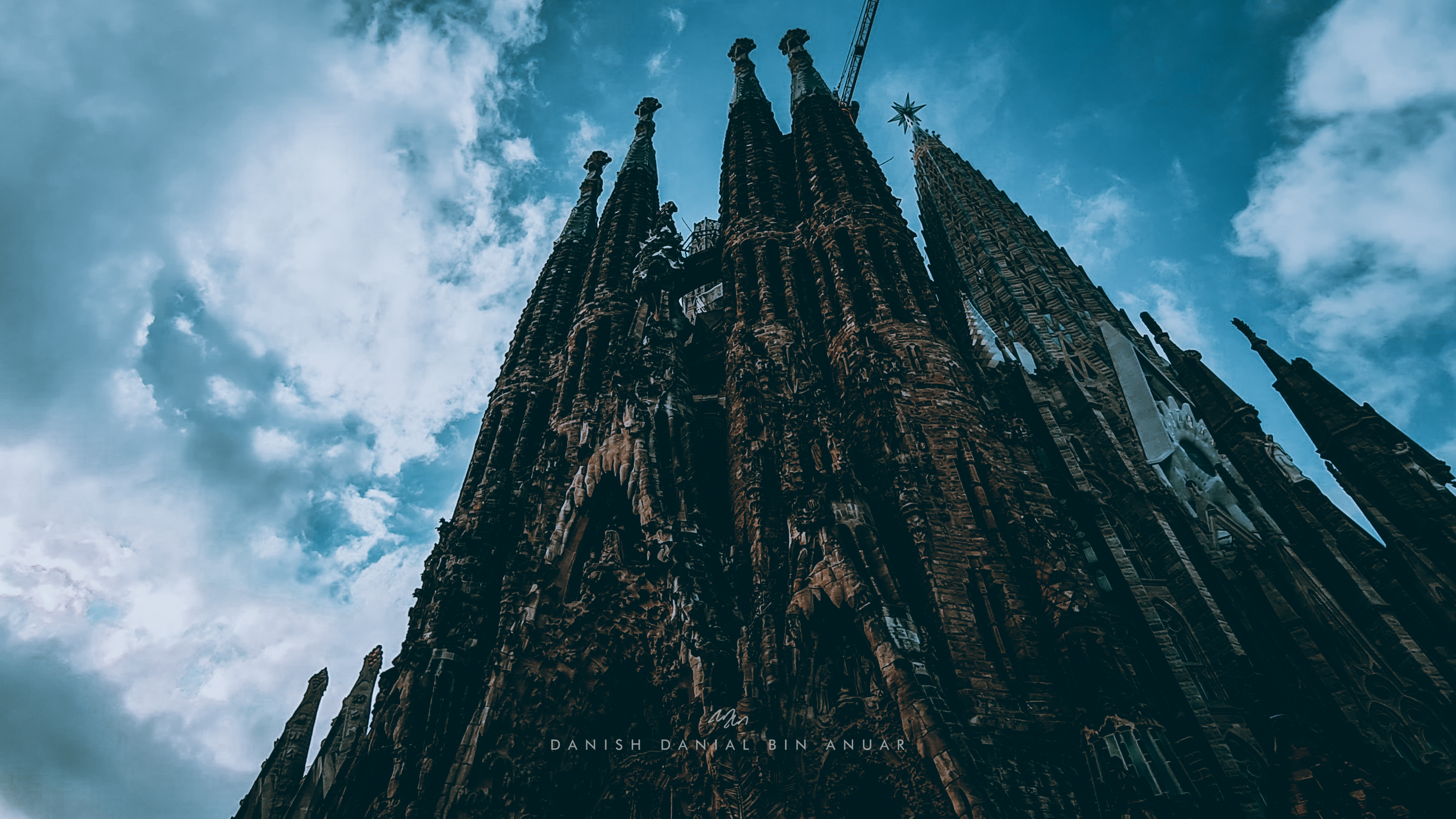
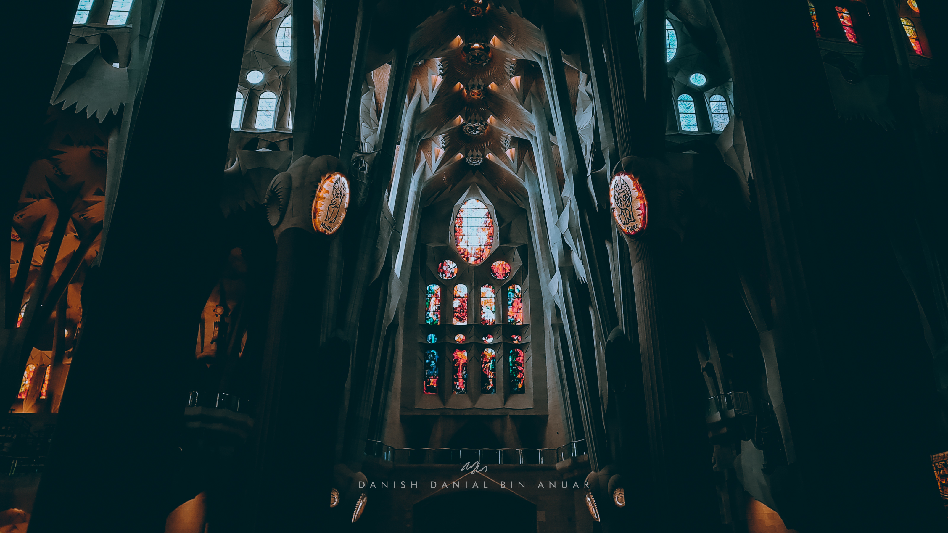
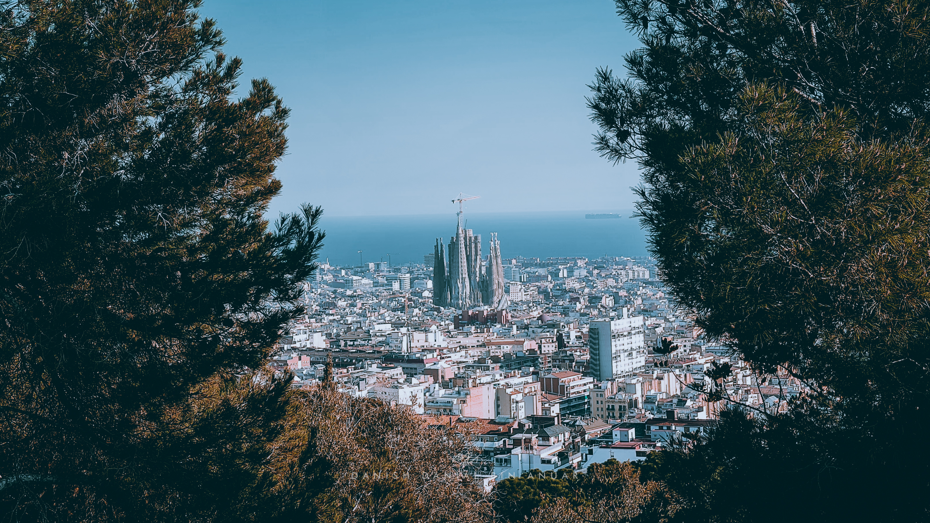
The Basílica de la Sagrada Família is essentially one of the major attractions in the city. Starting its construction in 1882, this basilica is still under construction, and works are expected to be completed beyond 2026. Some of its unique features include the use of a mix of both gothic and modernist Catalonian architecture, the huge spires that overlook the city, as well as the detailed sculptures on the facade. As I entered the basilica, I was mesmerized by the huge columns and nave vaults, and the lights that shone through the colorful stained windows.
Sagrada Família
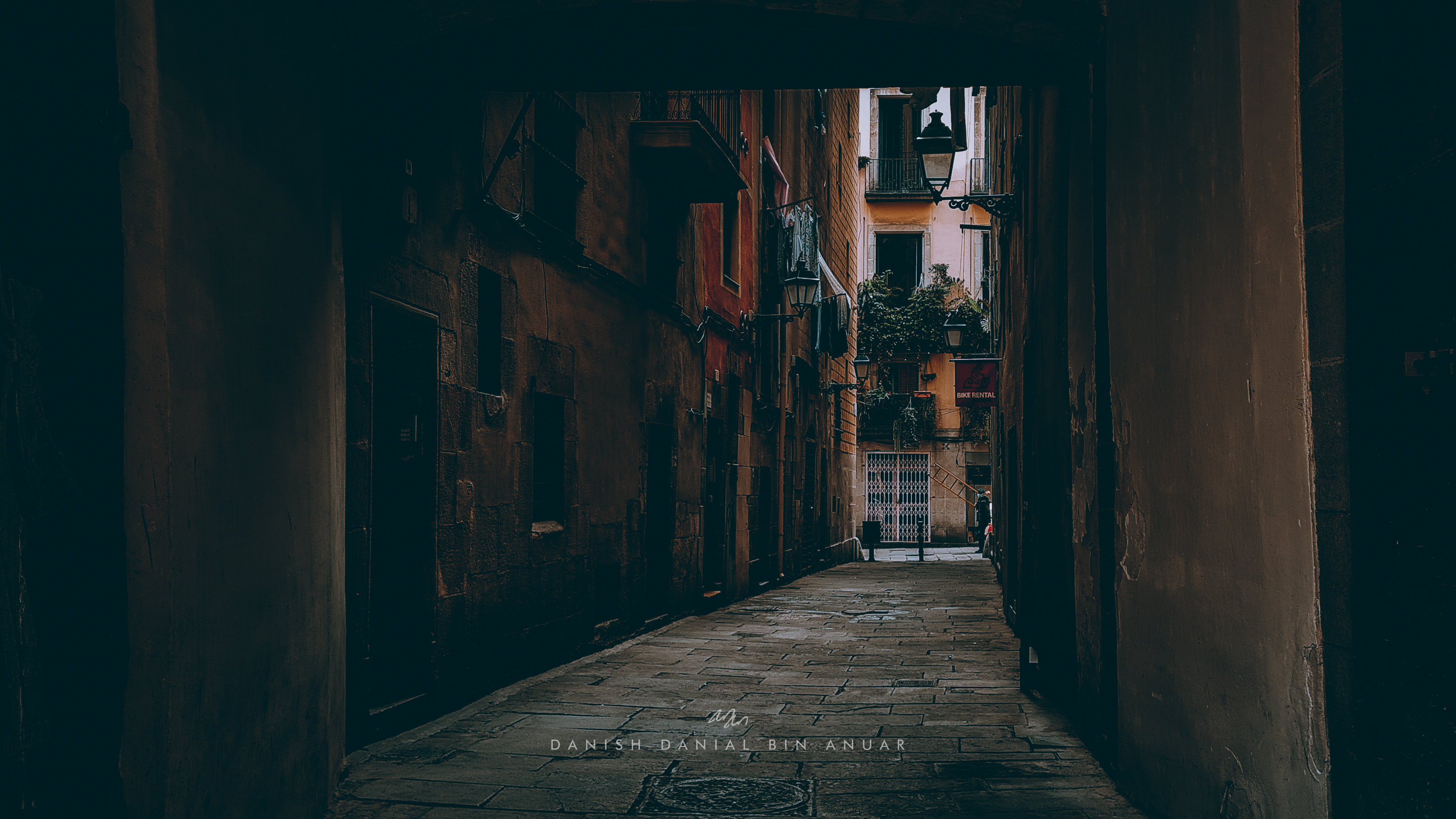
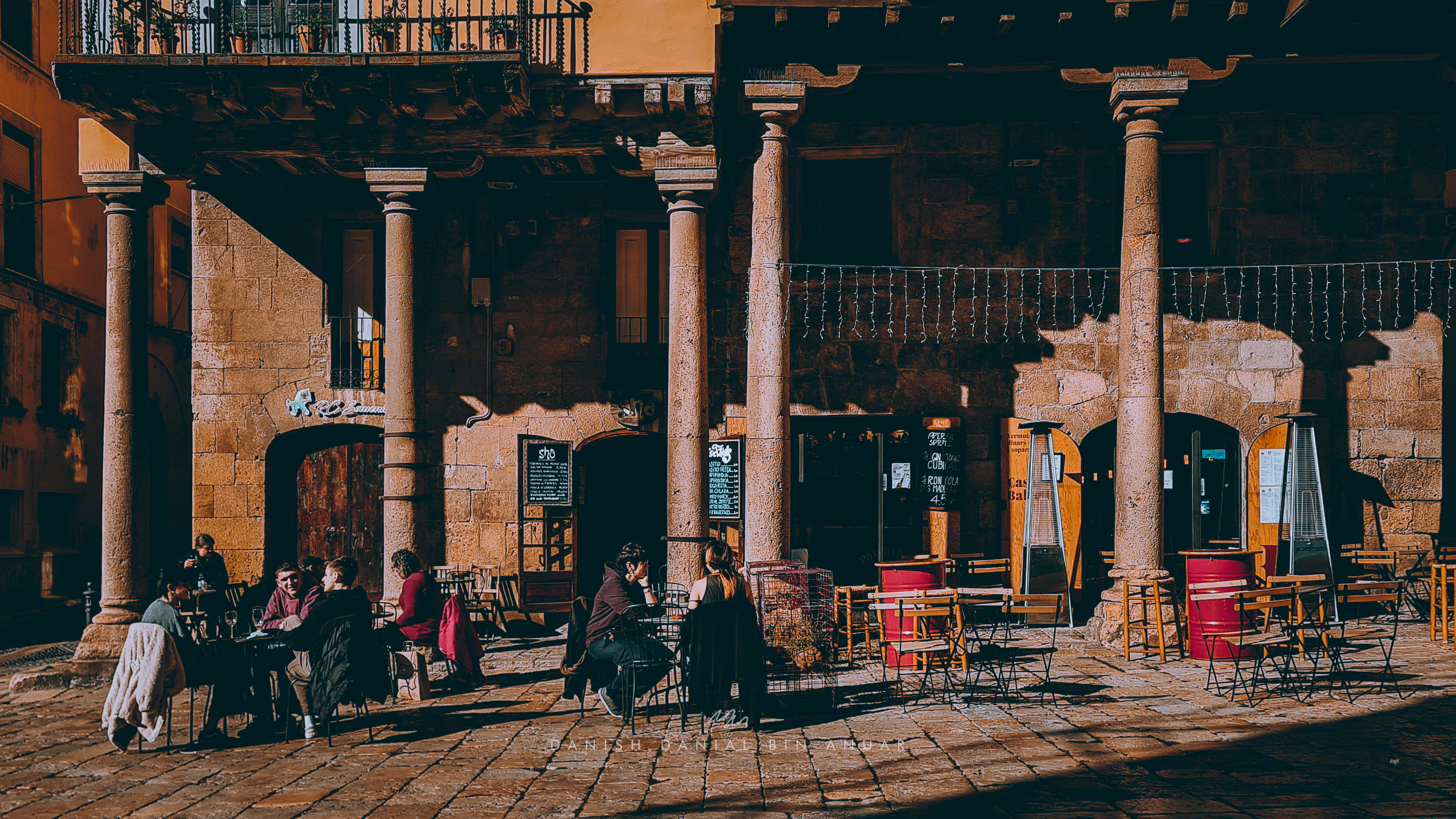
Afterward, I headed over to Barri Gòtic, or the Gothic Quarter to have my lunch as well as explore some of Barcelona’s medieval historical sites. Every alleyway and every street was pretty interesting to explore. I stumbled upon different kinds of restaurants, shops, and cafes. Some of the sites that I visited included the Cathedral of Barcelona, La Casa de l’Ardiaca, and the photogenic Carrer del Bisbe.
Cathedral of BarcelonaLa Casa de l’ArdiacaCarrer del Bisbe
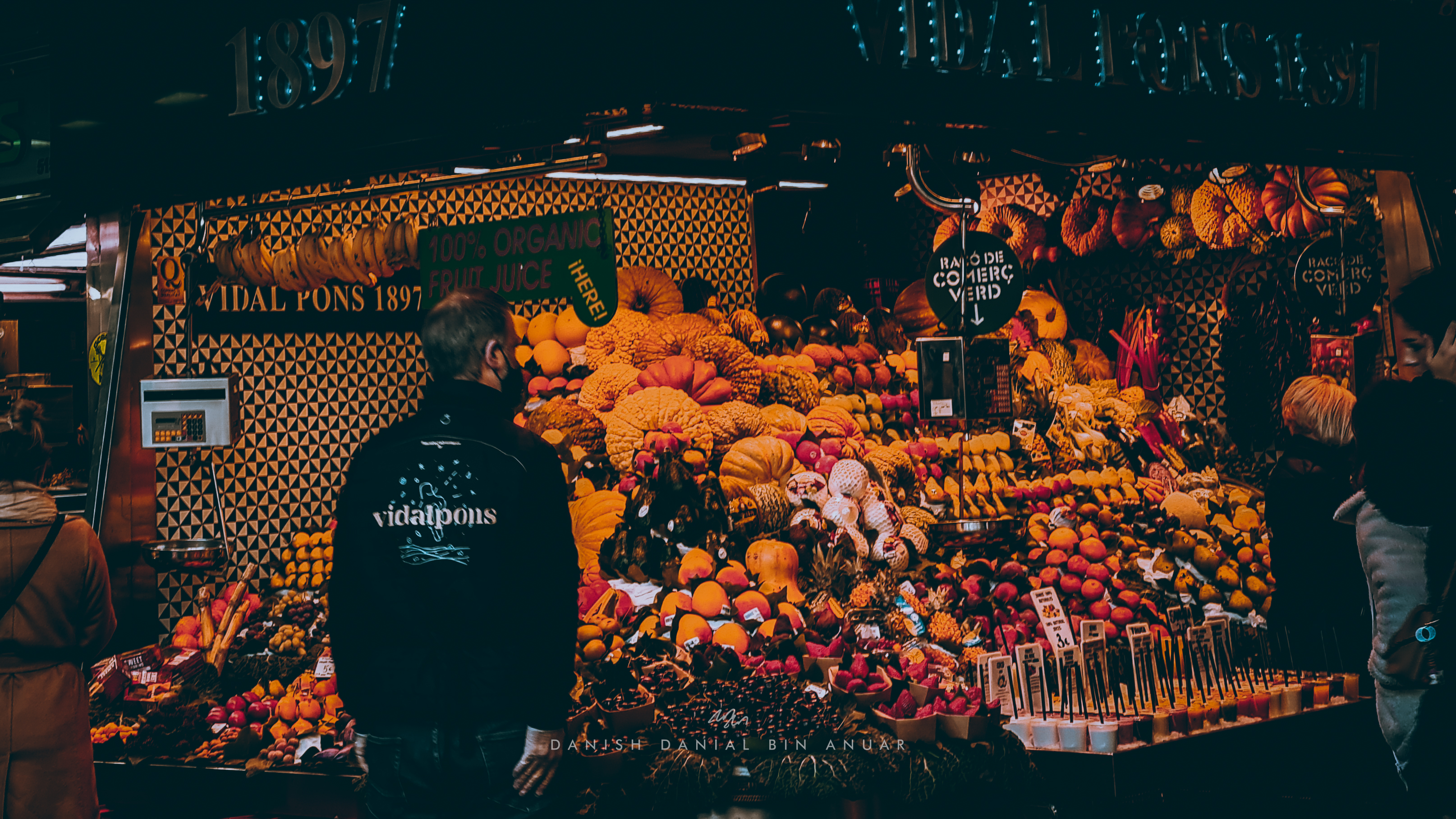
Nearby, I visited the Mercado de La Boqueria which was a famous market that sold all sorts of things such as meats, sweets, as well as fruits, vegetables, and other sorts of food.
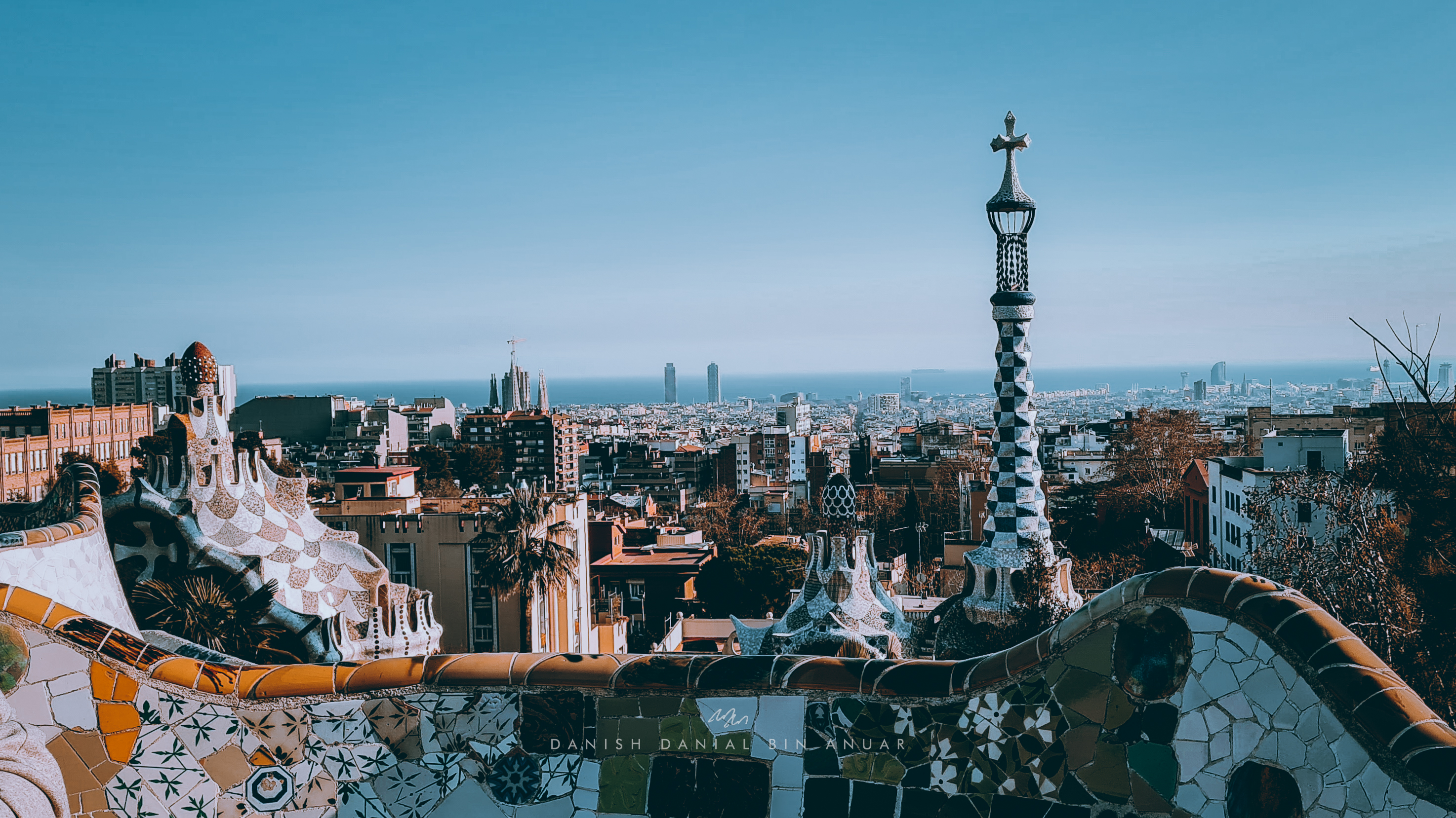
Next, I walked down the La Rambla to hop on the metro to Vallcarca on my way to Park Güell. The walk up to Park Güell wasn’t exactly easy as I had to climb up steep hills to get there, but along the way, I got a glimpse of some of the neighborhoods. Once I’ve passed the main entrance, there was more climbing to do, and I eventually, arrived at this lookout point that rewarded me with stunning views of the city. Afterward, I went down to the Greek Theatre to take a look at the intricate mosaics, and buildings also designed by Antoni Gaudi.
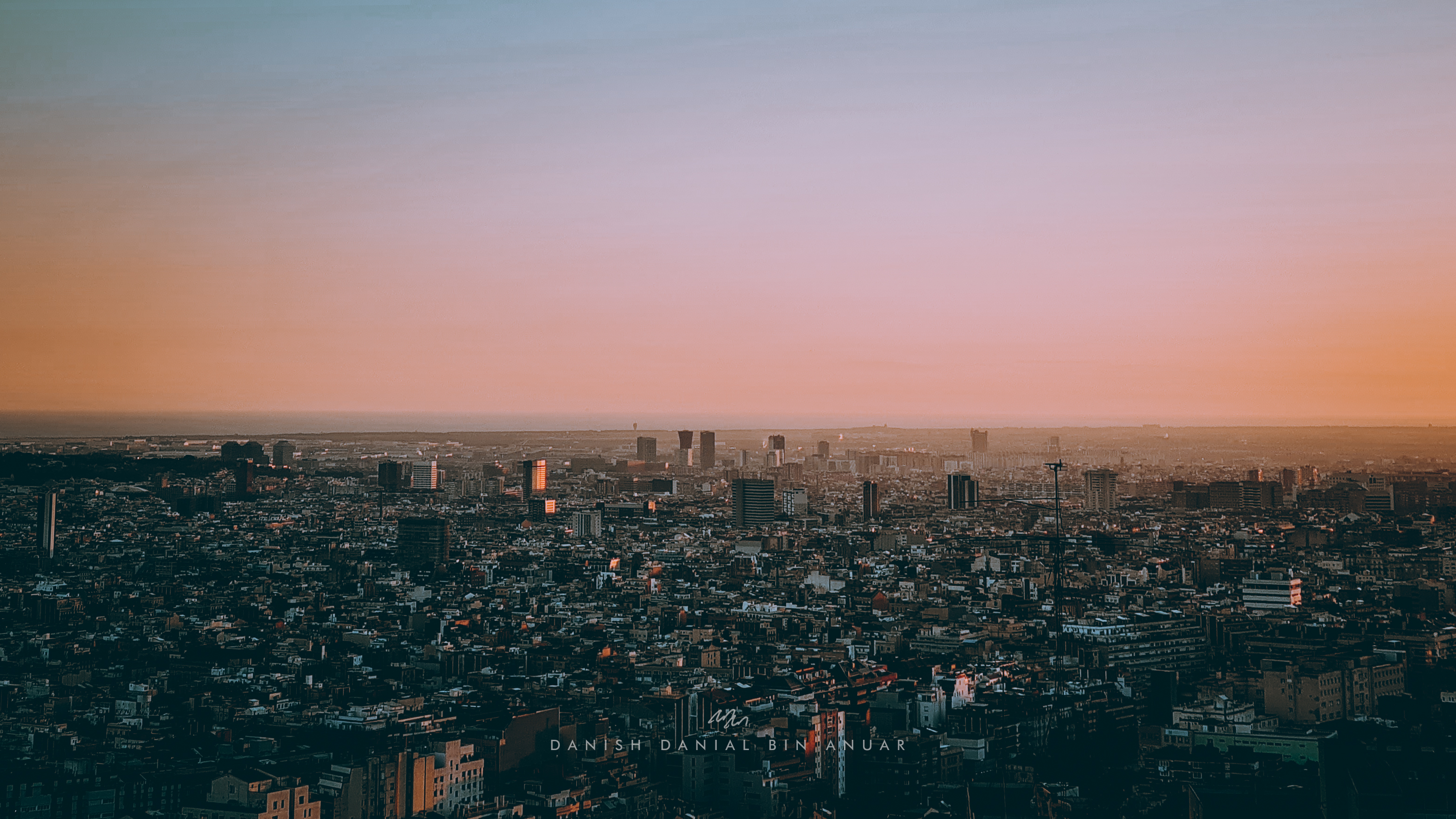
After exploring parts of Park Güell, I walked through some neighborhoods to get to Puente de Mühlberg to watch the sunset.
Day 2
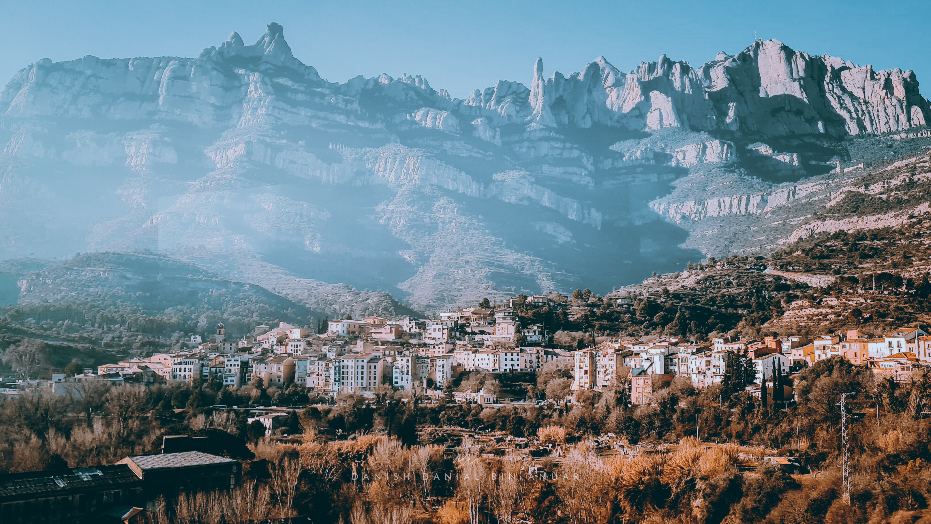
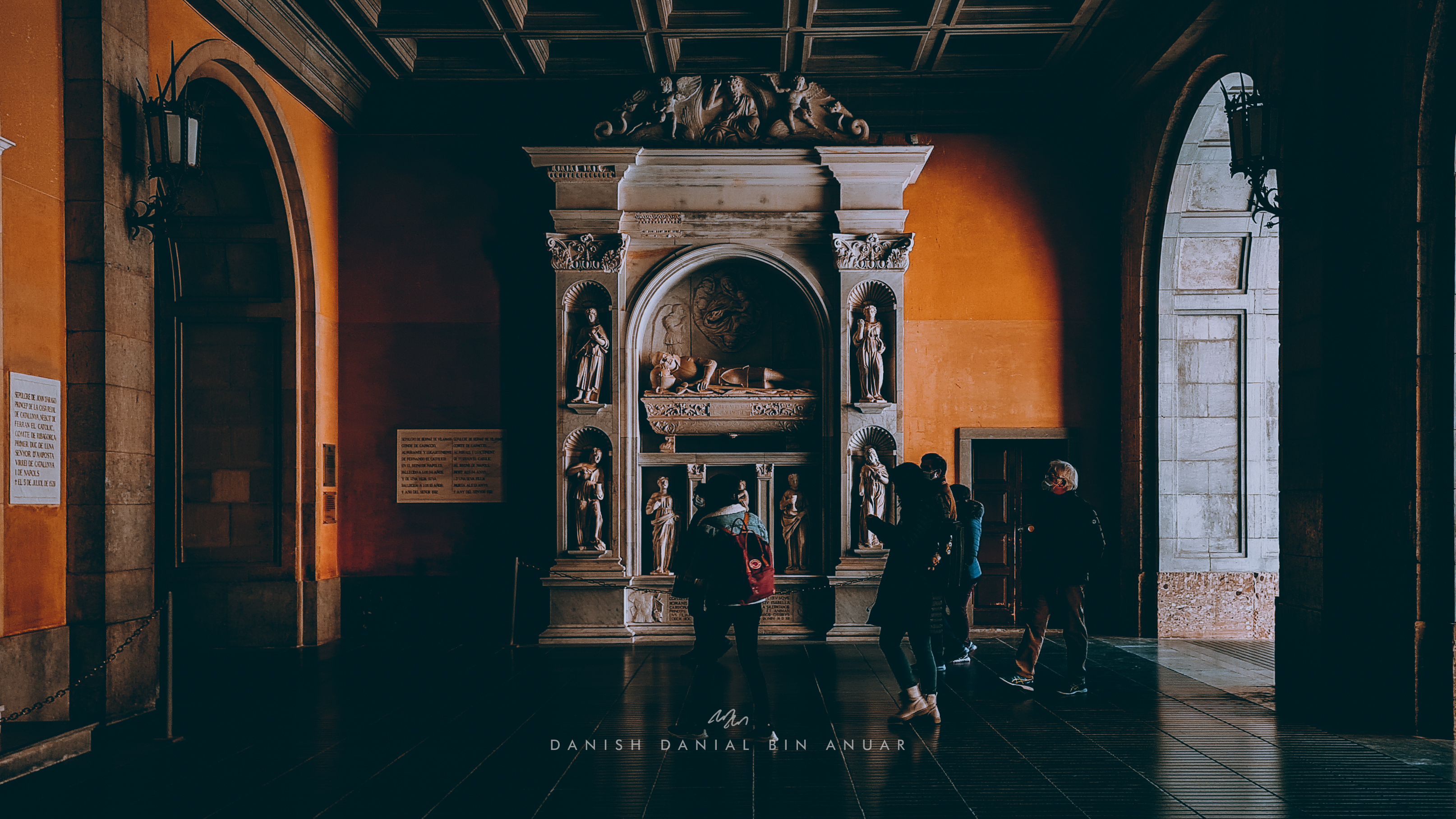
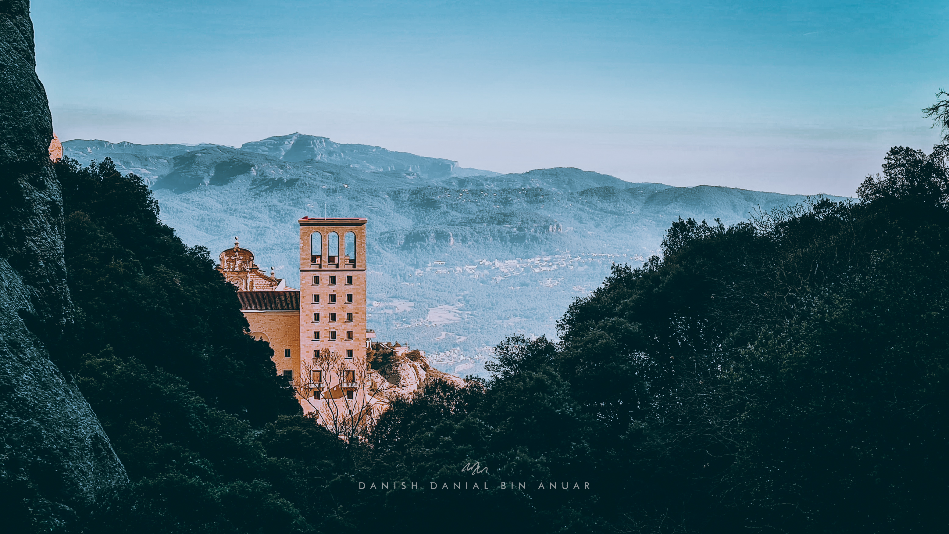
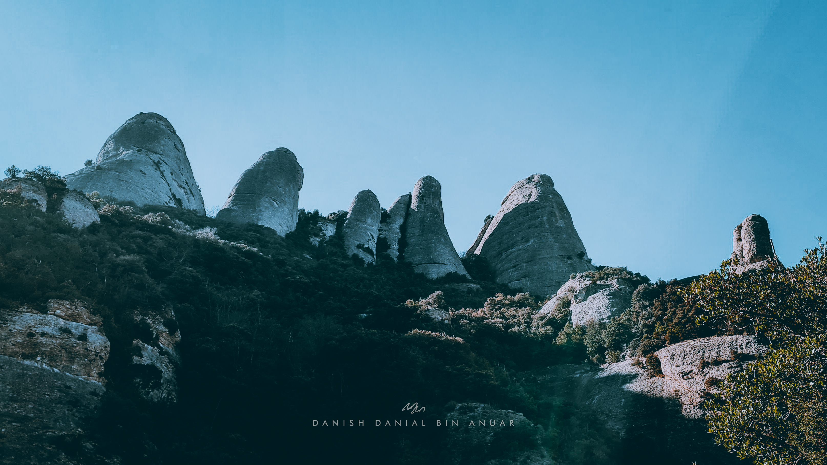
The morning after, I caught an hour train that took me to Montserrat. Montserrat got its name from its serrated look, and the moment I caught sight of the mountain, I was just amazed at the scenery. I hopped on another train from a town at the base of the mountain that took me up to a monastery called the Santa Maria de Montserrat. This sanctuary holds an important place as a religious retreat for Catalonians and they say that you’re not Catalonian if you’ve never hiked up here which was crazy because this was at an altitude of around 720 meters above sea level.
After exploring the monastery, I decided to go for a hike and climbed up one of the suggested routes to get better views of the mountain range.
Day 3
On my third day, I decided to have my first proper day trip. I boarded a regional train to Tarragona, which was a city south of Barcelona. Along the way, I had scenic views of beaches as well as some coastal towns.
Tarragona is well known for its rich history. From the Roman Empire to Islamic Rule, and then to the Aragon Kingdom, various kingdoms have left their mark on this city. The first stop I made was at a Roman Amphitheatre where gladiator fights & public spectacles once took place. Built in the 2nd Century AD, over the years, this amphitheater was utilized for many purposes including being a church, and it was finally abandoned in the mid-20th century after serving its purpose as a prison.
Roman Amphitheatre
Next, I visited the Circ Romà which was a 1st Century AD Roman circus. It was pretty interesting to explore all of the tunnels and chambers that were under the circus itself. There was also a tower that gave me a nice view of the beachfront.
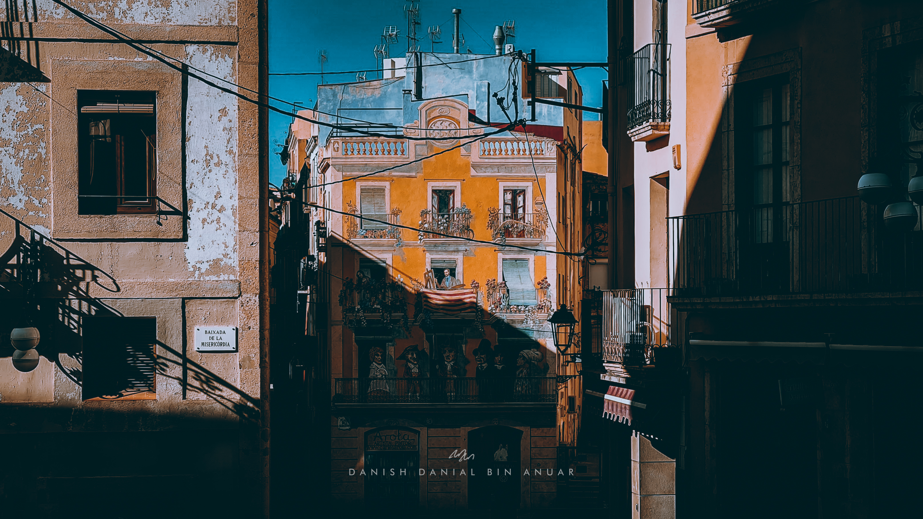
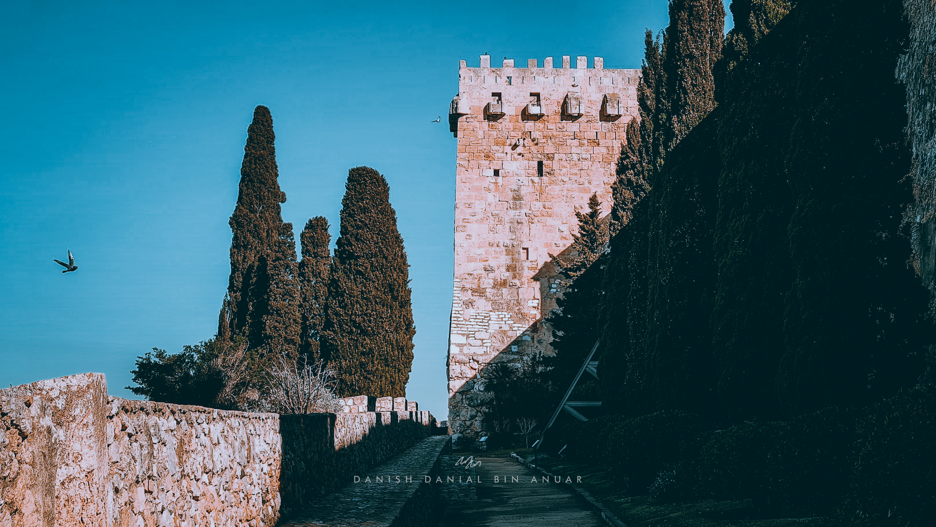
Next, I explored the Old City. Every street was just beautiful. There were really old houses, restaurants, cafes, and cathedrals for me to see. Nearby, I climbed up the old Roman Walls which had old fortification artifacts as well as different views of the city.
Roman Walls
From the city walls, I walked through the streets to get to the old Roman Forum, where administrative matters used to take place. What was left were just fragments of walls and columns.
Roman Forum
Then, I took a bus towards the North and hiked through some trails and hills to get to an old Roman Aqueduct. Photos don’t really do justice but it was really huge. You were also able to walk across the aqueduct as well and get a view of the forests to the north of Tarragona.
Roman Aqueduct
As the sun was setting, I quickly hiked and took a bus back towards the beach to catch the sunset at Punta del Miracle.
Day 4
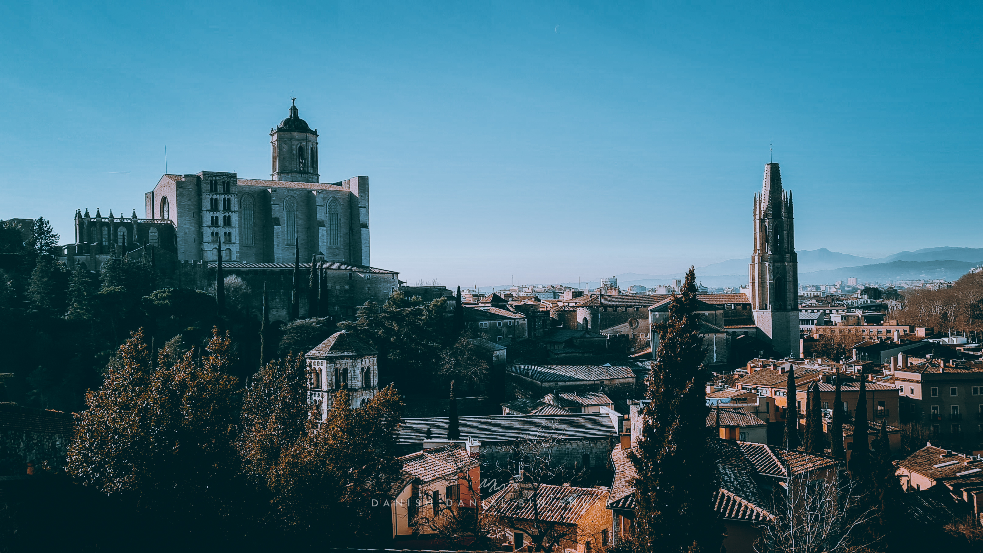
On my final day, I boarded a high-speed train to Girona. Girona is located in the north of Barcelona and it takes just 40 minutes to get there. Just like Tarragona, this city is also full of historical sites. The only difference is that Girona is more medieval in nature as compared to Tarragona, and most of the sites here were from the 10th century AD. Spoiler alert: Girona was probably the most beautiful place I’ve seen in the past 4 days.
First, I visited Barri Vell, also known as the Old Quarter. From the various bridges, you had views of the colorful buildings that lined the River Onyar.
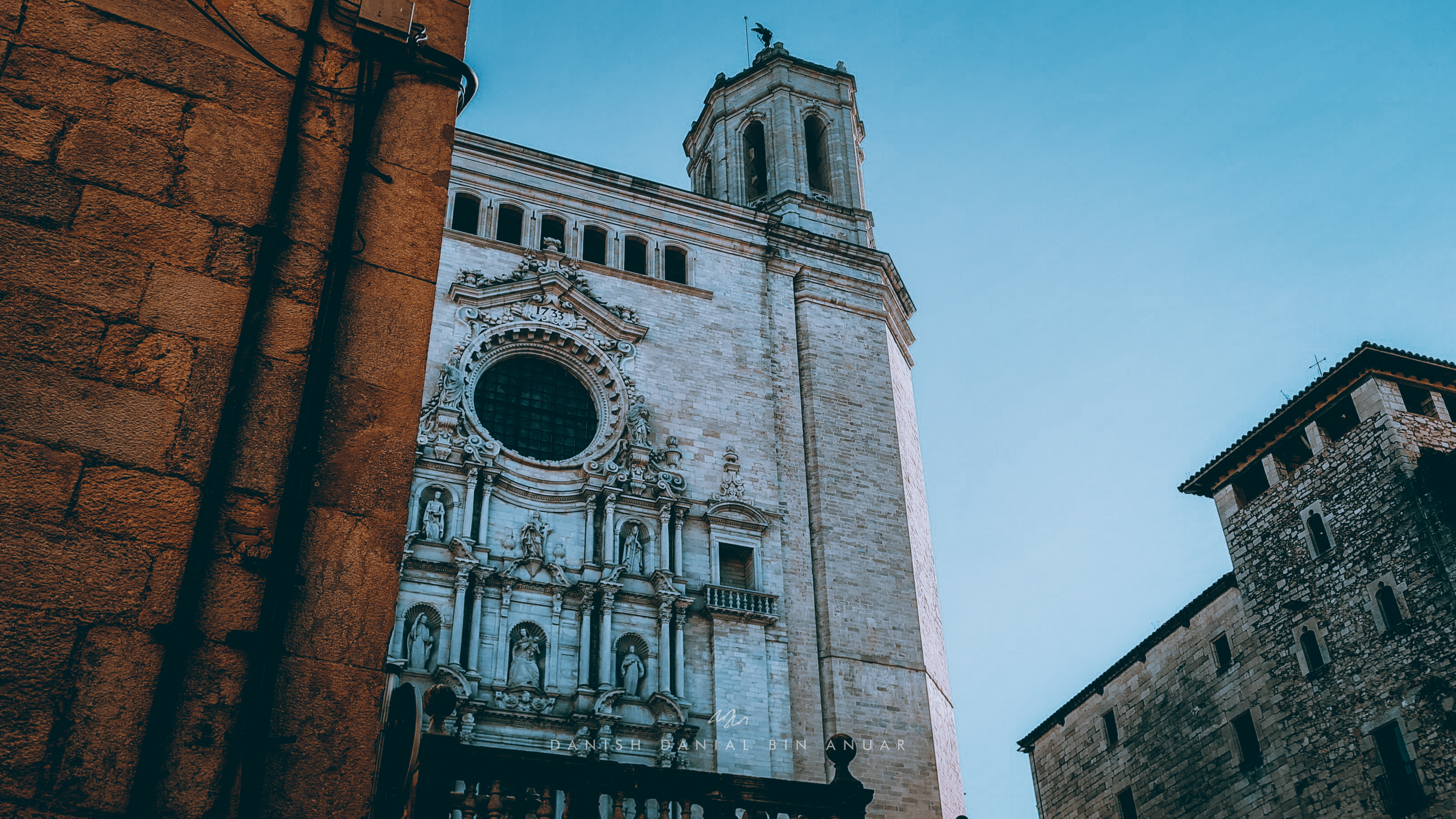
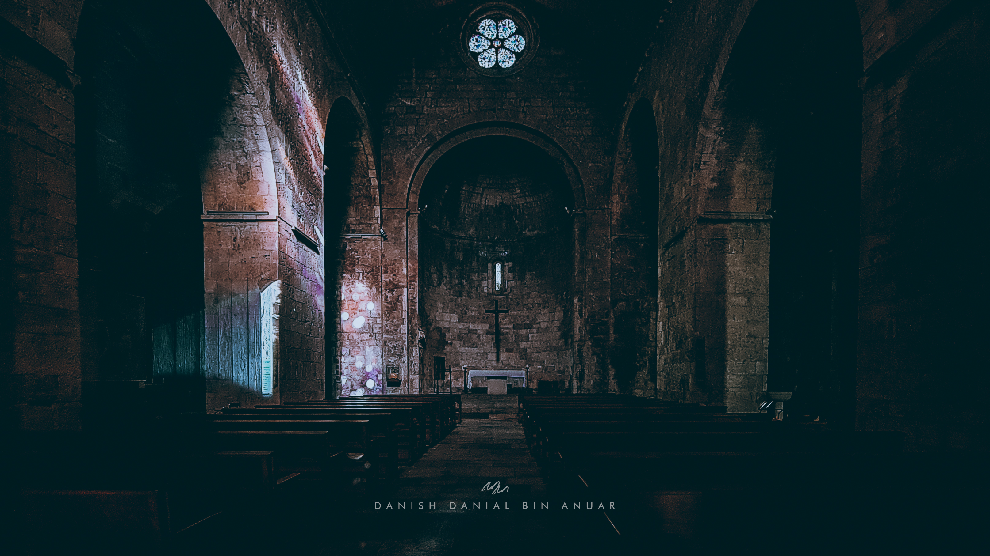
Within the Old Quarter, there were various sites such as the Old Fortress, the Banys Arabs, which used to be a Public Bath, and the Cathedral of Girona. There were also huge medieval city walls that you can actually climb to get sweeping views of the city.
Banys ArabsCathedral of GironaView from the City Walls
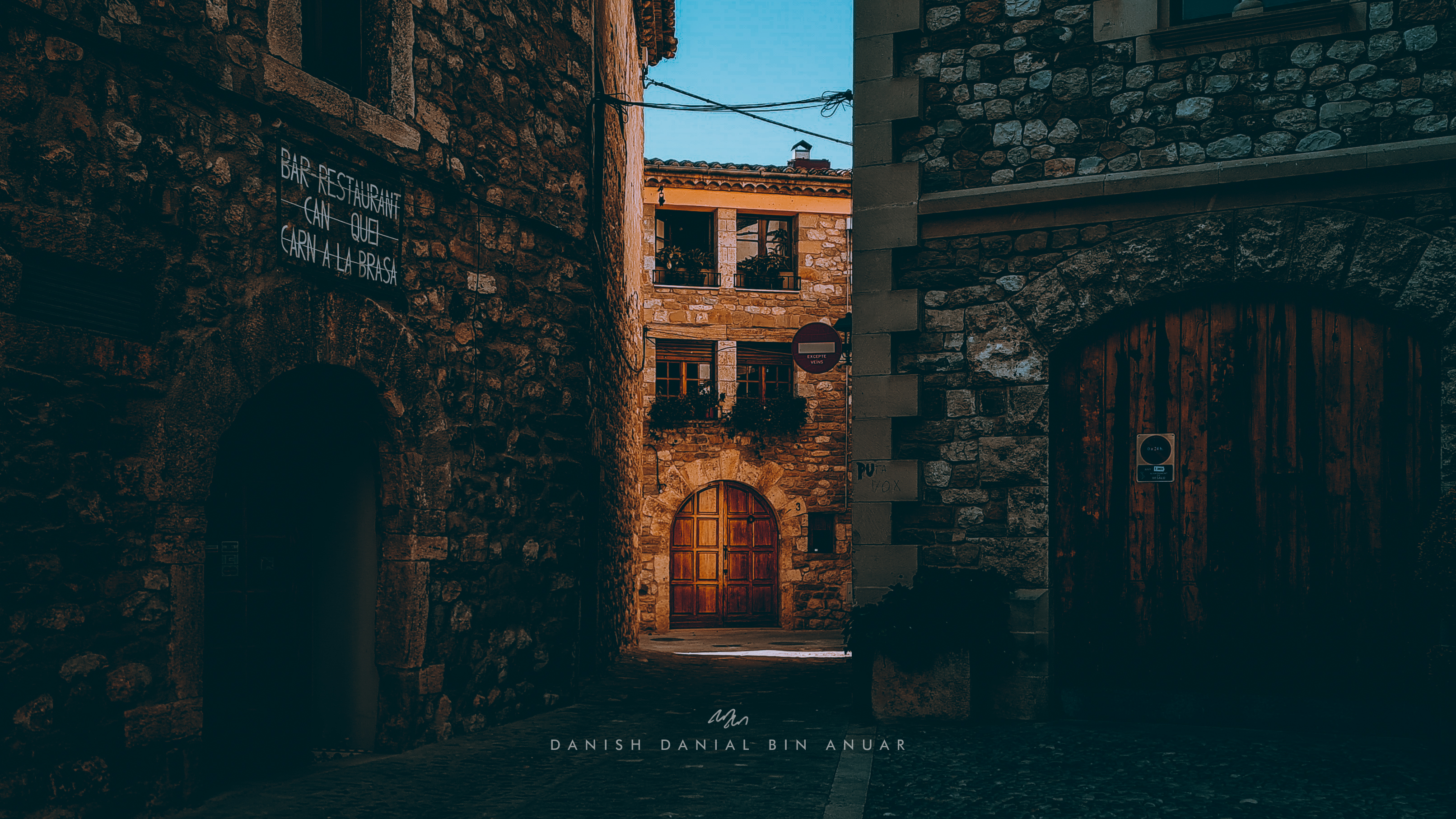
Next, I boarded the bus further up north to Besalú. Along the way, I caught views of the countryside as well as views of the Pyrenees mountain range which separated Spain from France and Andorra. Besalú is a town that used to be a fort. The fort from the middle-ages still exists today, and I had a picturesque view of it from a nearby bridge. There was a bridge that I could cross to get to the old city itself which was pretty fun to explore. I genuinely didn’t know what I was expecting at every turn and I just found interesting things one after another. Given the pandemic, it was actually pretty quiet, and loads of shops were closed.
And so that was my time in Catalonia. A nice 4-day solo trip packed with lots of interesting things to see and do.
This was rather impromptu. Seats were running out. Ticket prices were twice they were a few weeks ago. But I really needed to take a break. And so I did. But was it worth it? Well, yes. Anyway, I’ve always wanted to visit Penang. Georgetown, specifically. Being someone who’s passionate in history and the arts, the city is like the perfect city to pay a visit. Plus, I heard about the food.
Day 0
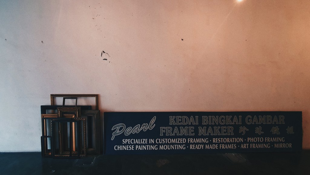
I took a 1.5-hour evening flight onboard Scoot from Singapore to Penang, and from the airport, we took a Grab cab to our hostel in Georgetown which took another 30-40 minutes. For the next two days, Grab was our main mode of transportation since it’s the most convenient way to pay for and book a cab. The hostel we booked was The Frame Guesthouse, and it was a pretty awesome place to stay in, especially for just $12/night. By the way, the pictures for this place online don’t do justice. Props to a certain someone who’s good at finding places like these.
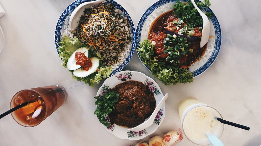
After unpacking our stuff, we headed over nearby next to the Kapitan Keling Mosque for some late-night Nasi Kandar with some Papadams at the side. It was delicious but I was stupid enough not to take a photo. I’m sorry.
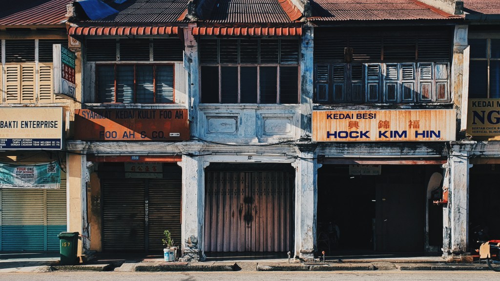
Shophouses in Georgetown, Penang, Malaysia
Day 1
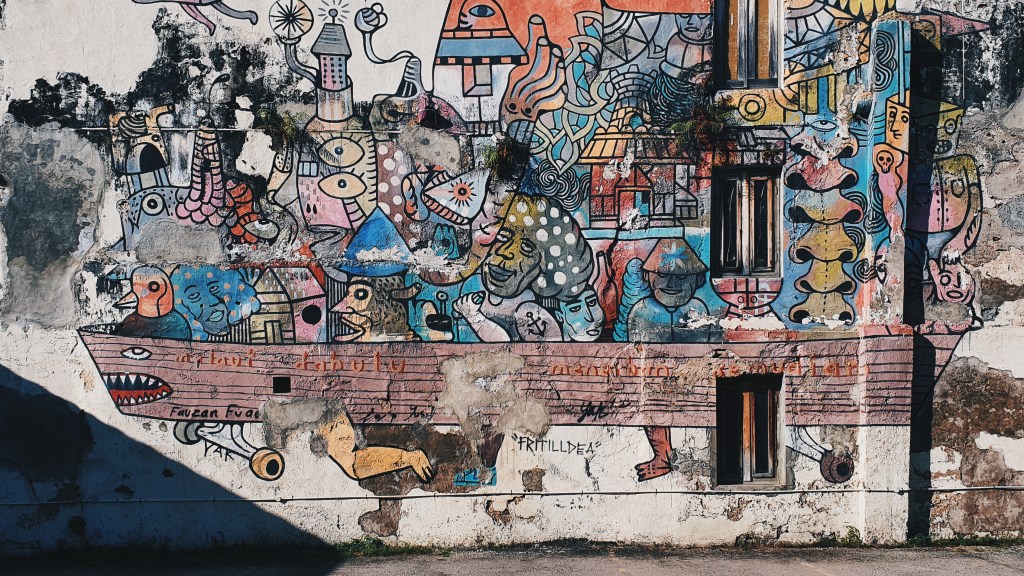
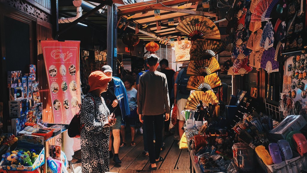
Streets of Georgetown
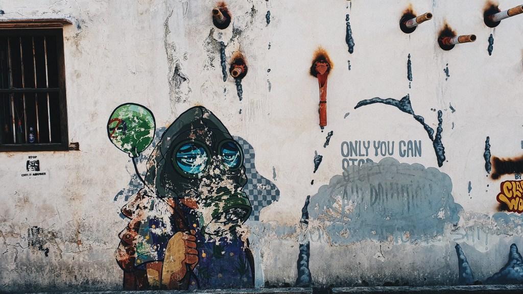
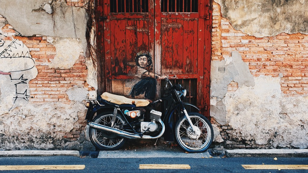
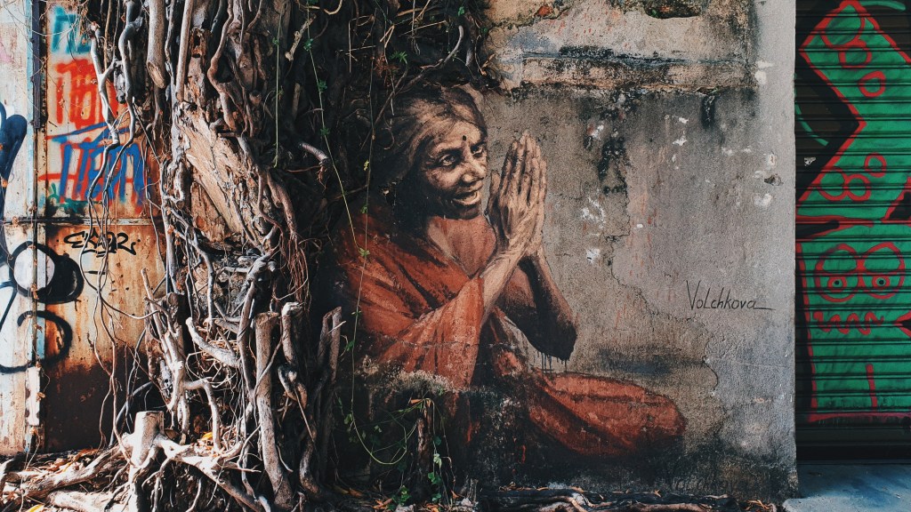
For the first day, our objective was to go for all of the street art since all of them were within walking distances from our hostel. After breakfast, we set out at 9am and navigated our way through the streets in search for all of the street art we marked on our map.
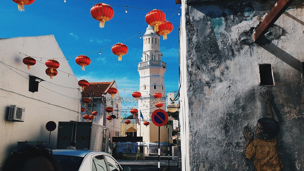
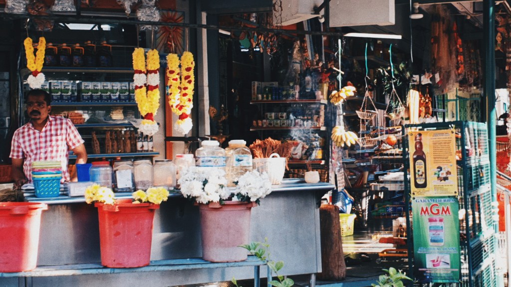
While street art were our main destinations, along the way, we had a nice glimpse of the streets and typical life here in Georgetown. Once in a while, you’ll see Trishaws coming around the corners, hear trumpets and bells from Chinese temples, smell whiffs of spices as you pass Indian tuck shops, and once in a while, you’ll hear the call to prayer from different mosques across the city.
It’s no wonder that this city is one of the most “Instagrammed” cities in the world. We actually had a really fun time coming up with creative poses with the street art here. And there was plenty of street art so you can only imagine how much spam there is in our photo albums.
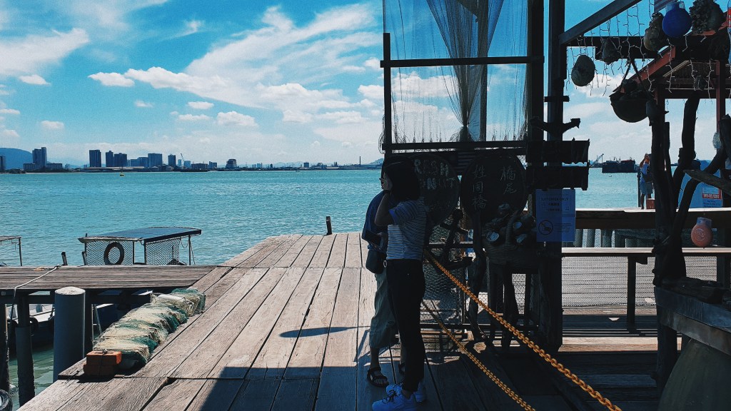
Chew Jetty
After covering all of the street art, we walked over to Chew Jetty which was a Chinese settlement on stilts. There was a narrow boardwalk walkway with shops mainly selling souvenirs and snacks as you walk further towards the sea.
At the end of the boardwalk, you’ll get a view of the channel between mainland Malaysia and Penang Island, and in the distance, you’ll be able to see Penang Bridge.
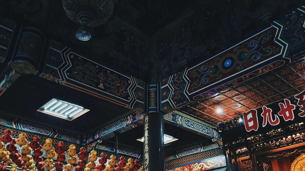
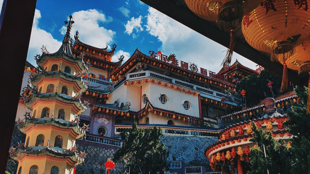
Kek Lok Si Temple
After having a hearty lunch nearby at an old-school eatery, we took a Grab to head over to Kek Lok Si Temple located at the side of a hill overlooking Georgetown. The temple was huge and impressive with tons of lanterns hanging by the ceilings and intricate Chinese art lining the walls and columns. There weren’t that many visitors that day so it was really peaceful and quiet. Inside, you were able to see worshippers conducting prayers as well as an area where you were able to write your name against colourful streaks of fabric.
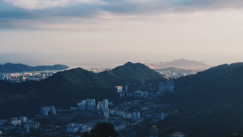
You were able to climb to the higher floors of the temple where you would be able to sit down, relax, and appreciate the view of Georgetown.
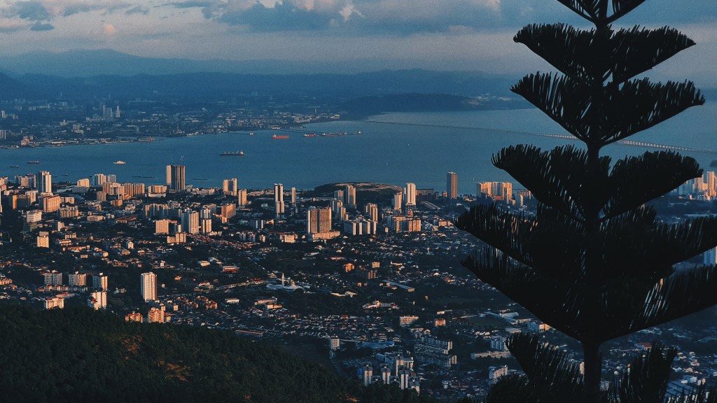
Penang Hill
I have to admit that prior to moving off to Penang Hill, we actually spent quite a while debating on whether we should actually visit Penang Hill since we already had a nice view of the city from the temple, plus we were also tired. However, we made the decision to move off towards Penang Hill that evening, and we never regretted that decision. To get to the top of Penang Hill, we had to take a tram ride which cost around $10 2-way per person.
Other than the cooler environment, at the top, we had breathtaking views of the city, and it was more breathtaking when the sun started to set.
As it got dark, we concluded the day with street food at a street somewhere near our hostel.
Day 2
On the second day, we decided to visit some historical sites including the mansions that were around the city.
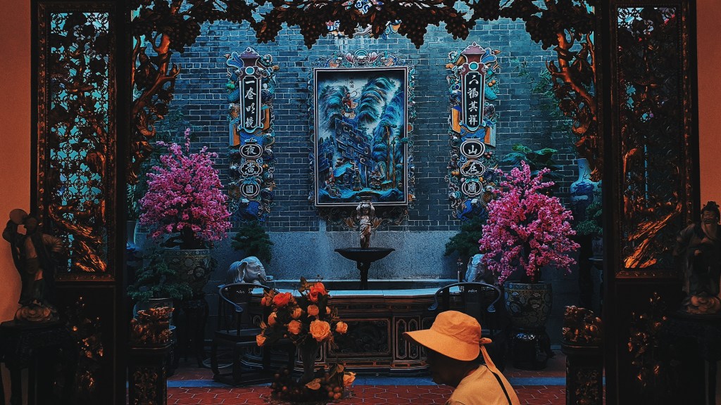
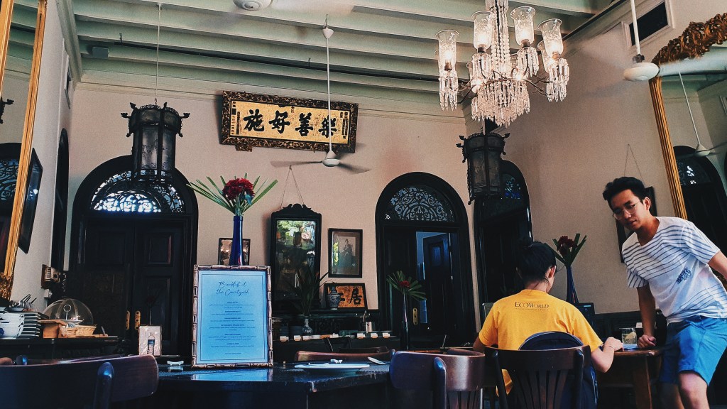
Peranakan Mansion
Our first stop was the Peranakan Mansion which also was a walking distance from the hostel. By the time we got there, there were already quite a number of visitors. On top of that, there was some shooting event as well so the place was a little busy.
For someone like me who has never been to a Peranakan-styled mansion before, as you enter, you’ll be amazed at how grand it is. From the furniture to the tiles to the things on display, you’ll find loads of things that you’ll associate with being owned by someone of a higher-status. Attached to the mansion itself, you would find a museum where they housed a number of historical items belonging to the previous owners.
After spending some time here, we had some mandatory laksa somewhere close to our next destination.
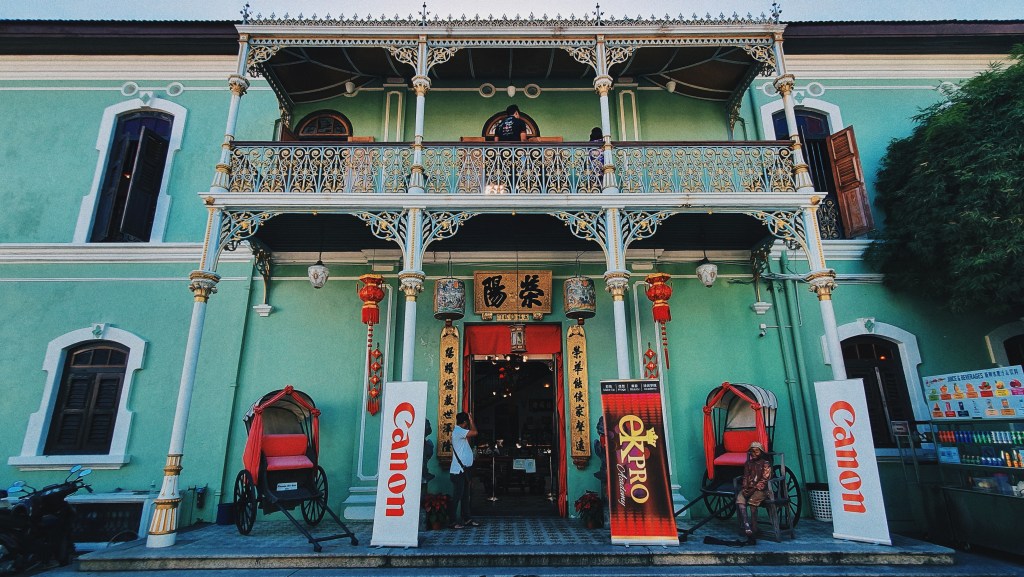
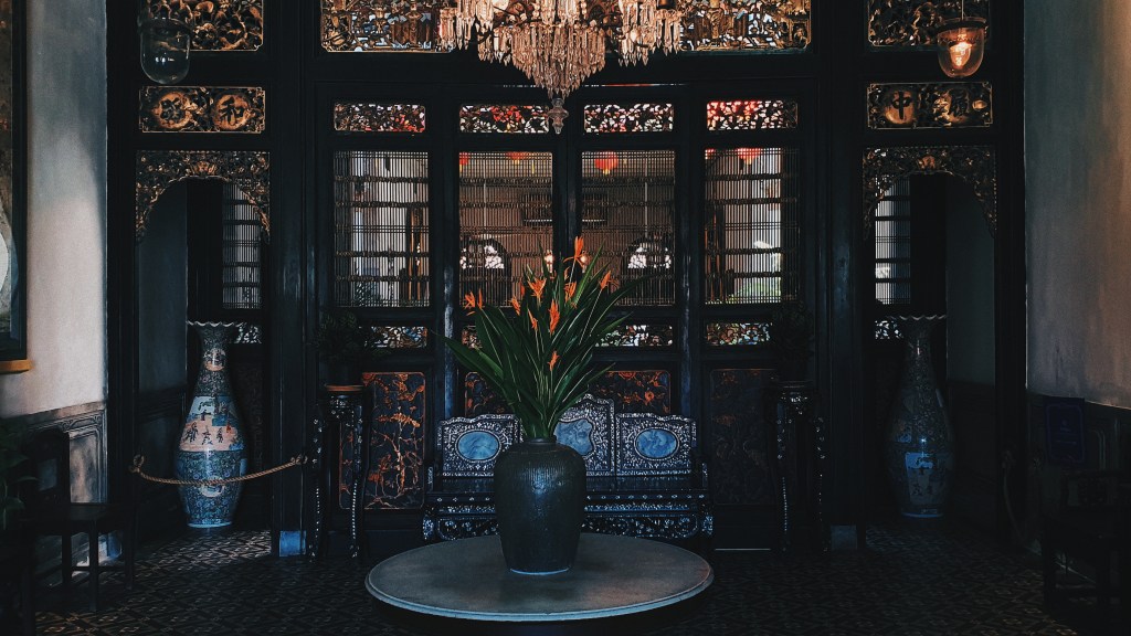
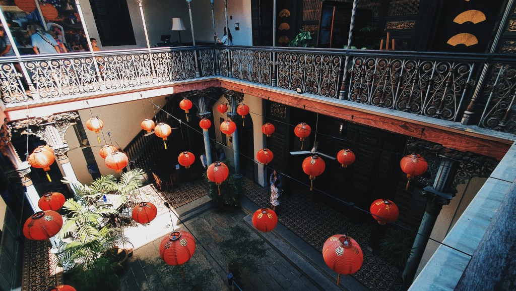
Blue Mansion
The Blue Mansion, was built by Cheong Fatt Tze, a prominent Chinese businessman and politician, at the end of the 19th century. In 1989, the mansion was then purchased by a group of local Penang individuals in a bid to preserve the building. Since then, it has won a number of awards from UNESCO. This place was also known as where they filmed a scene in Crazy Rich Asians.We bought tickets for an awesome group tour which was about $6 per person. Sally, the tour guide, on top of being entertaining, she provided us with a lot of interesting information about the mansion. Just like the previous mansion, I was amazed at how grand it was as well.
The visit to the Blue Mansion was pretty much our last major activity of the day (and of the trip). After getting some local lunch nearby, we collected our bags at the hostel and headed back to the airport.Overall, we had a really pleasant and fun experience in this town. From the sights to the food, everything was pretty awesome. The only thing that I dreaded was the fact that we had to return to work the day after 😂
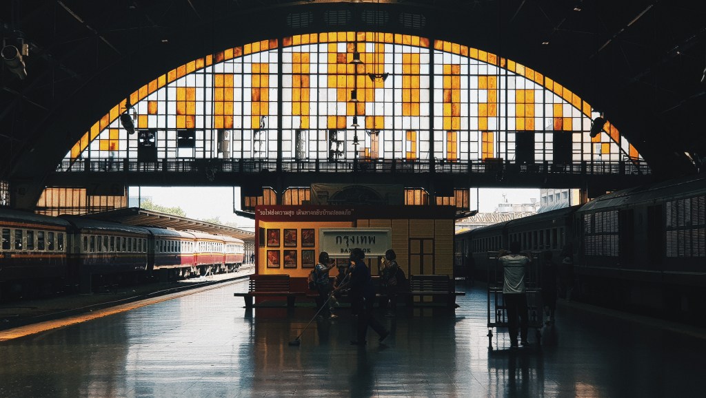
While it was more ideal to leave for Ayutthaya from Bangkok in the morning, we only boarded the train for Ayutthaya in the early afternoon since we had plans in the morning. I’ve always wanted to pay a visit to Ayutthaya especially visiting all of the historical monuments and temples that were there. Also, being Siam’s old capital city, I was pretty curious to see what it looked like. It just so happens that the city was the hometown of a friend as well.
There were a number of options of getting there; prebook a taxi, board a bus, or board a train. We decided on the train since it was the more “adventurous and scenic” route. There were a number of train classes and timings that we could choose from. We bought the regular train tickets in the regular class cabin which was about $3 both ways. The journey would take about 1.5-2 hours.
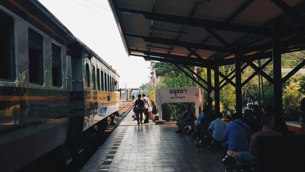
As we arrived in Ayutthaya, there were a number of tuk-tuk drivers quoting their prices for taking us to different temples and historical sites for the day. Without hesitation we just hired one for about $30 which was quite reasonable to me. Anyway, we arrived a little later in the day so we had to rush to the different locations before it got dark, and we also had to catch the sunset.
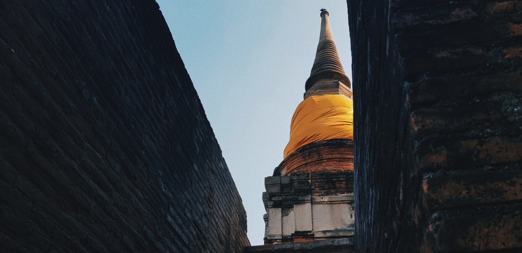
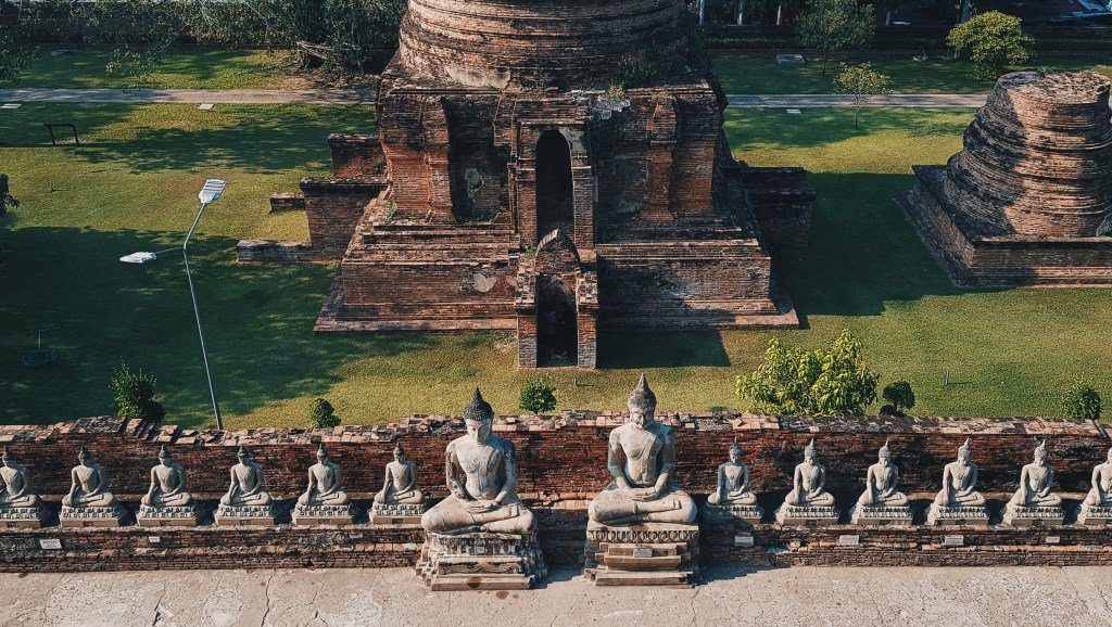
Wat Yai Chaimongkol
The first stop was Wat Yai Chaimongkol. This temple was built in 1357, and further expansions such as the pagoda that you see as you enter was built in 1592. It was a really impressive temple as you can see Buddhas lining the outer walls, surrounding the huge pagoda in the middle. At the top of the pagoda, you’ll be able to have a nice view of Ayutthaya.
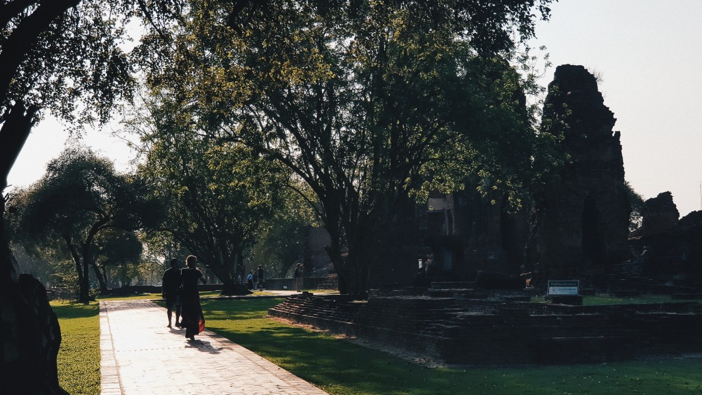
Wat Maha That
Our next stop was Wat Maha That, built in 1374. Today, this massive temple is a shell of its former self, after Burmese armies sacked the temple. Across the temple complex, it will be common for you to see damaged Buddha statues. Being a larger complex, we spent more time here.
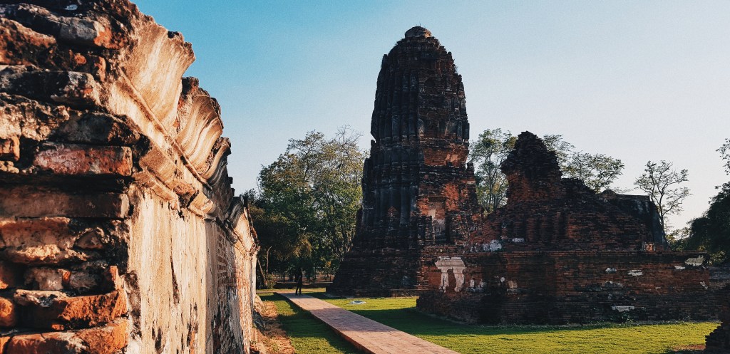
Wat Phra Si Sanphet
On the site of this temple in 1350, a grand palace used to be constructed. Later on, it was converted to a temple, and this temple was significant since it was the holiest temple in Ayutthaya when Ayutthaya used to be Siam’s capital. Again, being a shell of its former self, 3 prominent Chedis remain in the temple compound.
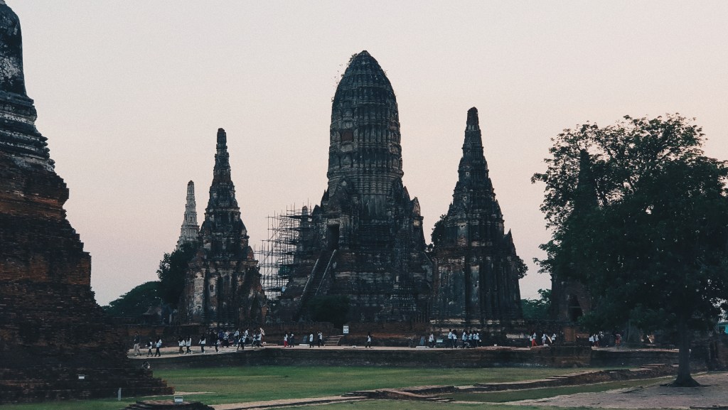
Wat Chaiwatthanaram
As the sun started to set, we made our way to Wat Chaiwatthanaram, which was a popular attraction, and a place that you have to be at when the sun sets. When we arrived there, there were already quite a number of tourists exploring the temple.
Overall, it was an awesome experience! If you’re thinking of escaping the busy life of Bangkok, Ayutthaya is just a train ride away!
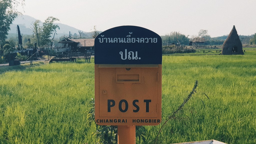
Fun fact: We bought the tickets on impulse – AirAsia had this huge sale and we didn’t want to miss the opportunity. So, prior to the trip, we actually had very little planning. That was why as we landed into Chiang Rai, there was only one place that we were looking forward to – and that was the mountain ranges surrounding Phu Chi Fa.
Getting There
So after booking a homestay in Phu Chi Fa, came the next problem – how do we get there in the first place? Public transportation was non-existent (well there was a bus that took you from Central Chiang Rai to a village an hour away from Phu Chi Fa which only ran twice a day), we couldn’t figure out how to hire a taxi, and car rental was a little, well, risky, since we weren’t familiar with the terrain. Thankfully though, we had some connections and we contacted a couple who happened to be on break who agreed to take us to Phu Chi Fa and back to Chiang Rai for a reasonable fee.
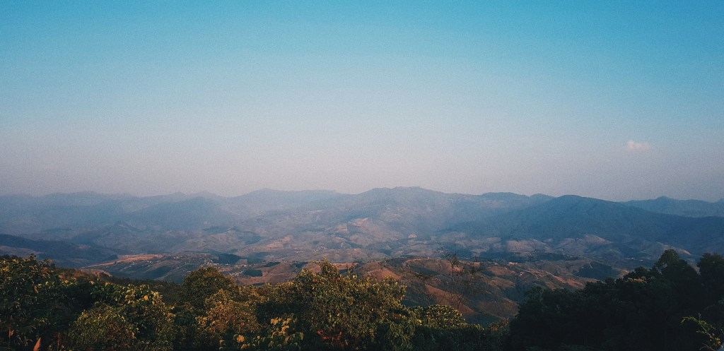
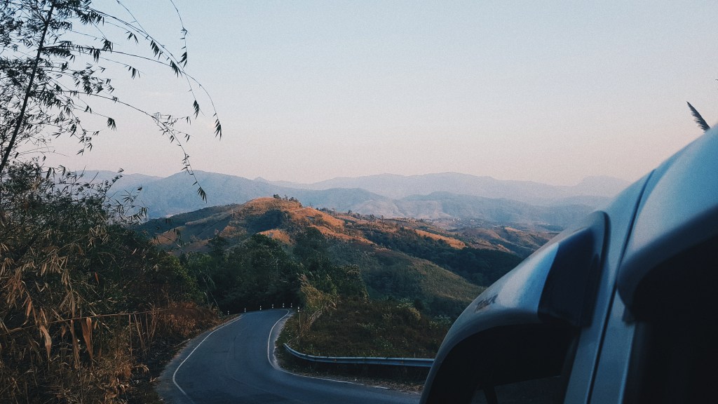
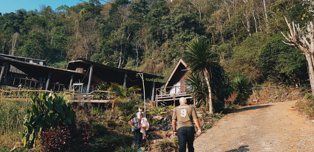
Our Journey from the airport to our homestay near Phu Chi Fa took us about 3 hours. We took our time getting there since we stopped by at some cafés for coffee breaks and at a few vantage points to appreciate the scenery. I must say, on the way to Phu Chi Fa, the scenery and sights were some of the best I’ve ever seen in my life.
As we neared our homestay near Phu Chi Fa, we were greeted by tons of signs at a junction.
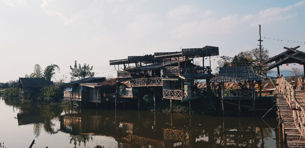
Our homestay was at a quiet cosy place on the side of a hill overlooking some valleys. On top of that, the environment was really comfortable since compared to Chiang Rai itself where the temperature averaged at about 30 degrees, at the area where we stayed, the temperatures dropped to about 25 degrees and down to below 20 at night (so yes, it was freezing at night).
That night, we agreed that we would set out at 5:30am the next day so that we could catch the sunrise at the peak of Phu Chi Fa.
Before we went to bed, given the low light pollution in the mountainous areas, my friend spent some time taking shots of the Milky Way. He had a professional camera while I only had a mobile phone, but it was so dark, my phone was able to capture a shape of the Milky Way.
Not only can you capture this with your camera, but if you let your eyes adjust to the darkness, you’ll be able to see the Milky Way. This was the first time in my life seeing the Milky Way with my very own eyes.
The Climb
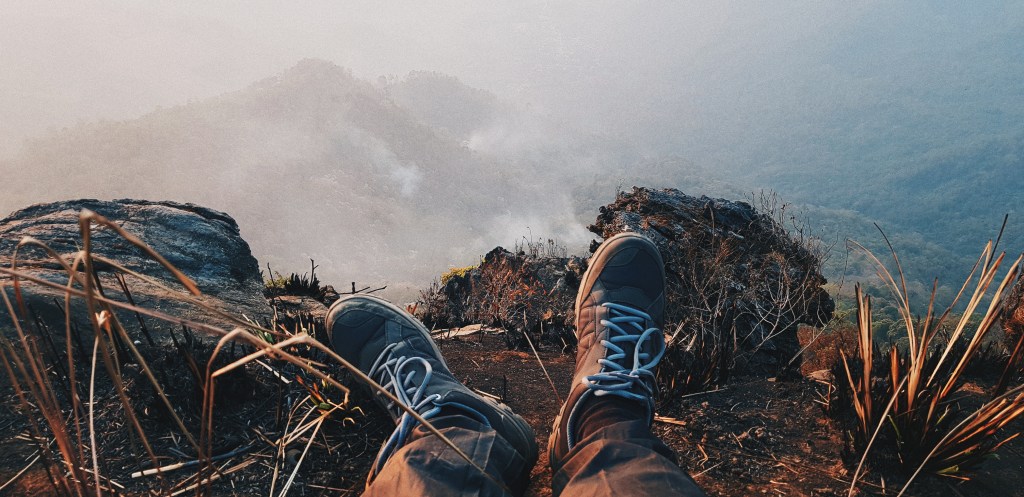
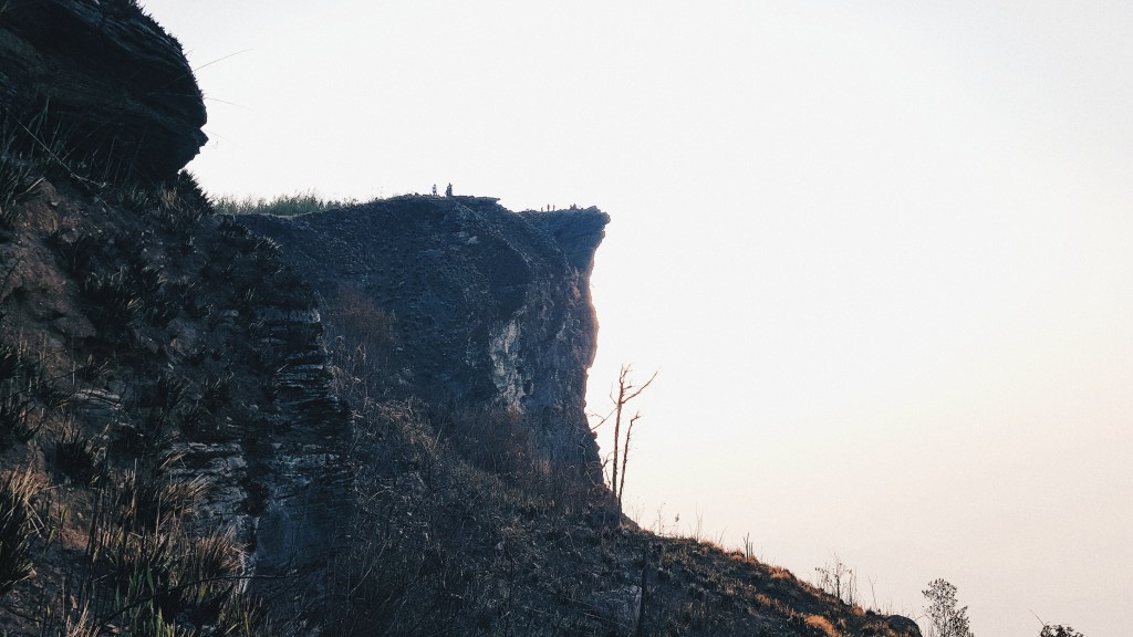
We set out as agreed at 5:30am. There was no street lighting and so our truck had to traverse in complete darkness to the base of Phu Chi Fa. From there, we climbed up a flight of steep steps and rough terrain to get to the peak of Phu Chi Fa. We were already tired from waking up really early, plus we got even more tired from climbing up; but the views we got at the top were beyond spectacular.
The mountain ranges where we were were considered to be the border between Thailand and Laos. So, on the other side we could see some Laotian villages. Unfortunately, there were some fires causing the environment to be hazy so we couldn’t get clear shots of the landscapes.
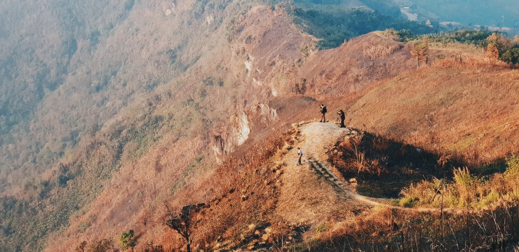
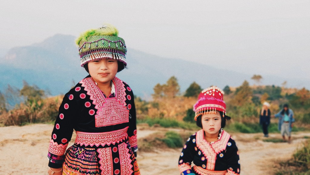
Other than some other tourists, there weren’t that many people there so it was really quiet and serene at the peak. That was until we met a couple of local Hmong Tribesman who were there to entertain us! By the way, if you’re ever coming here, don’t forget to leave a tip for them!
After spending a couple of hours appreciating the scenery and taking some shots, we headed back down to have an amazing breakfast back at out homestay. If you’re wondering, here’s the link to where we stayed. Teerawat was such an amazing host!
After breakfast, we took a ride back to central Chiang Rai to continue our travels. That would be a post for another time.
I was on a flight from Bahrain to Singapore with a 6-hour layover in Colombo, Sri Lanka. You see, I’m not the kind of person who would just sit in the airport for 6 hours. While 6 hours may be a short amount of time, I took the chance to quickly visit some popular areas in Colombo, Sri Lanka. I quickly hired a personal taxi at the exit of the airport (I took any price they offered), and I was on my way.
Just a tip – if you ever have a short layover in Colombo, don’t take the risk to go to Colombo, go to Negombo Beach instead! You’ll have a much more relaxing time there as compared to me rushing through different spots in Colombo.
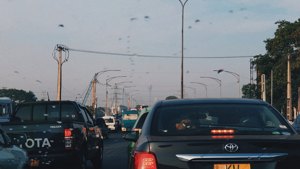
My Sri Lankan friends told me how bad the traffic was in Colombo… and they were right. There was a huge jam close to the city and I was anxious if I was going to be able to make it back to the airport on time. However, the taxi driver assured me that all was okay.
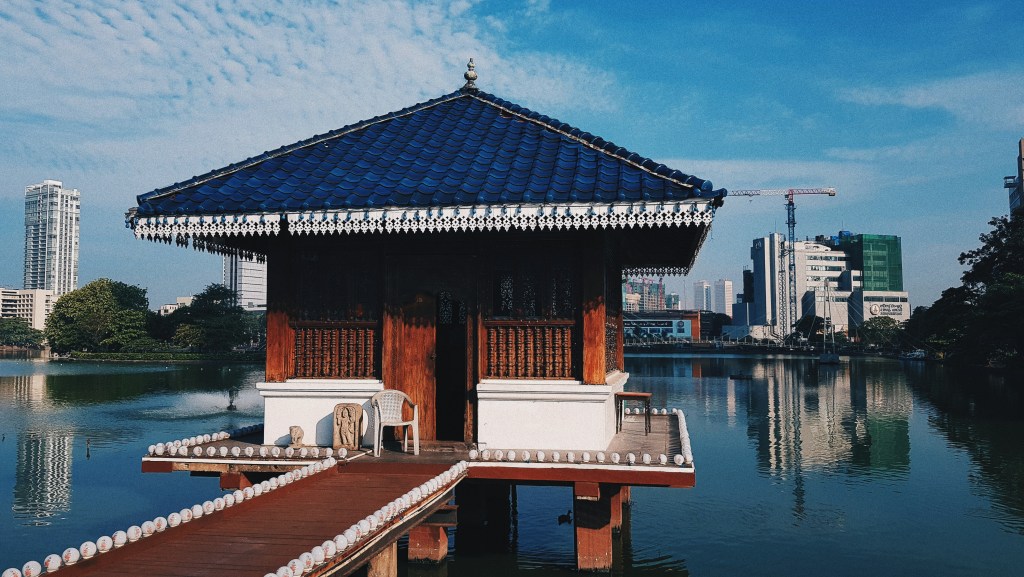
Gangaramaya Temple
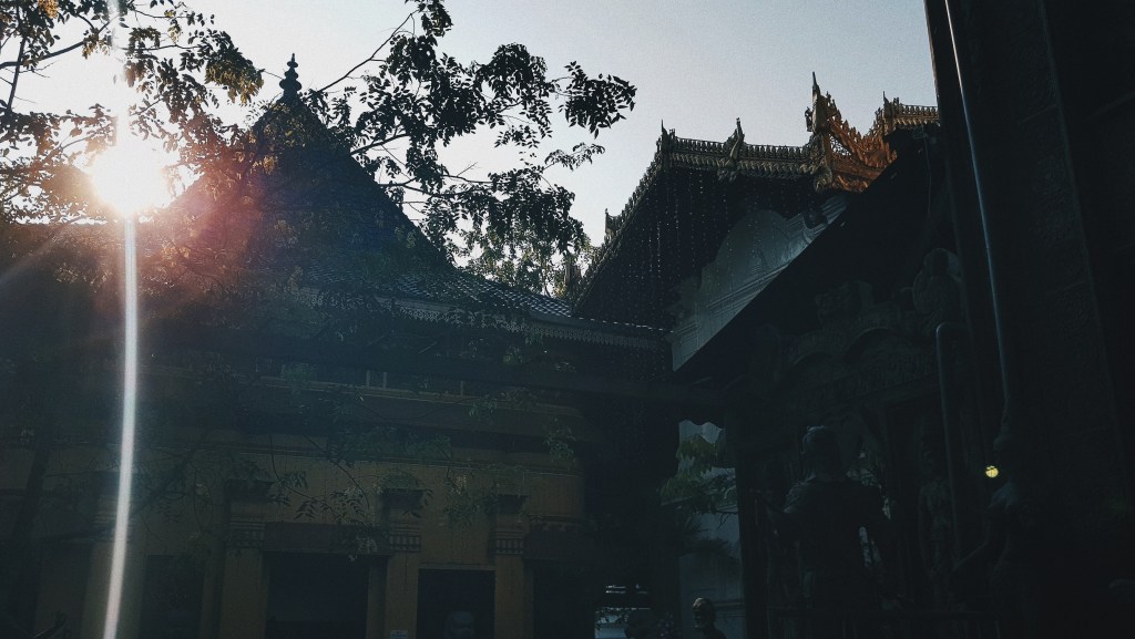
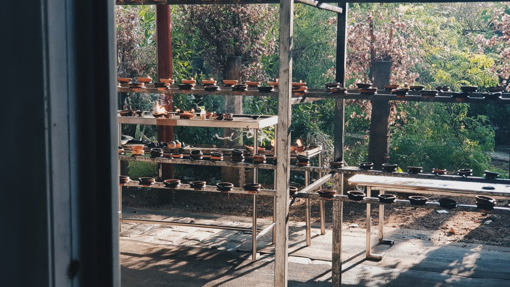
My first stop was Gangaramaya Temple, a Buddhist temple located in the heart of the city. It was a really beautiful temple and quiet temple, with some worshipping activities going on as I was there. I took some time to walk around the main temple building, and I also visited the secondary part of the temple that floated above the lake.
Processed with VSCO with hb2 preset
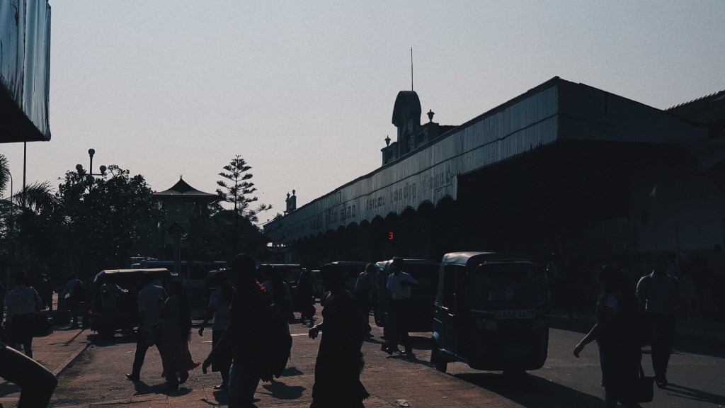
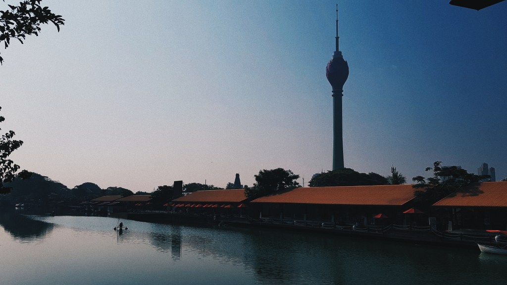
Pettah Market
My next (and final) stop was the surroundings of Pettah Market. There were already a few places that I could drop by there. Petath Market was next to Fort Train Station, which was the Central train station in Colombo. It was really busy – it seemed that everyone was on their way to work. I spent a while walking around the area and trying out some of the food they were selling as the market as well. By the way, everything was super spicy.
There was a floating market nearby too but it was closed.
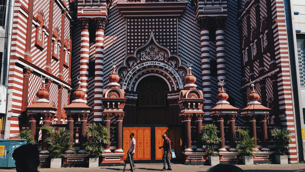
Wedged in between the streets, there was the Red Mosque. Pretty hard to miss.
Even for 6 hours, I had a really good glimpse of what Colombo was like and I would love to return again for a proper trip!
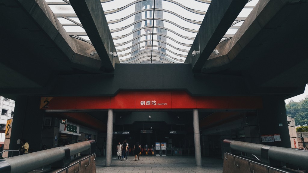
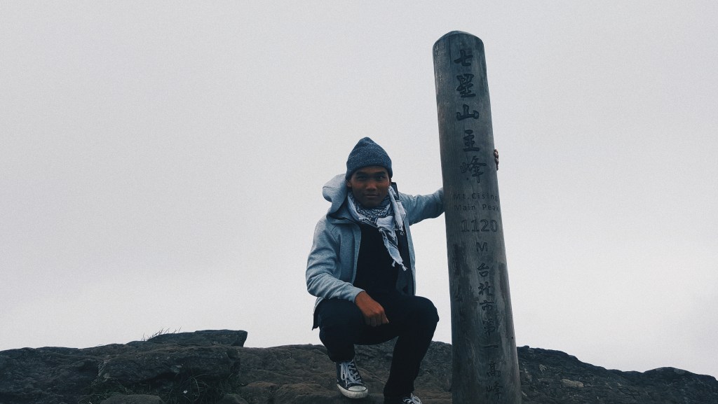
On the 3rd day of my trip to Taipei, Taiwan, I decided to dedicate the day to visiting Yangmingshan National Park. I set out from my hostel a little later that day since I was a little tired from the previous two days, and after having breakfast at 10am, I made my way towards the National Park.
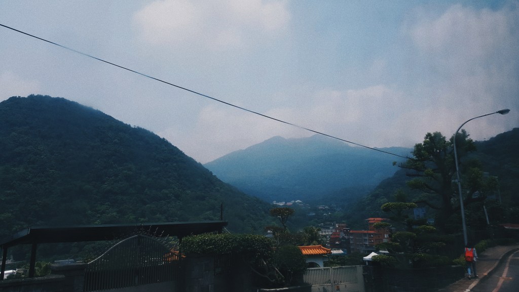
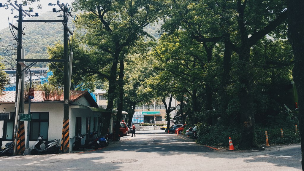
To get to one of the entrances at the park, I took the train to Jiantan Station on the Red Line, and then took a bus to the Section 1, Hushan Road Entrance. The bus ride towards the National Park was pretty scenic as you move away from the city into the less-developed mountainous areas. Close to the National Park entrance were a couple of houses, but there were some recognisable shops as well such as Starbucks and a 7-11.
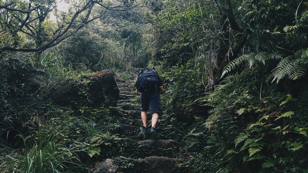
The distance from where I started to the top of Mt. Qixing was roughly 4km. It took me around 2.5 hours to reach the top, making some stops midway to take a break and also take a couple of photos. As compared to my previous climb on Bukhansan in South Korea, this climb was so much easier since everything was paved and there were no narrow paths or steep cliffs simultaneously.
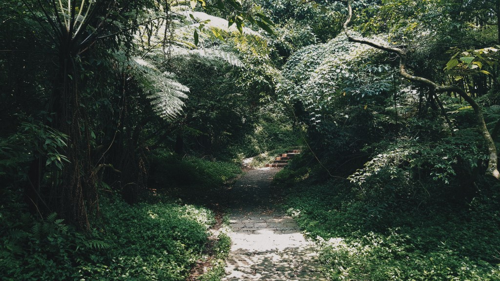
Given that the National Park is tropical in nature, there were signs warning you to stay away from poisonous snakes or insects, and the paths were shrouded in trees, bushes and leaves. Of course, being alone, I had to keep my guard up.
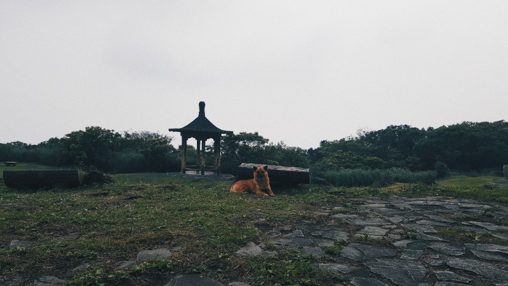
Halfway through, I stopped by Qixingshan Park where there were a few huts where some hikers stopped by to rest and a large field where a cute little dog was freely roaming around.
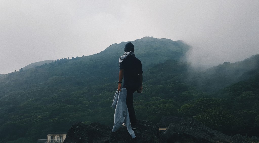
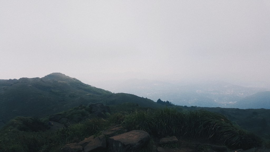
After spending some time resting in the park, I continued my climb on Mt. Qixing. As I got closer to the top, the paths started to become less covered by trees, and grass started to get a lot longer. The sky also started to get covered by the clouds and fog expected at the altitude that I was in. Eventually, I was greeted by awesome views of the surrounding areas. While I couldn’t really see much of Taipei city itself, you pretty much have a bird’s eye view of the National Park itself. Even during the summer, it was pretty windy and cold at the top so I was pretty lucky to bring my jacket and scarf with me.
While I wouldn’t advice anyone to do so, I went back down the same way as I climbed. There were a couple of different routes you could take back down, and you would pass by some interesting things as well such as the landslide-sulphur formation at the side of Mt. Qixing. Evidently, I didn’t plan this very well. However, I got a bus which took me to Shilin Station where there was a popular night market there. And that is an experience for another post.
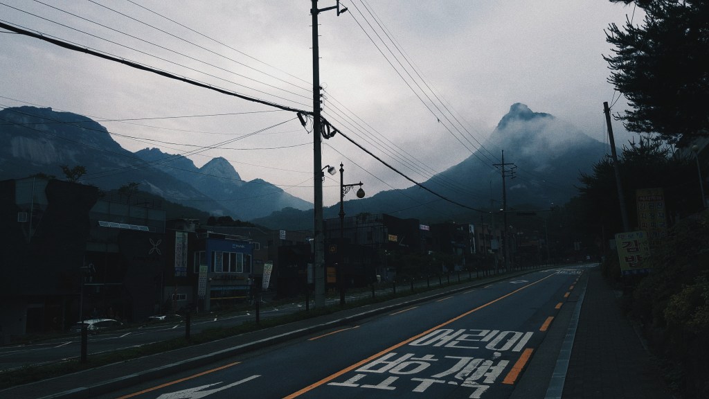
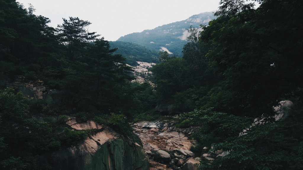
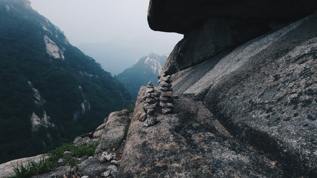
On my second day in Seoul, South Korea, I decided to climb up Bukhansan. My goal was to reach the highest peak, also known as Baegundae Peak, which was at 836m. This was my first time ever climbing any mountain, and I’m doing it solo so I was slightly nervous but excited at the same time. I set out from my hotel earlier that morning, at about 7 in the morning.
To get there, I took the subway to Gupabal train station and took bus 34 that took me close to the base of the mountain. I actually missed my bus stop since the entrance was not so obvious, so I actually walked all the way back. At the base, there was a street with a number of shops, but all of them were closed.
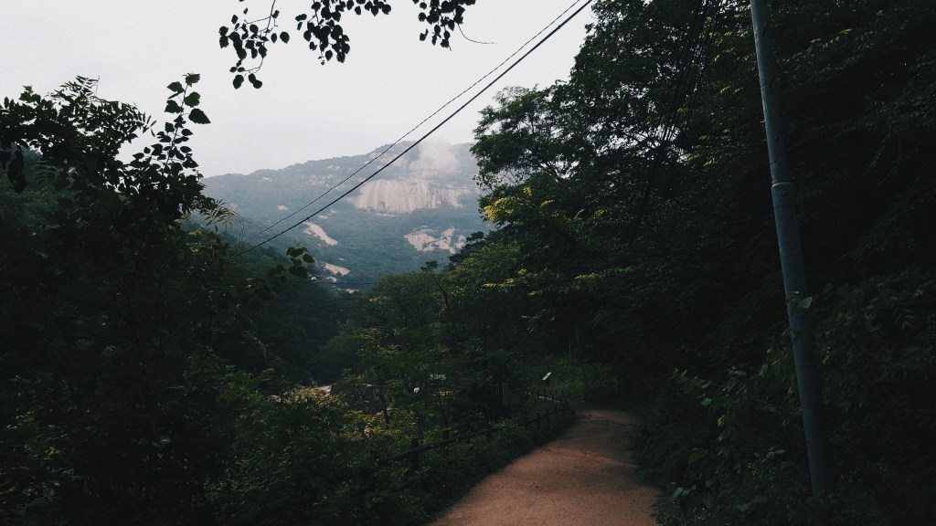
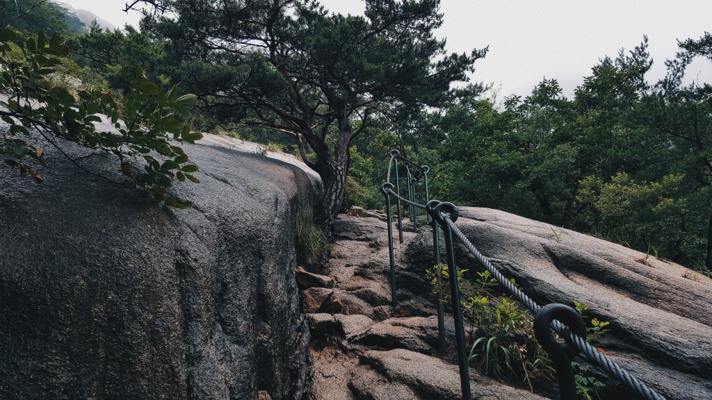
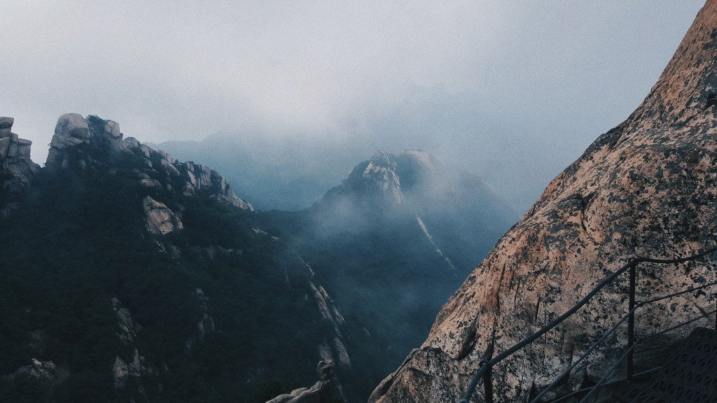
On my climb up, there were some amazing views of the mountain ranges as well as Seoul itself. I also bumped into some structures and temples along the way, and the temples, were active by the way.
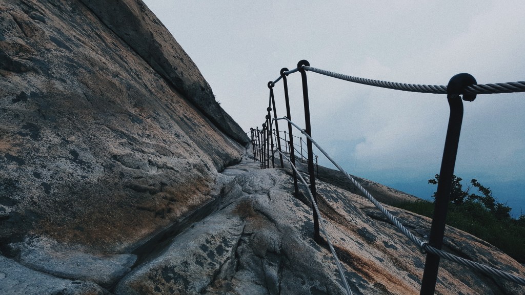
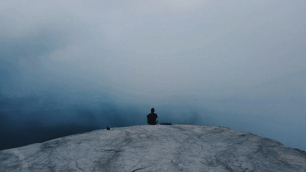
As I got closer to the top, paths got a little more narrower, and there were railings that you would have to hold on to (so that you wouldn’t fall down the steep cliffs).
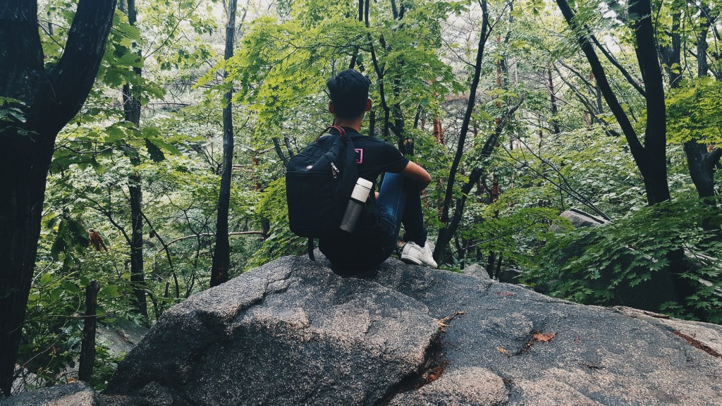
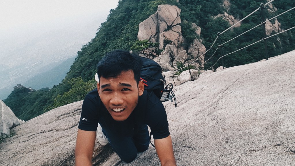
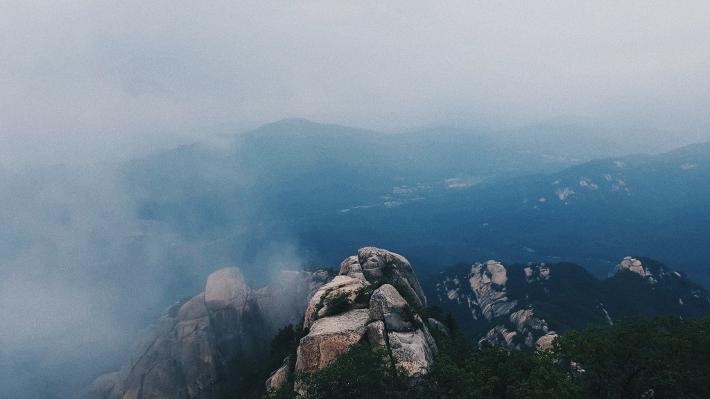
After 3.5 hours of climbing, I was rewarded with awesome views at the top.
Overall, it was quite the experience, and it was worth it! I spent about an hour or so at the peak appreciating the scenery and rested in the cooling environment.
After 3 years with my phone, it died of the cold here in Seoul. All of my work, projects and photos went with it. However, I looked at this more of an eye-opener rather than a… erm… loss. I mean from what I learnt in Busan, not having a phone actually made me realise the importance of disconnecting with the virtual world and re-connecting with the real world. I was able to appreciate every moment and every second of my time here in this vibrant city.
Anyways, like I said, I lost most of the pictures I took here (coincidentally, ALL of them were pictures of food) in Seoul, and as a substitute for my phone, I brought along my MacBook Pro and used the front facing camera to take photos. So, I’m sorry if the quality of the photos degrade as you scroll down this post.
THROWN INTO THE POT
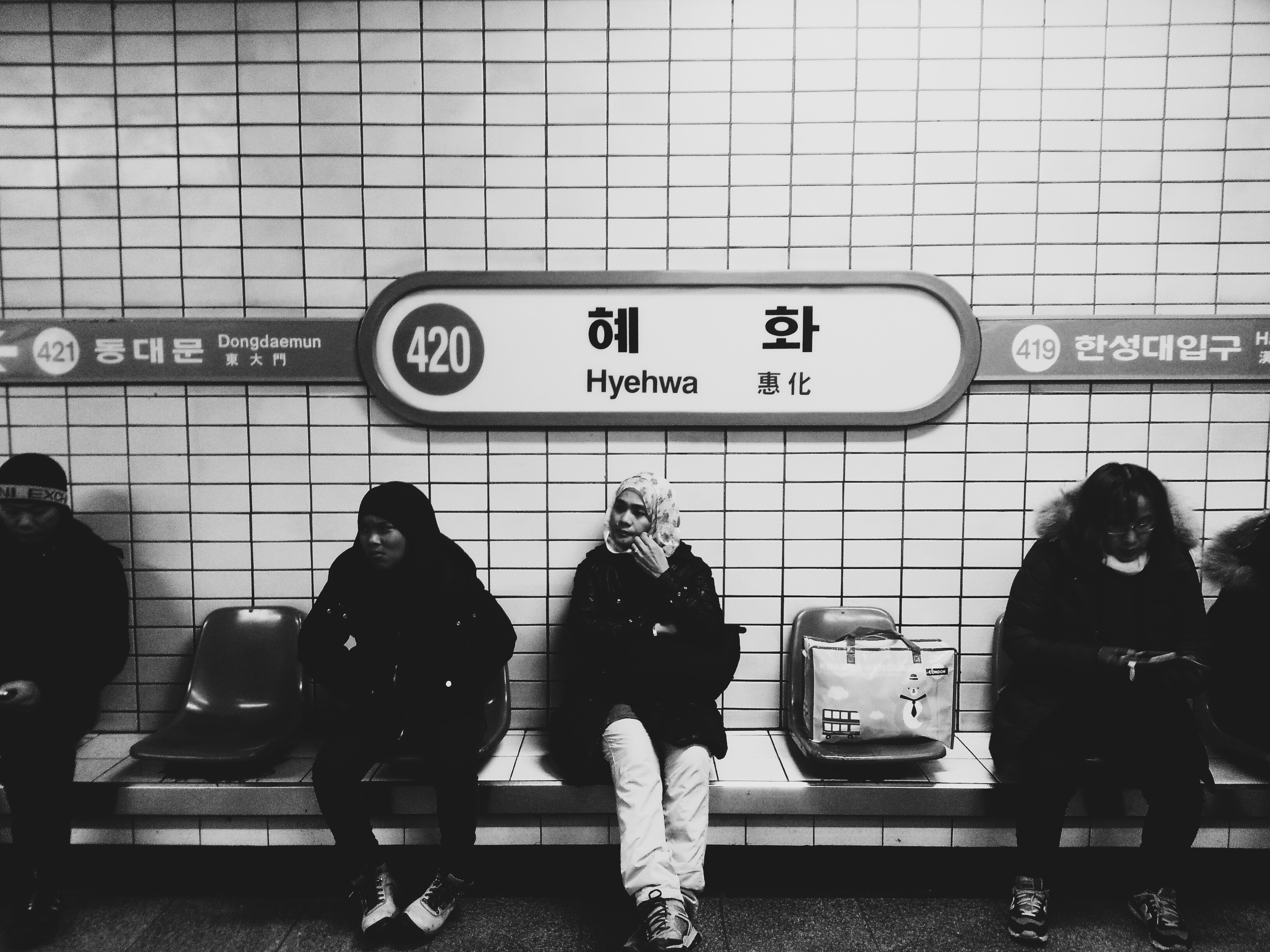
It was about a 2-hour bus ride from Pyeongchang to Dong-Seoul Bus Station where we rode a taxi to our little motel in Hyehwa. The long journey was painful but the sights and views as we went along actually helped alleviate the strenuosity of sitting in a tight, confined seat for a long time.
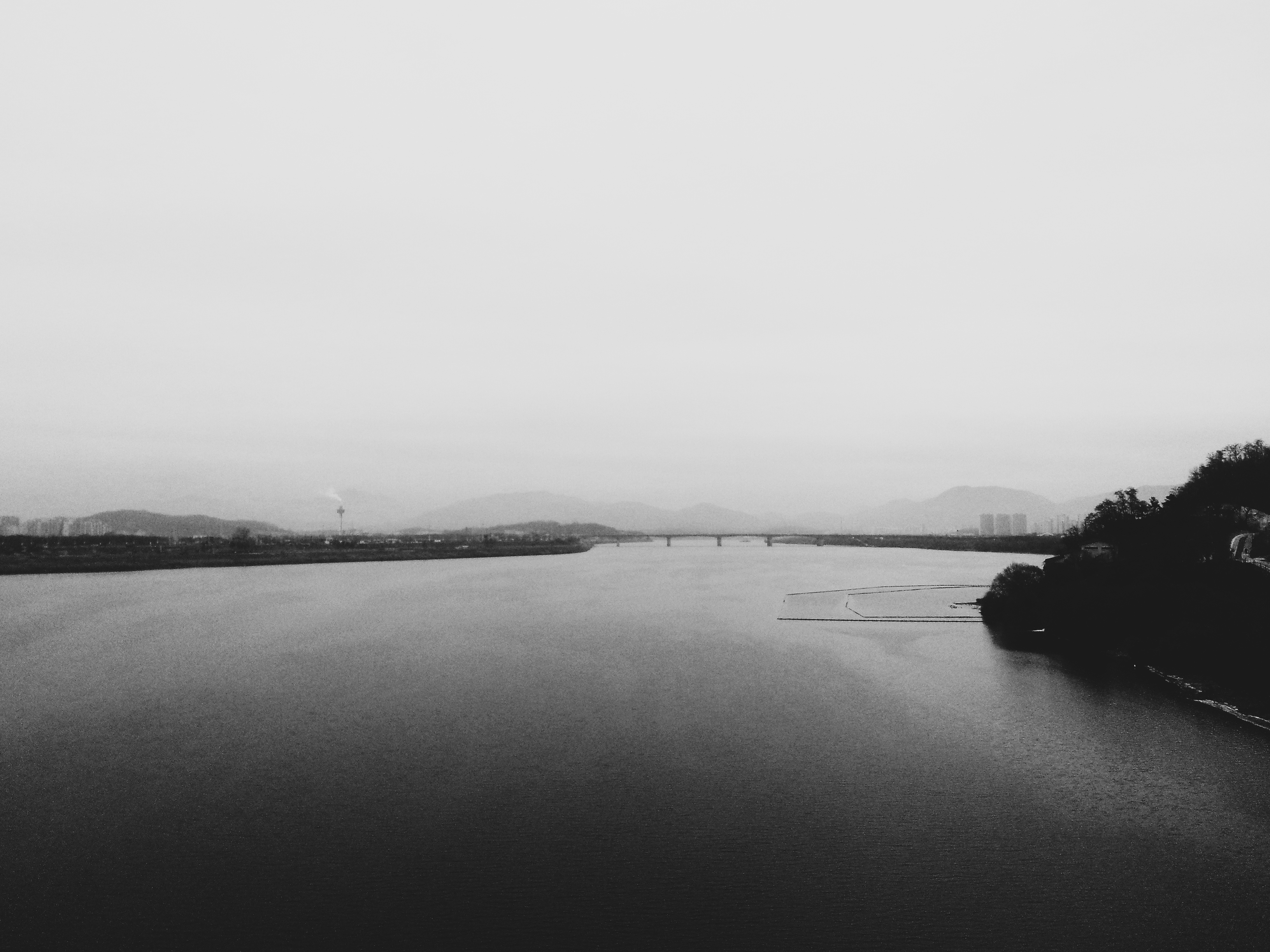
My first impression of Seoul was that it was a City of Bridges. I mean… it’s kinda hard to miss a bridge here. Well, they have to build the bridges to link up both sides of the Han river that cuts through the city core. There are bridges of all kinds ranging from suspension bridges, to regular beam ones. Most of them have eye-popping architectural features that make them stand out in the city skyline.
PUBLIC TRANSPORTATION
As always, the subway is a popular choice of public transportation for tourists. Like we did in Busan, we did face some complications using the subway system for the first time. I’ll just list some tips here in case you want to know how to get around some of those problems.
When entering the gates, tap once and enter immediately. I was confused the first time because when I first saw the gates fully opened the first time, I thought the gate was faulty.
If you were rejected entry after tapping (like me the first time), go over to the wheelchair gate, and press the “HELP” button (or a huge button there).
Make sure you take note of our destination station, and take note of the next station after your station of departure that is in the direction towards your destination station. This is so that you enter the right platform when you tap in the gates since the most of the platforms are separated.
If you happen to enter the wrong platform, tap out, and proceed to point number 2.
Remember to get your refunds for your single use cards.
…and here’s a remix of Seoul’s Subway announcements I did when I was bored.
Alright. Now that’s out of the way…
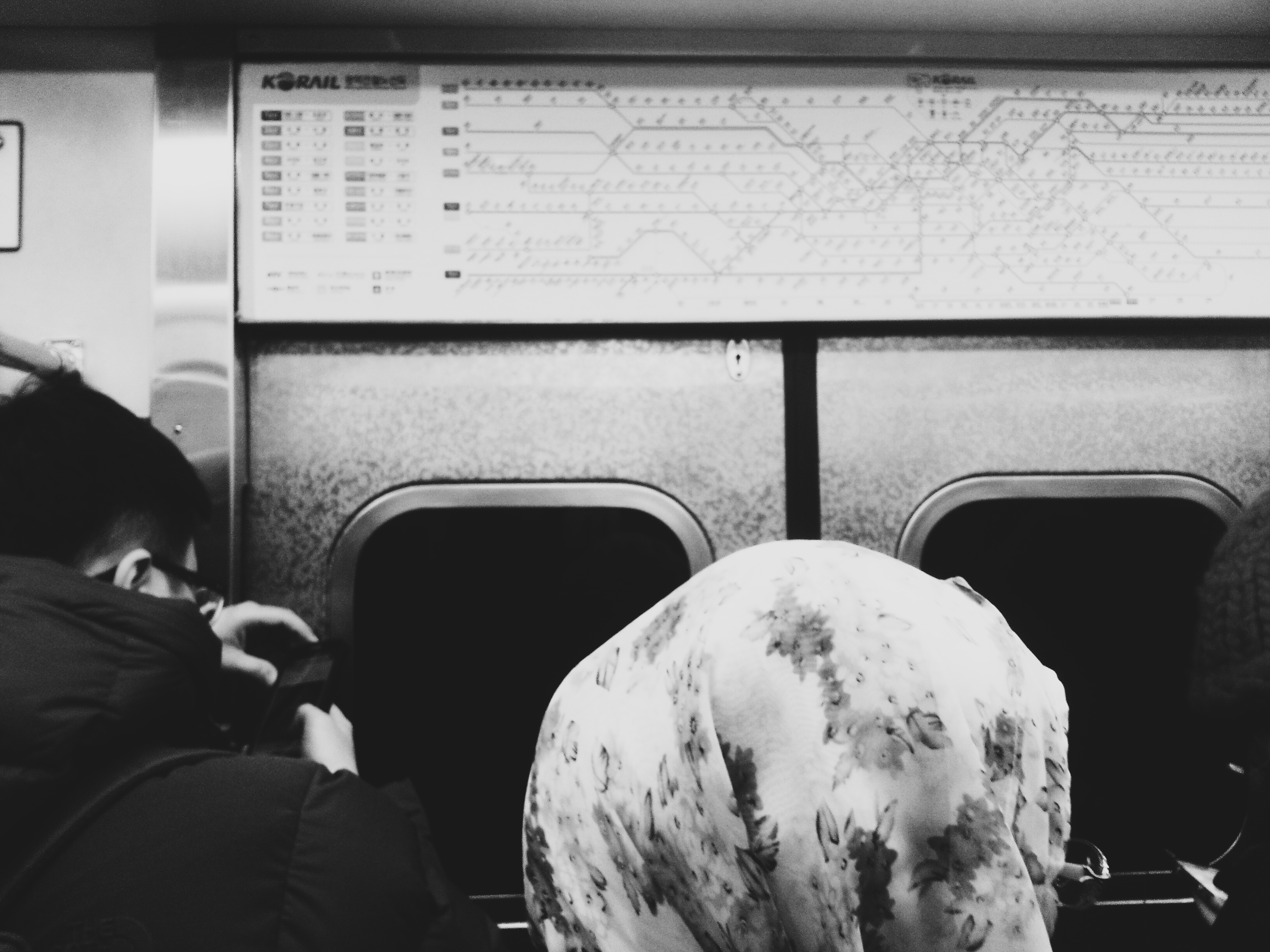
I feel that there is a huge different in environment and culture here in Seoul’s Subway as compared to Busan’s. Like I said in my blog post about my experience in Busan, smartphones seem to disconnect people from the real world which takes away opportunities to socialise with people and getting to know one another. In a developed and hectic city like Seoul, of course people have to be stuck to their phones to keep up with… “important” matters.
Once again, it’s a developed and hectic city. So, I expected a lot of traffic going through the system which means that peak hours were a “blast.” Like really. I pulled my hair out looking at the crowds that swarmed through the stations.
Did I have to stand for long periods of time? Surprisingly not! There were actually many kind citizens that gave up their seats to us tourists!
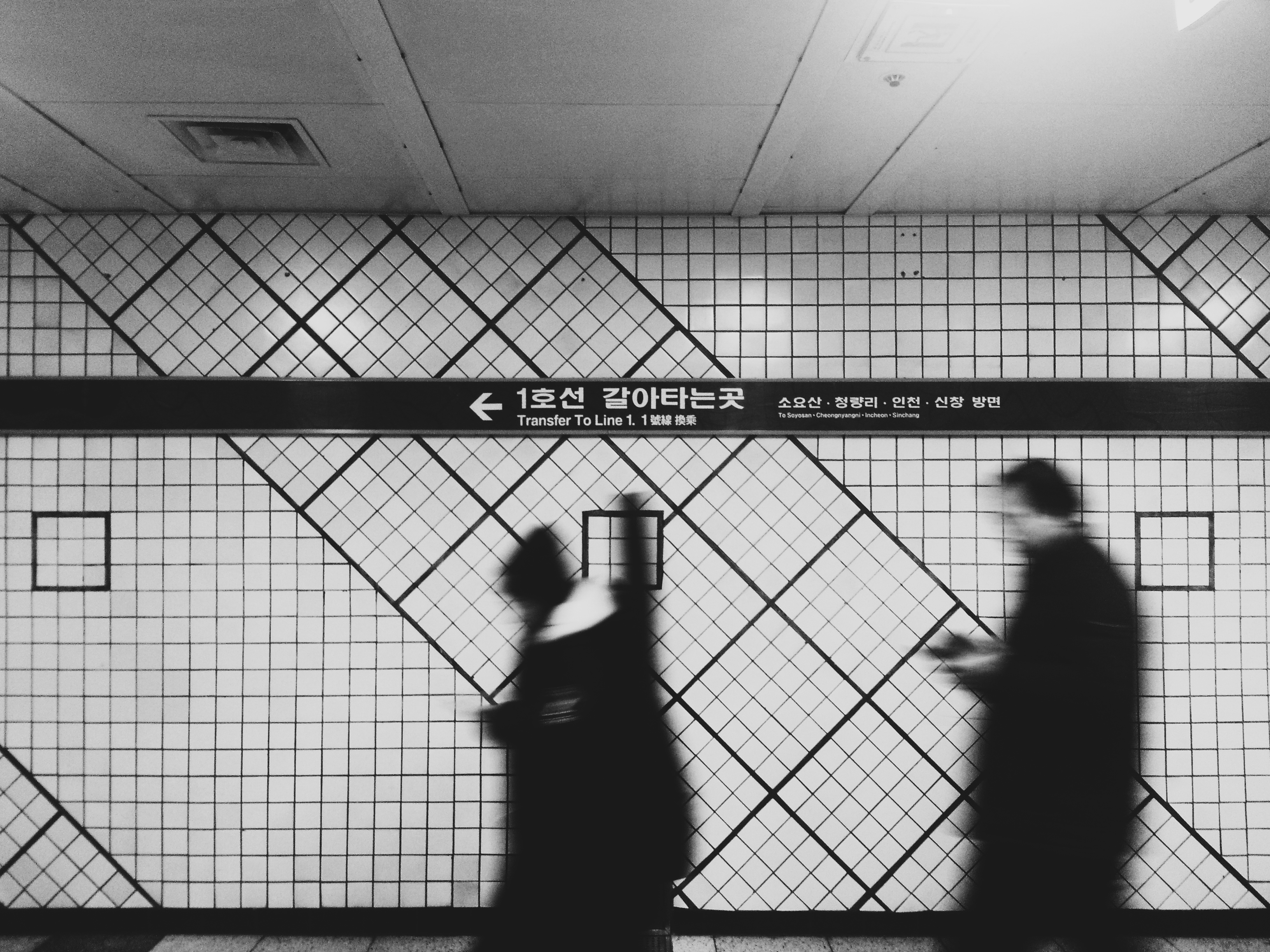
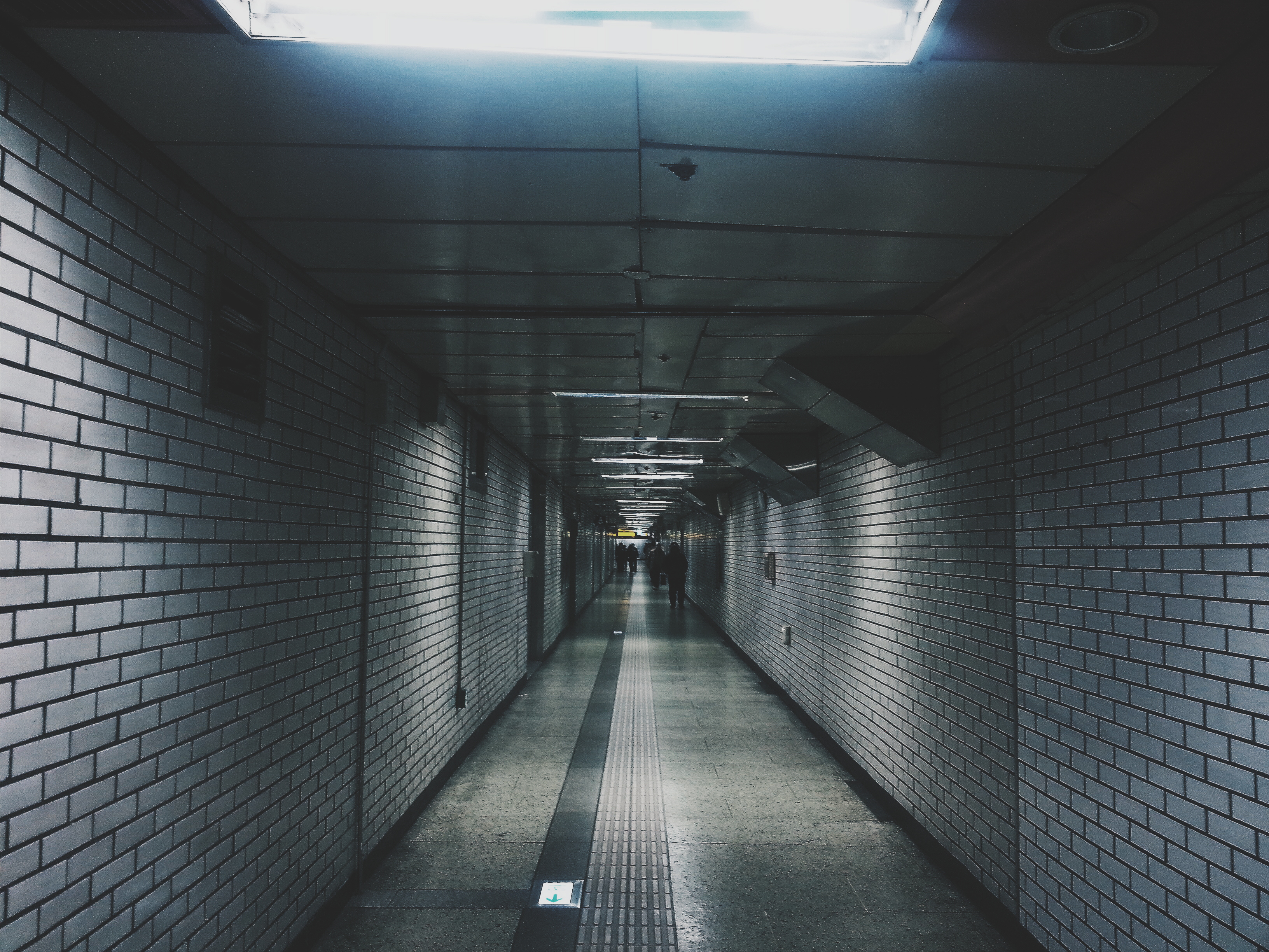
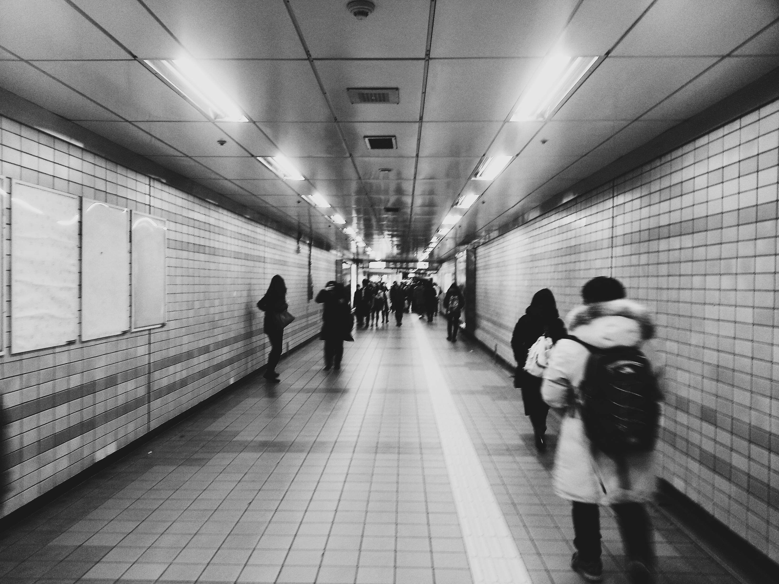
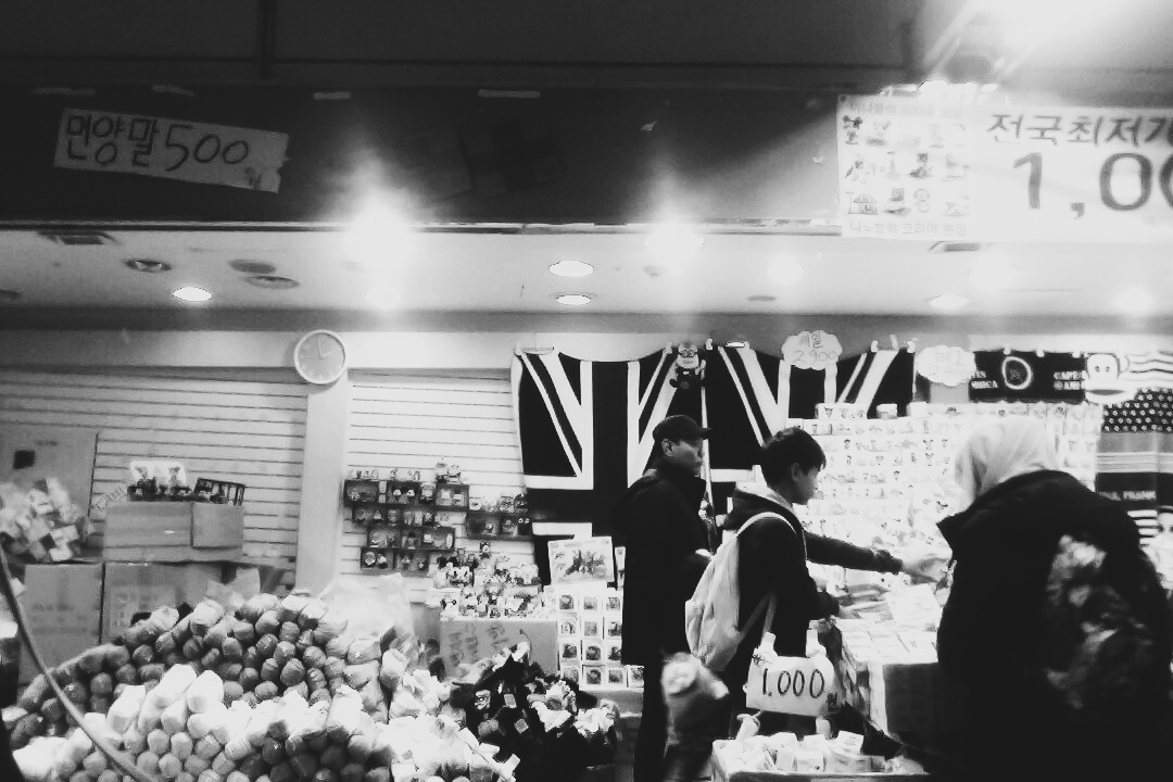
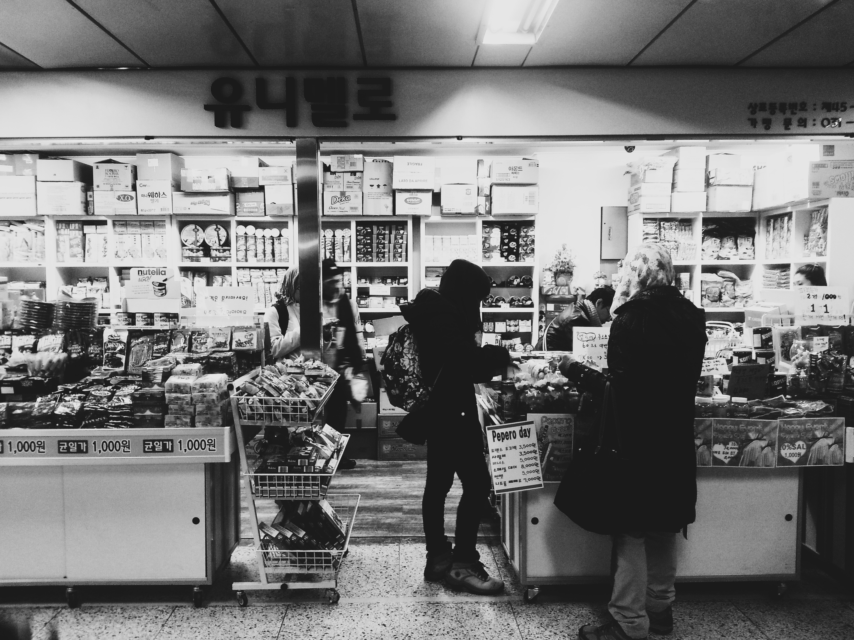
Oh yeah. We had to walk quite a bit in the underground link-ways that connected the different lines in interchanges.
Surprisingly, there little shops that actually sell food are common along those link-ways. It came as a shock to me because in Singapore, food and drinks are not allowed to be consumed in the subway. Other than food, goods that are sold include apparel, toys, and even fruits!
COMMIES IN SIGHT
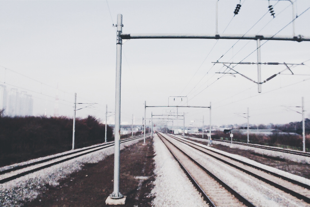
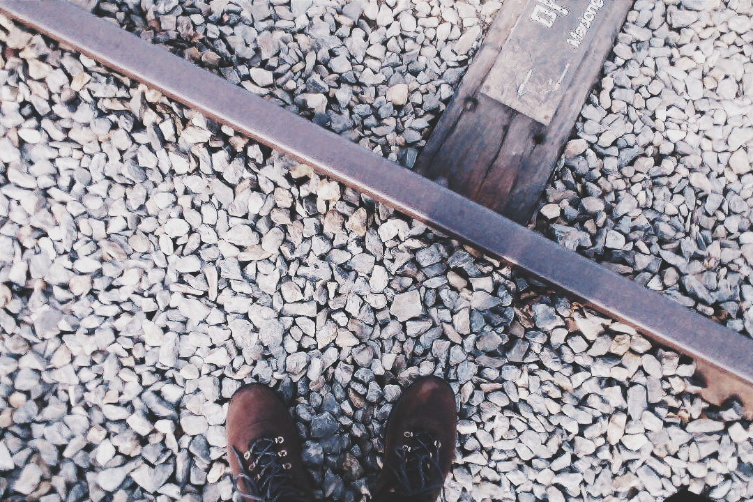
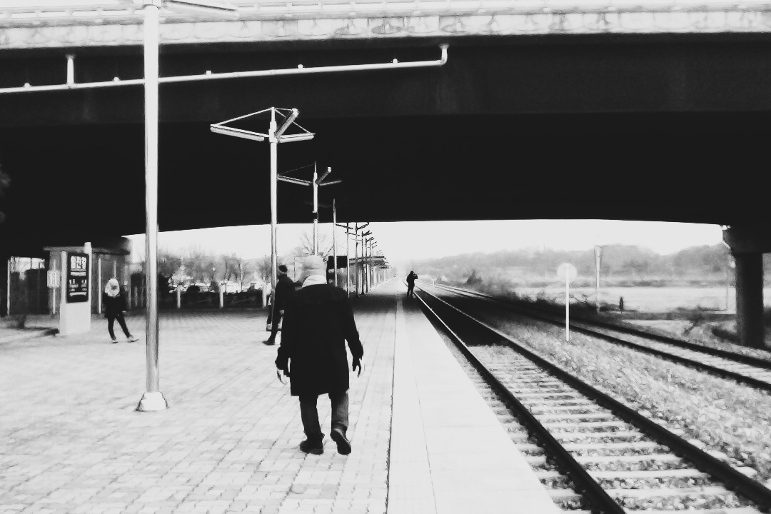
On our third day here, we got DMZ (The Korean Demilitarized Zone) train tickets to take us towards Dorusan, which is the northern-most station in Seoul. We simply got the tickets at the main ticket counter at Seoul Station. It takes about 2 hours to get there.
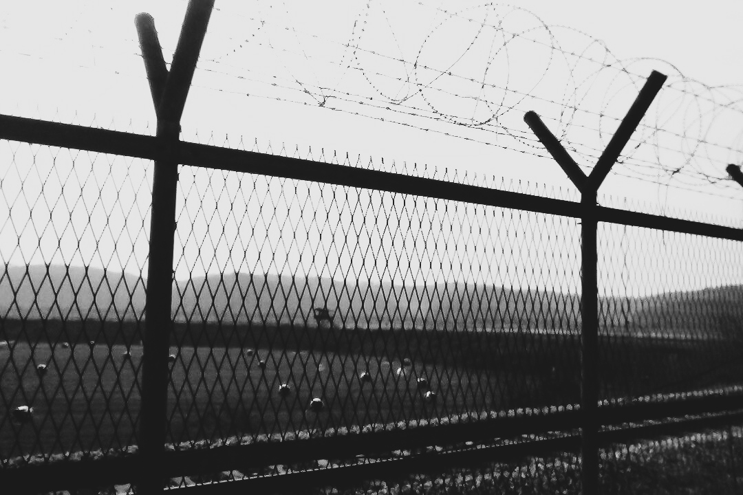
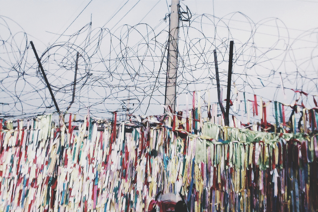
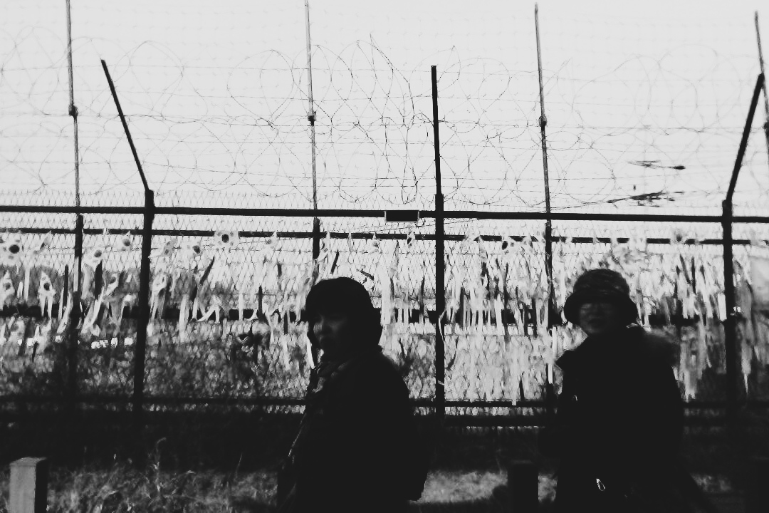
Dorusan is located in the DMZ Zone, which is a buffer zone that separates North and South Korea. It was created in an agreement in 1953 during the Cold War. It is considered to be one of the most dangerous places on Earth since both the North and the South have never signed a peace treaty. So basically, while you’re on tour there, bombs and rockets can start to fly and bombard out of the blue.
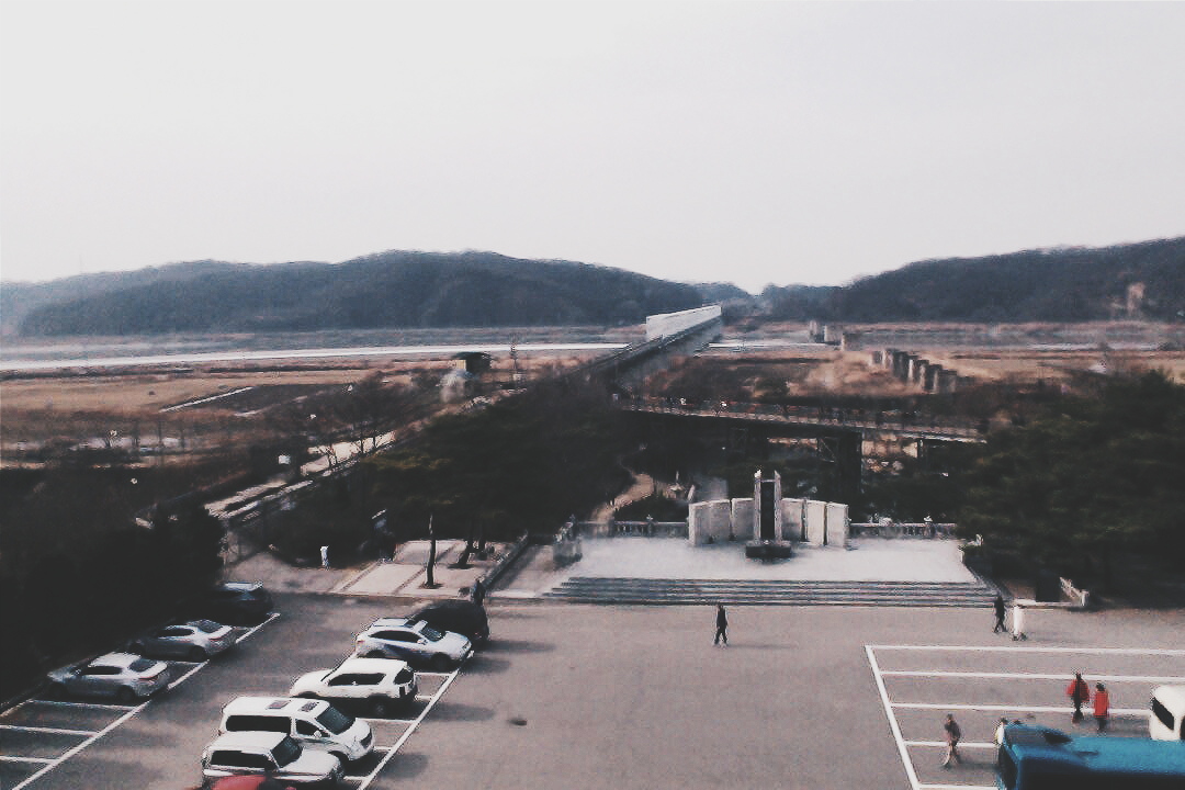
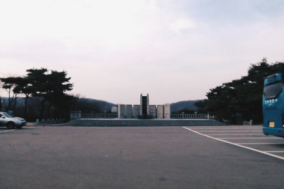
Sadly, we only stayed around Imjingak, which was the station before Dorusan. At Imjingak, there was a carnival (I thought it’s kind of weird) and a couple of tourist attractions which include a bunker that showcased art from the Korean War, and an observatory that allows you to peek into the opposite side of the border.
There were also a couple of monuments to honour those that died protecting South Korea against the communists from the North.
I think what I learnt from my trip to the DMZ was that actually, behind all of the “aggression”, the Koreans one day long to re-unite the two Koreas under one flag.
And actually… I made this post on Facebook…
Interestingly… if you walk around the souvenir shops, if you look closely at the maps and the globes that they sell, especially the ones that are made in Korea, the entire Korean Peninsula is combined into a single nation, with Pyongyang and Seoul as twin capitals. One day, the people hope that someday… Korea will be united under a single flag
THE OUTSKIRTS
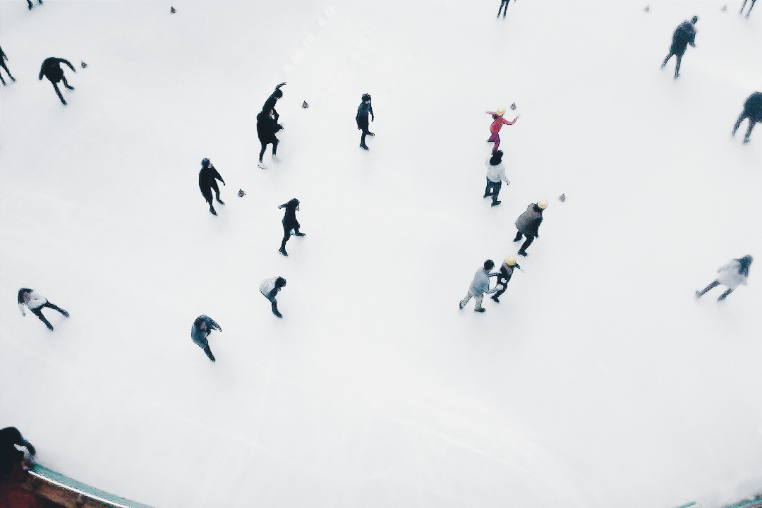
So… to Everland we go… It was quite a distance actually. We had to book a taxi to get here. Everland is basically a theme park with loads of attractions which were unfortunately closed due to the bad weather. …and the weather literally turned Everland into EVERLAND. I mean it takes you to a different place when the heavy fog kicked in.
Of course we wouldn’t end the day without fireworks!
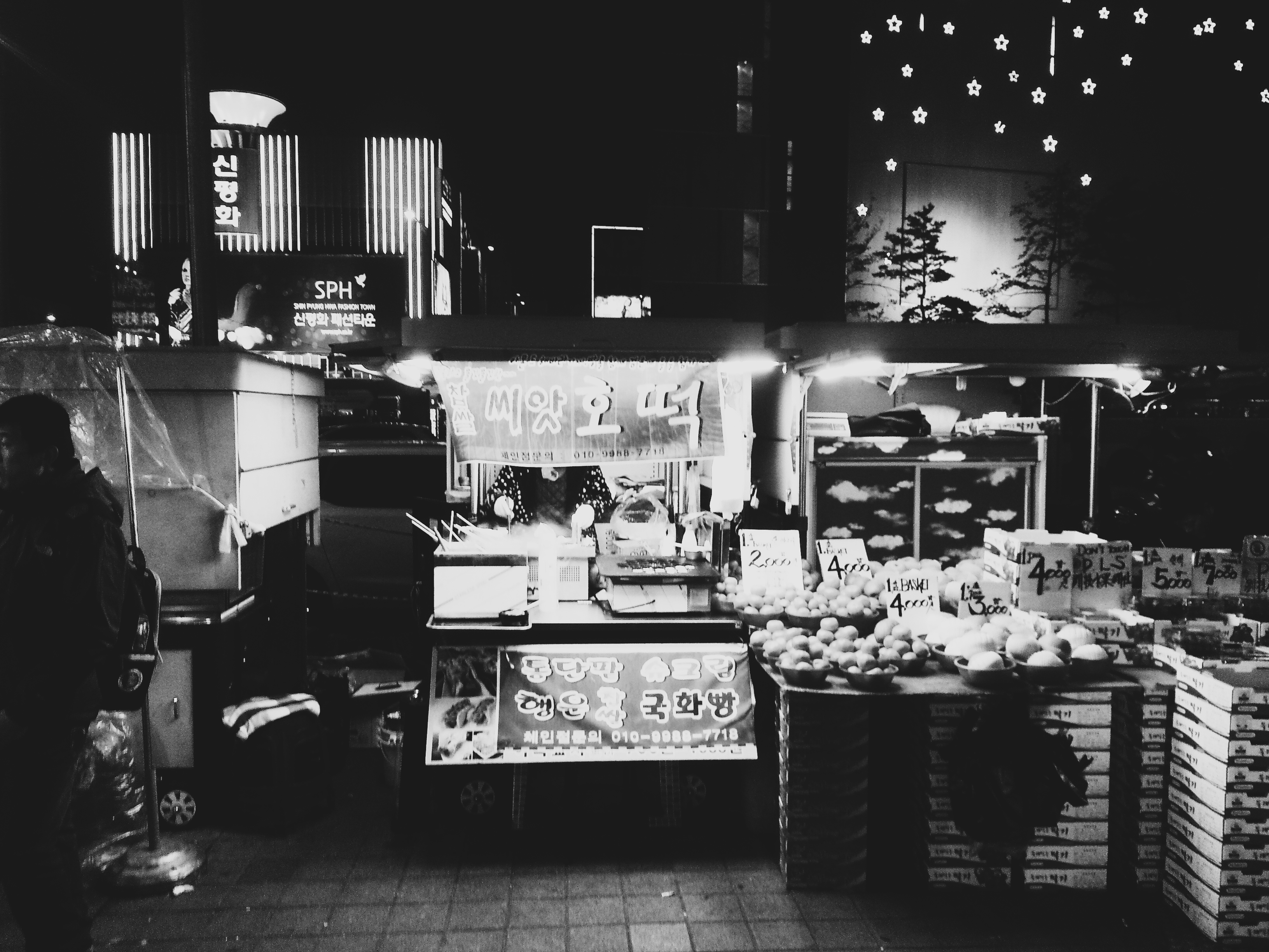
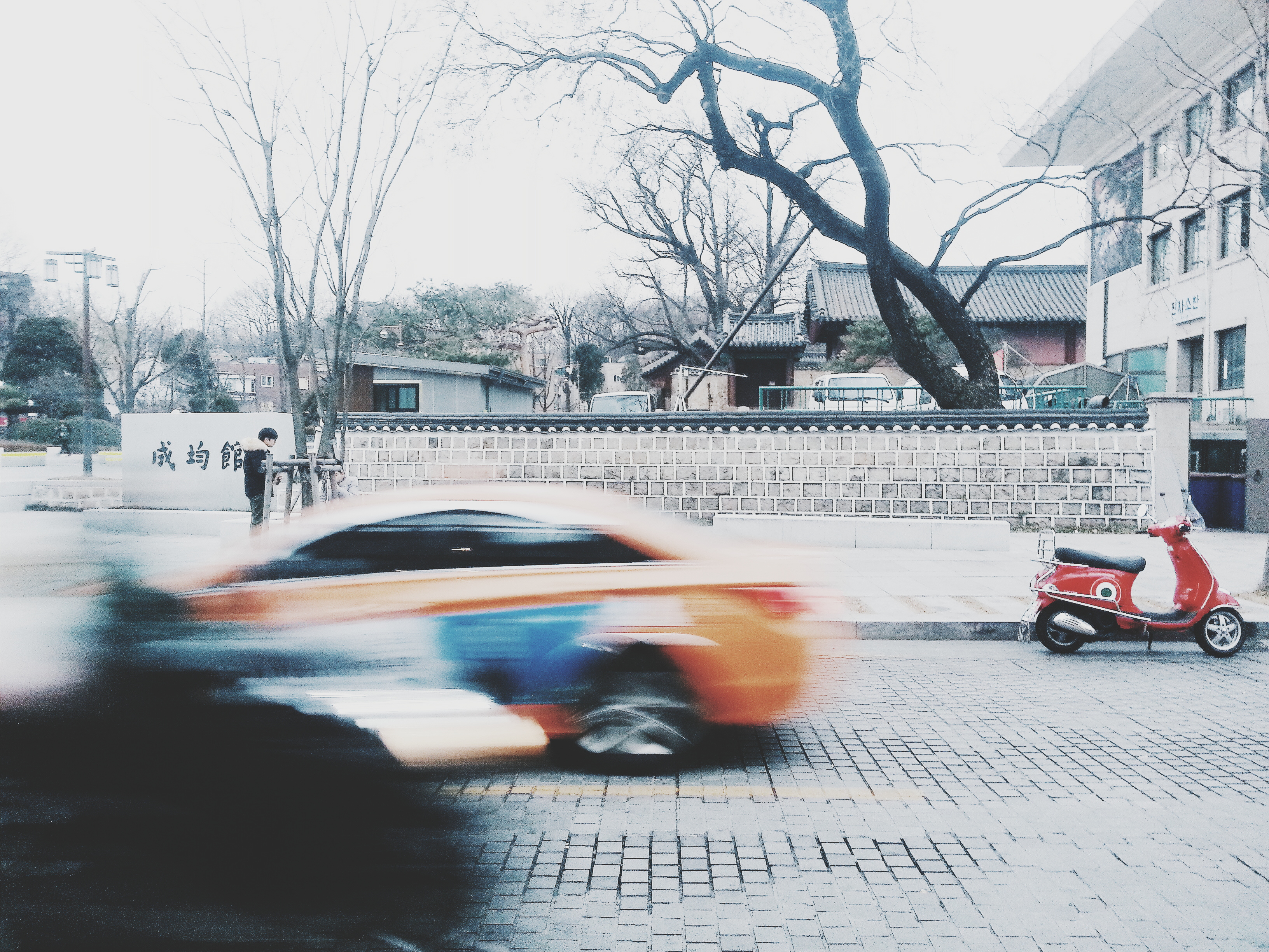
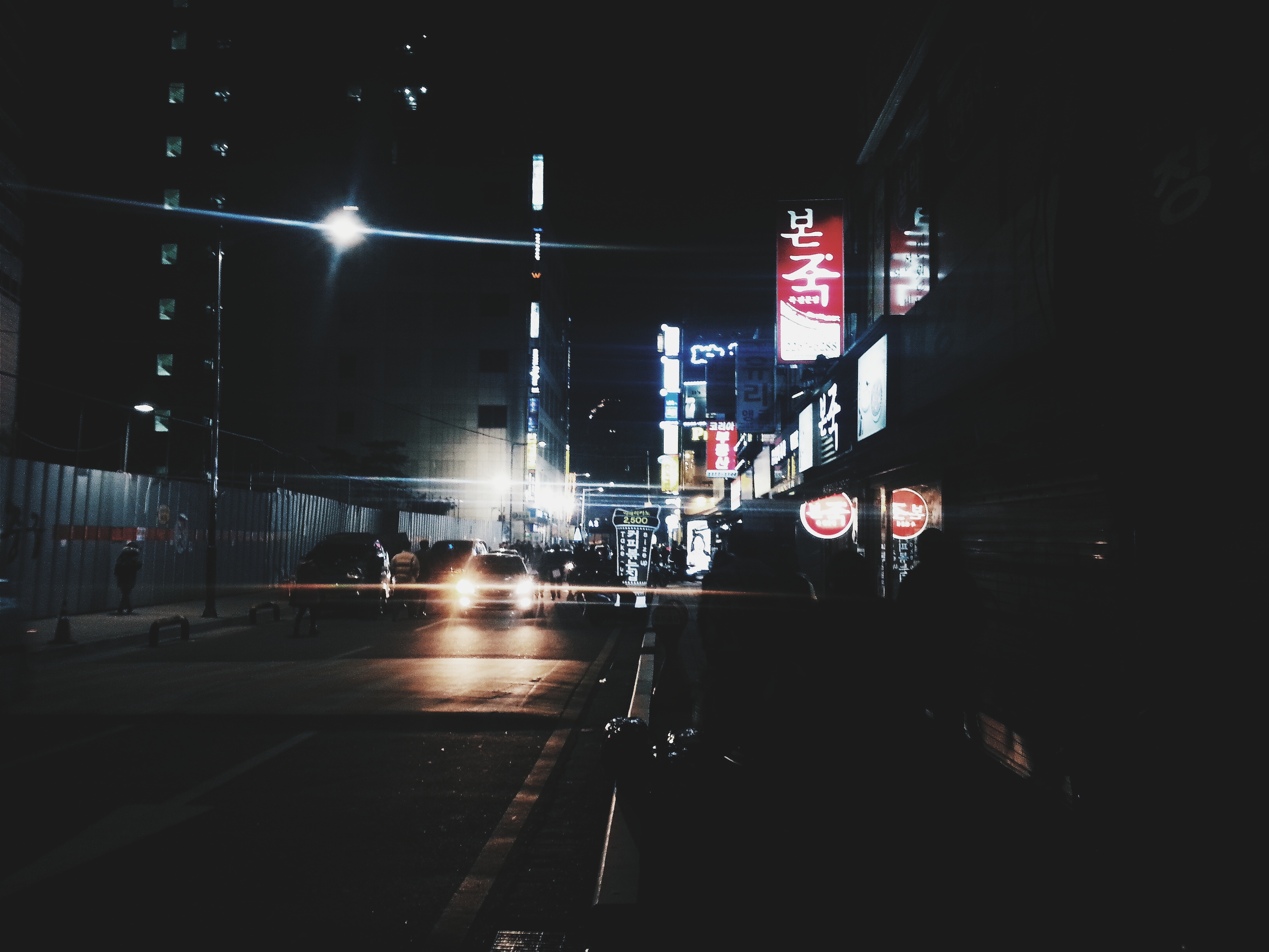
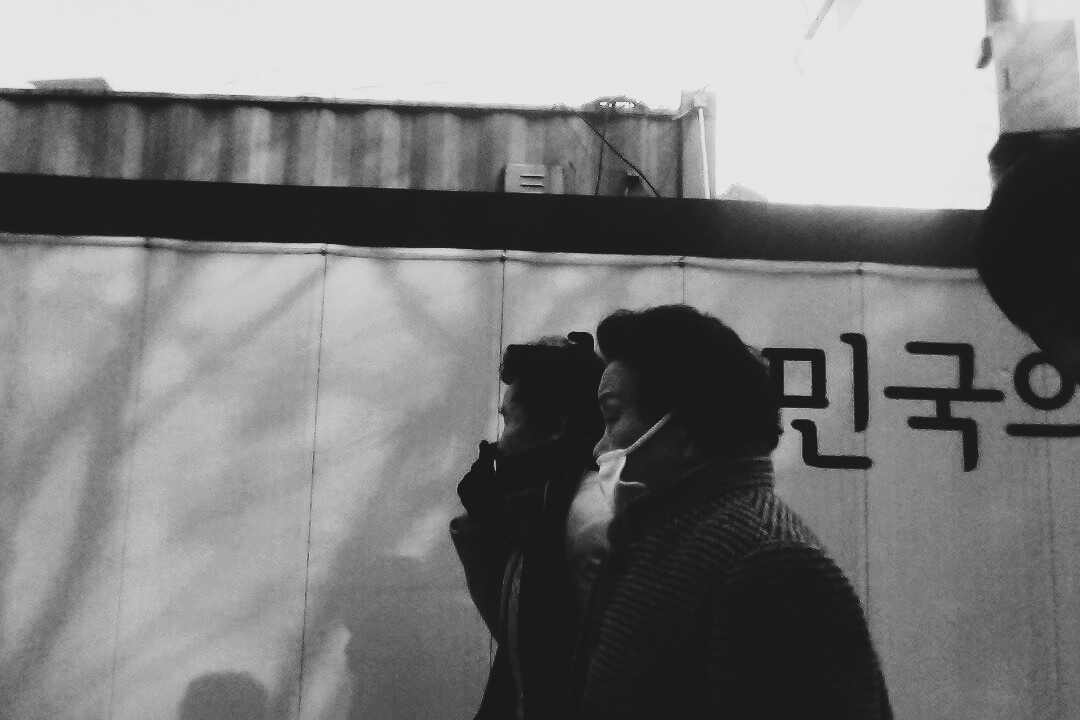
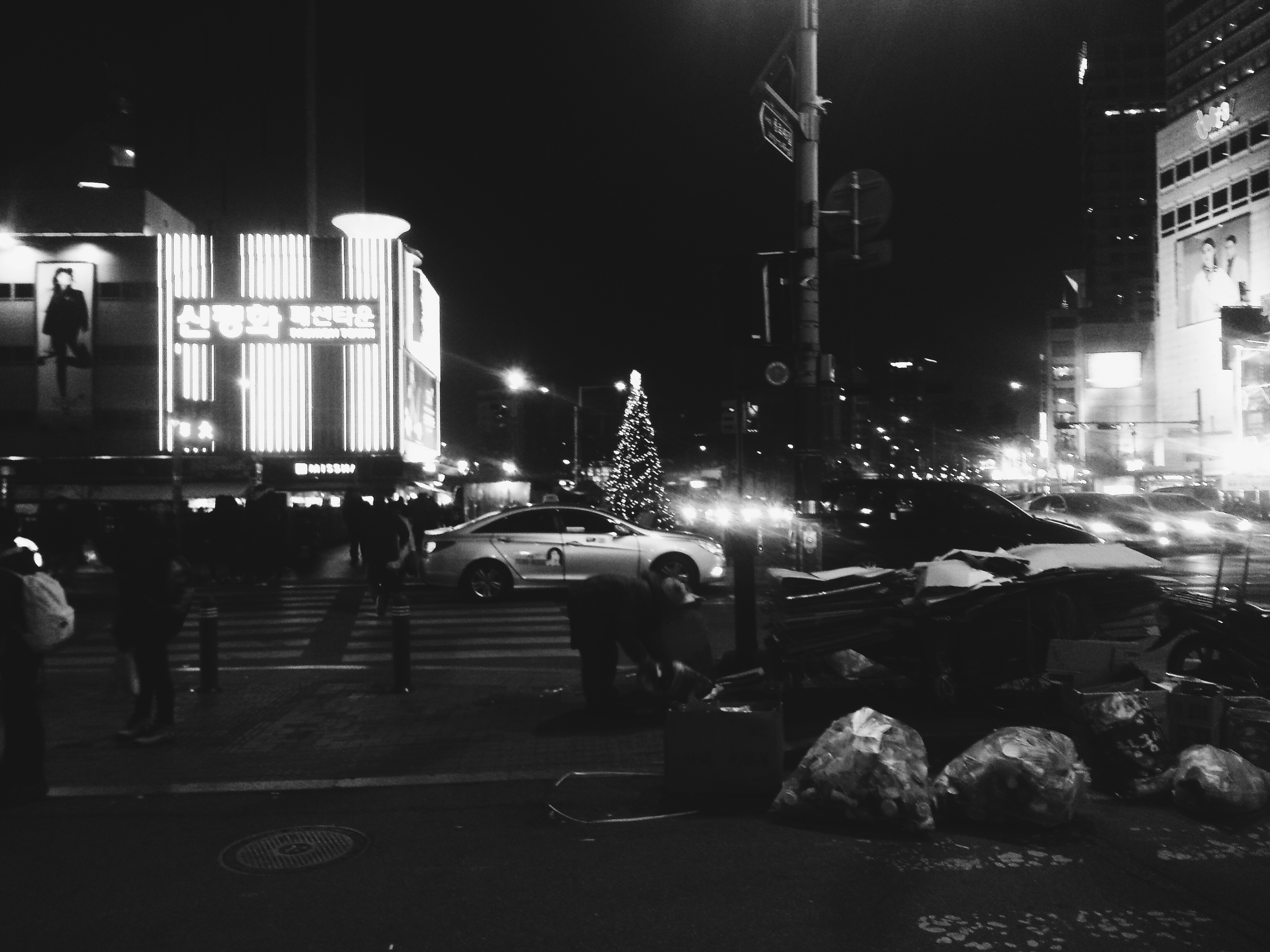
STREETS
Like I always say, my favourite part of the trip is to sit by the side and watch how people carry out their normal lives, and you can pretty much find all of these in the streets. It can be a really fascinating place to understand better one’s culture.
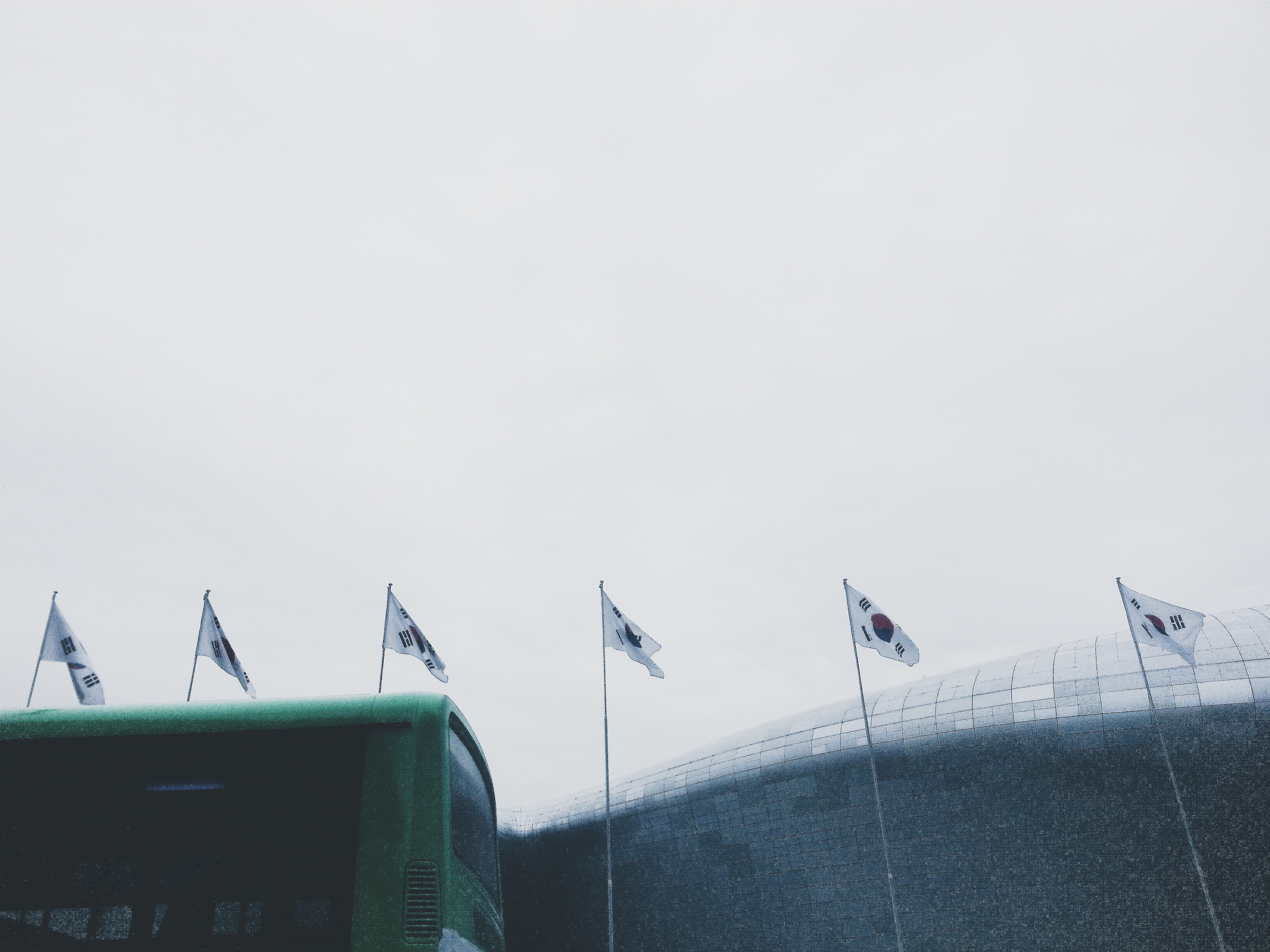
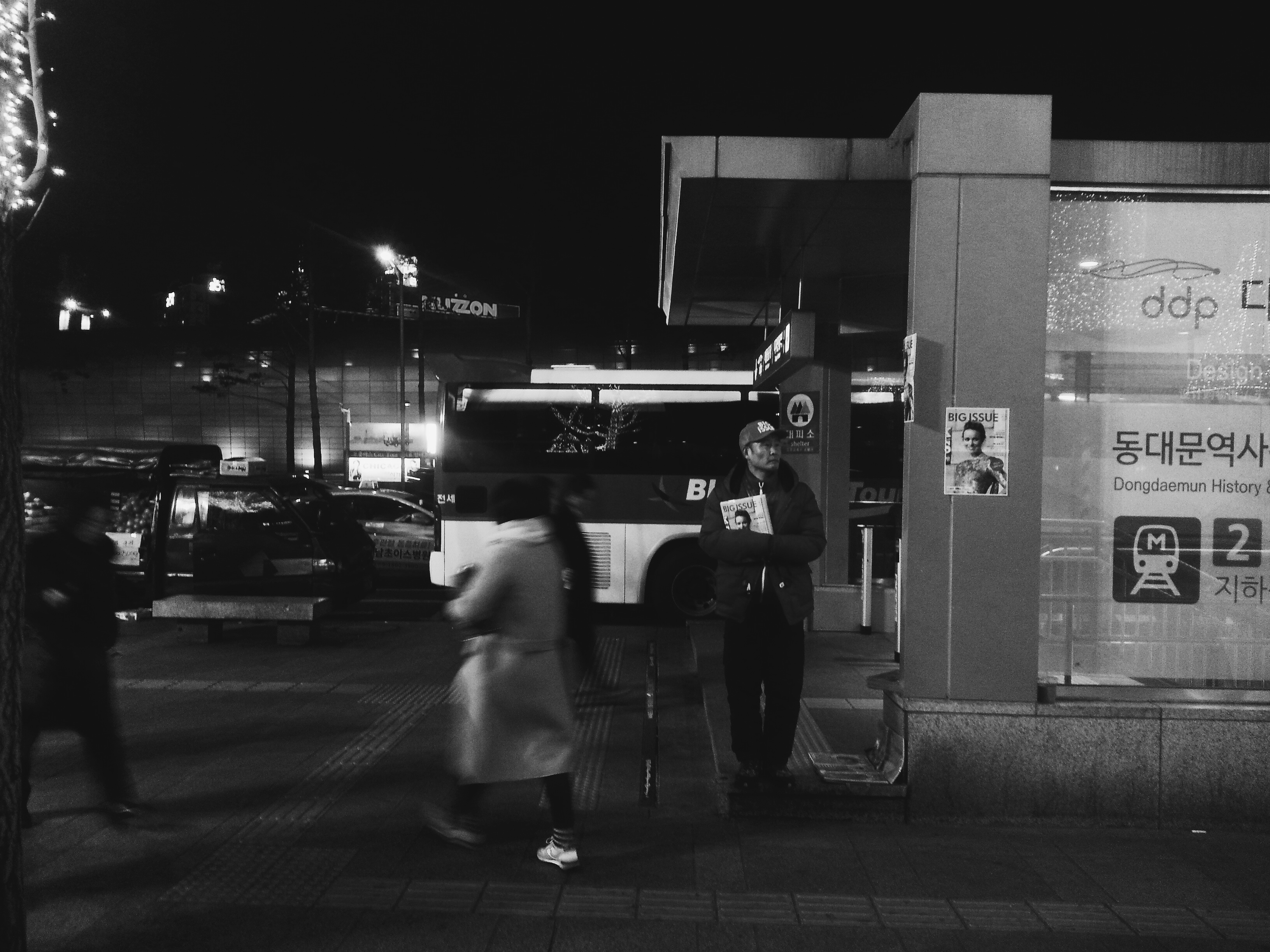
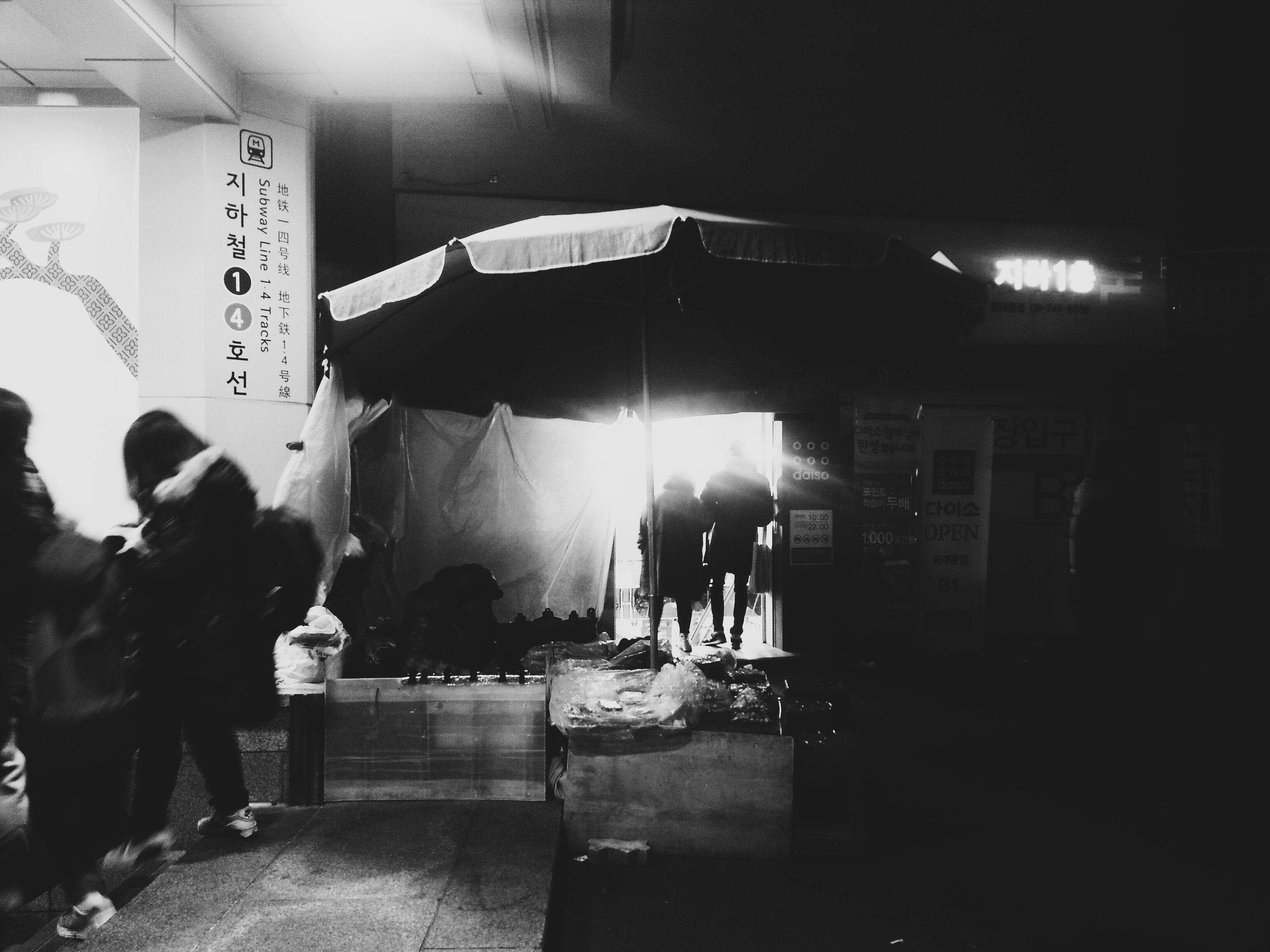
For me, I understand culture not only from the “people”, but also from studying architectural structures. You can find this wall entrance at Dongdaemun.
…and this is the Lotte Tower which is under construction.
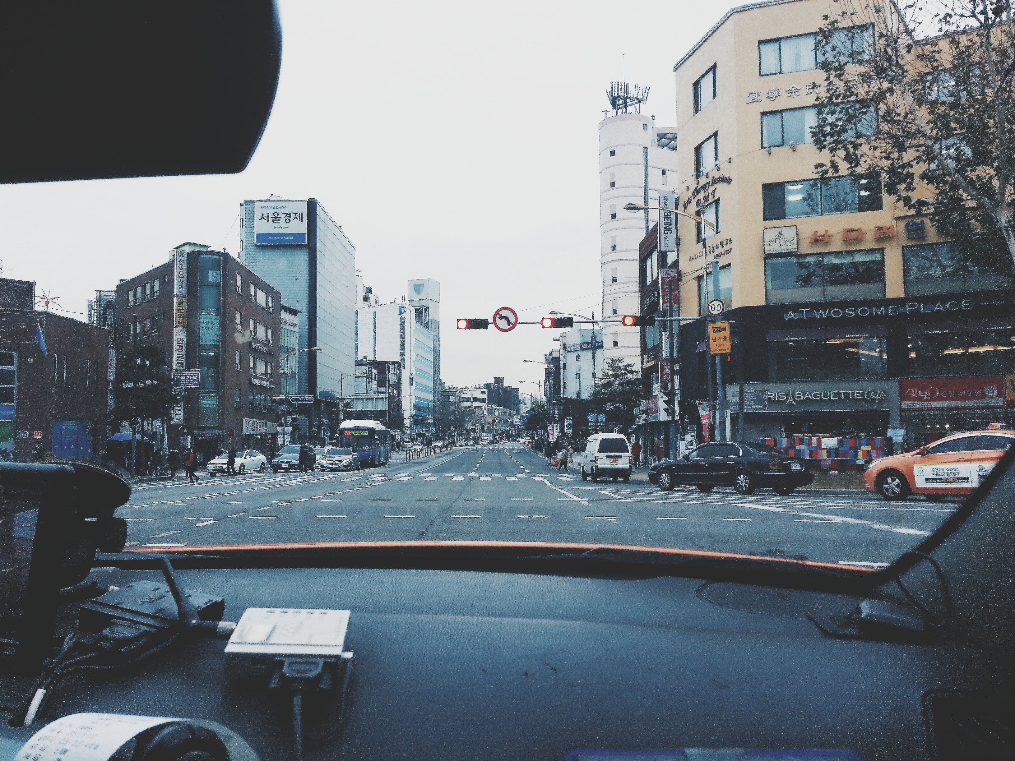
…and some other buildings…
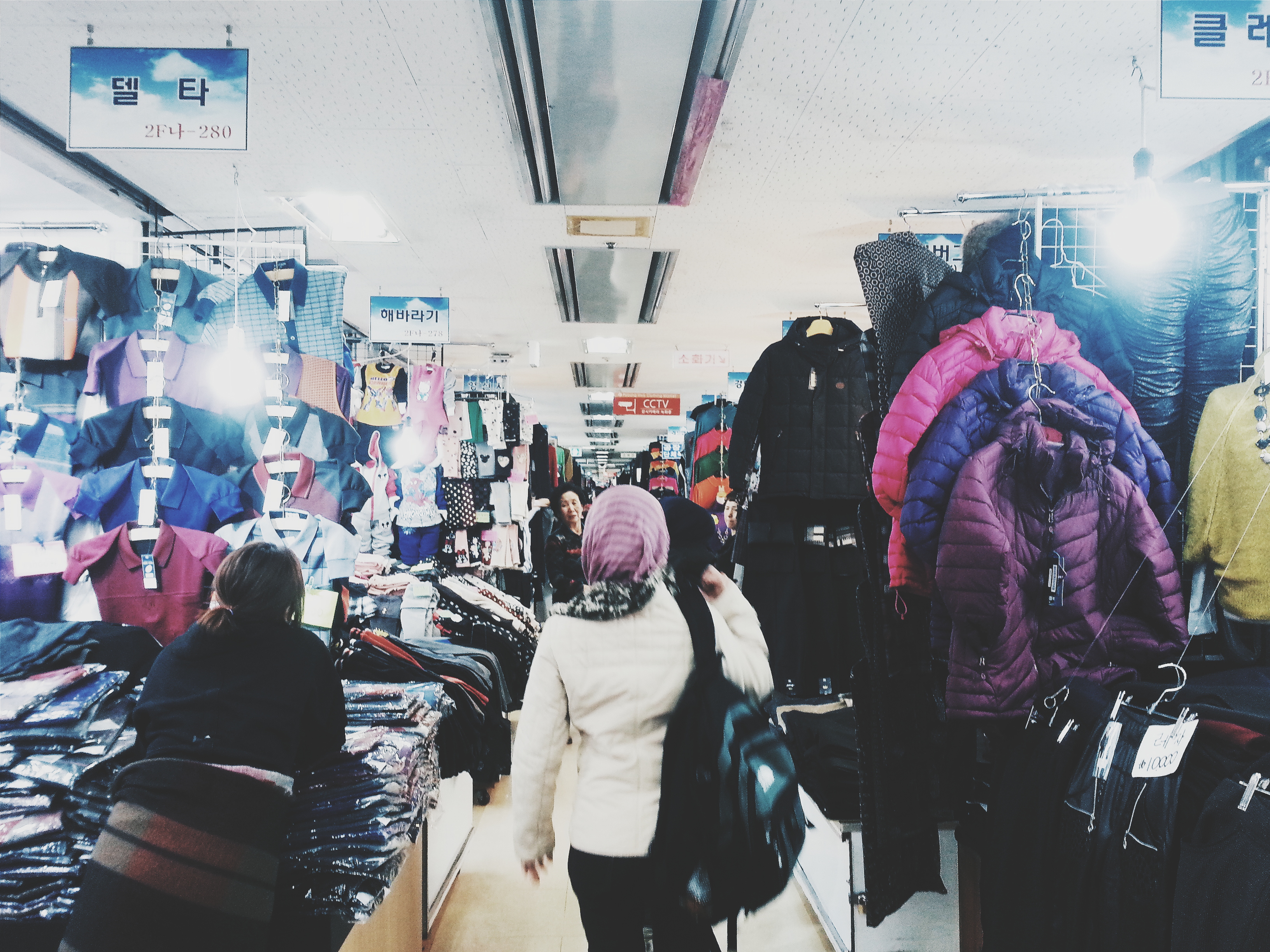
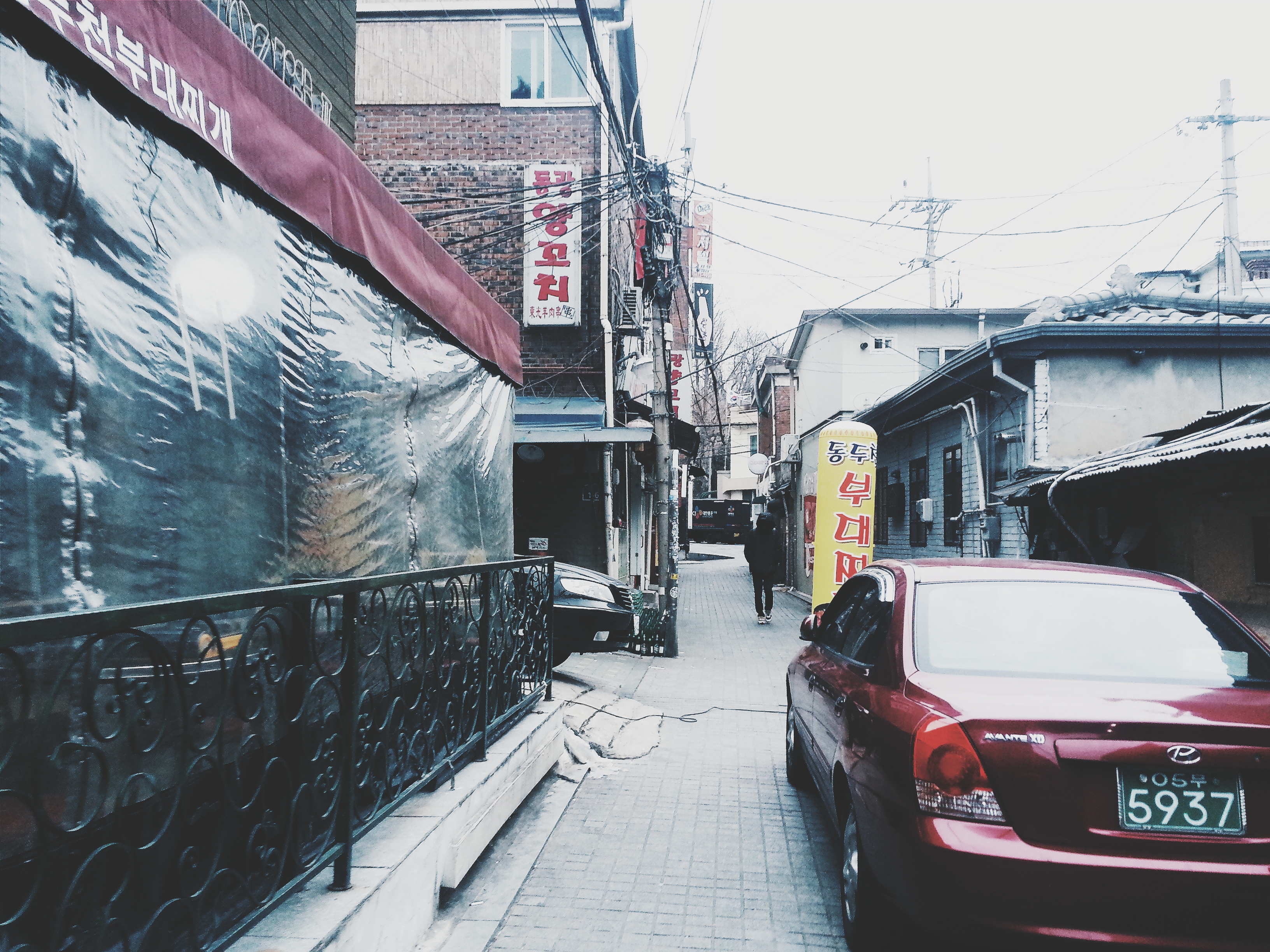
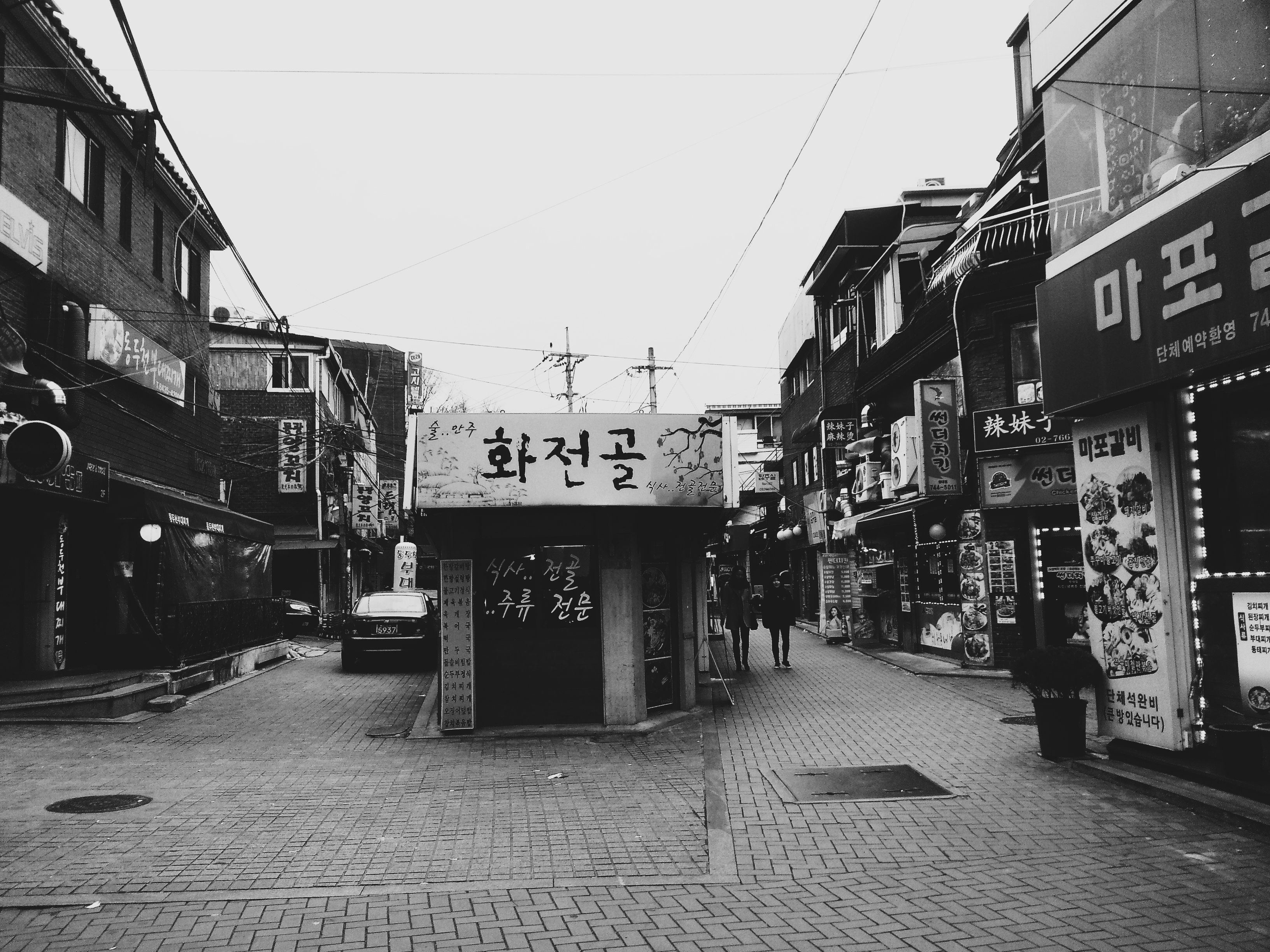
Here… we explore deeper into the minor lanes and streets…
Like in Busan, cardboard collectors were a common sight.
Well, after 10 days in Korea, I can say it was an exhilarating experience. For more pictures from Seoul, you can head over to my VSCO Grid!